Castledermot Friary, Co. Kildare.

Location - In Castledermot on the N9.
OS: S 783 848 (map 61)
Longitude: 6° 50' 9.81" W
Latitude: 52° 54' 30.21" N
GPS: S 78327 84778 (Elevation: 76m – Accuracy: 6m)

Description and History – This is a beautiful ruin and one that I will definitely be going back to.  It was closed when I was there so I assumed it was locked for the winter season but all you have to do it go across the road and get the key from the garage.  The sight of the beautifully huge gothic arches is too good not to go back to.  Because I couldn’t get into it I was only able to photograph it from one angle and the sun was setting behind it so the pictures below are not the greatest. 

The roots of this Franciscan friary may go back to the 9th century but the first mention of the friary in historical records is in 1247 when money was granted by John Fitz Geoffrey, the Justiciary of Ireland for the building the nave and chancel, the remains of both still stand.  The huge Gothic arches and most of the rest of the church date to the early 13th century.  Most of the friary was destroyed in 1317 by a Scottish army led by Edward Bruce which resulted in a period of rebuilding. In 1328 a transept was added to the friary by Thomas, the second earl of Kildare.  The tower was also added around this time.  The friary was destroyed by Cromwellian forces and was never rebuilt.

Difficulty – It is right on the N9 so you can’t really miss it.  There is some parking at the petrol station across the road.  It’s near a bend and cars race around this town so keep your wits about you.

For more ecclesiastical sites, click here.
For more sites in Co. Kildare, click here.
 
This is the best shot I could get through the gates.

Ballyartella Bridge, Co. Tipperary.

Location – Located on a third class road that connects the R493 and the R495.
OS: R 839 835 (map 59)
Longitude: 8° 14' 21.45" W
Latitude: 52° 54' 7.81" N
GPS: R 83962 83406 (Elevation: 38m - Accuracy: 10m)

Description and History – This is a very beautiful bridge and on the day that I saw it there had been a lot of rain the previous week and the water was really rushing through the bridge.  We are somewhat lucky that bridges like this survive.  The Road Act of 1727 set a minimum width for roads of 3.6m and many bridges were replaced to make them wider.  Luckily for us this bridge was merely widened.  The bridge passes over the Nenagh river and is 26.7m long and 4.4m wide.  There are five arches that make up the bridge and there is evidence of a wicker frame on the vaults of the bridge. 

There is a downside to this bridge and that is the car park. Although it is nice for there to be a car park so that people can easily enjoy the bridge it has attracted a lot of litter which detracts from it somewhat.  Apart from that this is a nice spot...but take your litter with you.  I just don’t understand people who litter such wonderful places.

Difficulty – There is plenty of parking and signage here.  Sites don’t get easier than this.

For more bridges, click here.
For more sites in Co. Tipperary, click here.

Viewed from the S side of the road.

As viewed from the modern weir.  From here you can get right out over the river and there are some great views from here.

Viewed from the N side of the road.

Srah Castle and Bullaun Stone, Ballydrohid, Co. Offaly.

Location – Just outside Tullamore town on the banks of the Grand Canal and next to the railway line.  It is accessible from the R443 on the N side of the canal down the road that runs along it.
OS: N 328 252 (map 48)
Longitude: 7° 30' 30.55" W
Latitude: 53° 16' 32.75" N
GPS: N32785 25159 (Elevation: 59m – Accuracy: 12m)

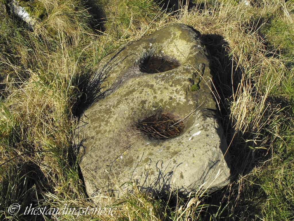
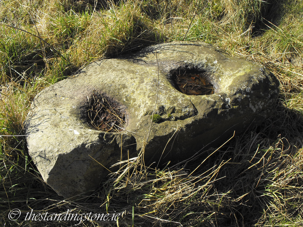
Description and History – This site intrigues me somewhat because of the 
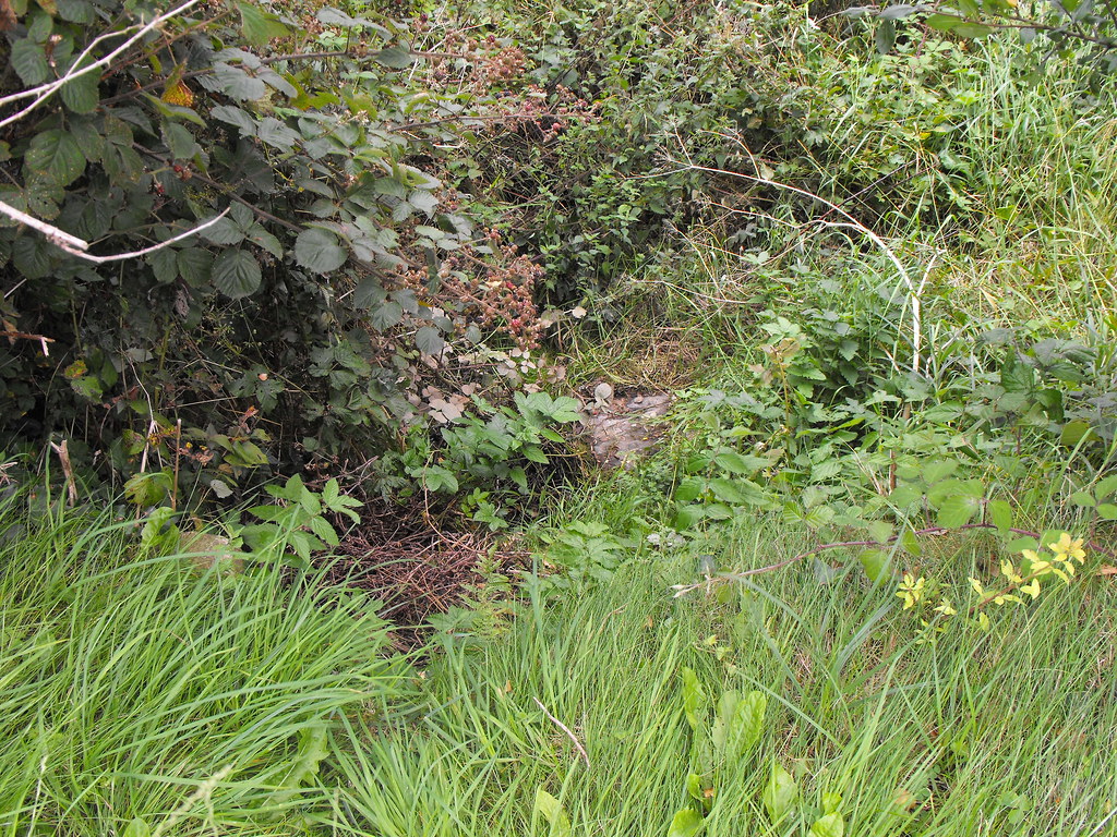
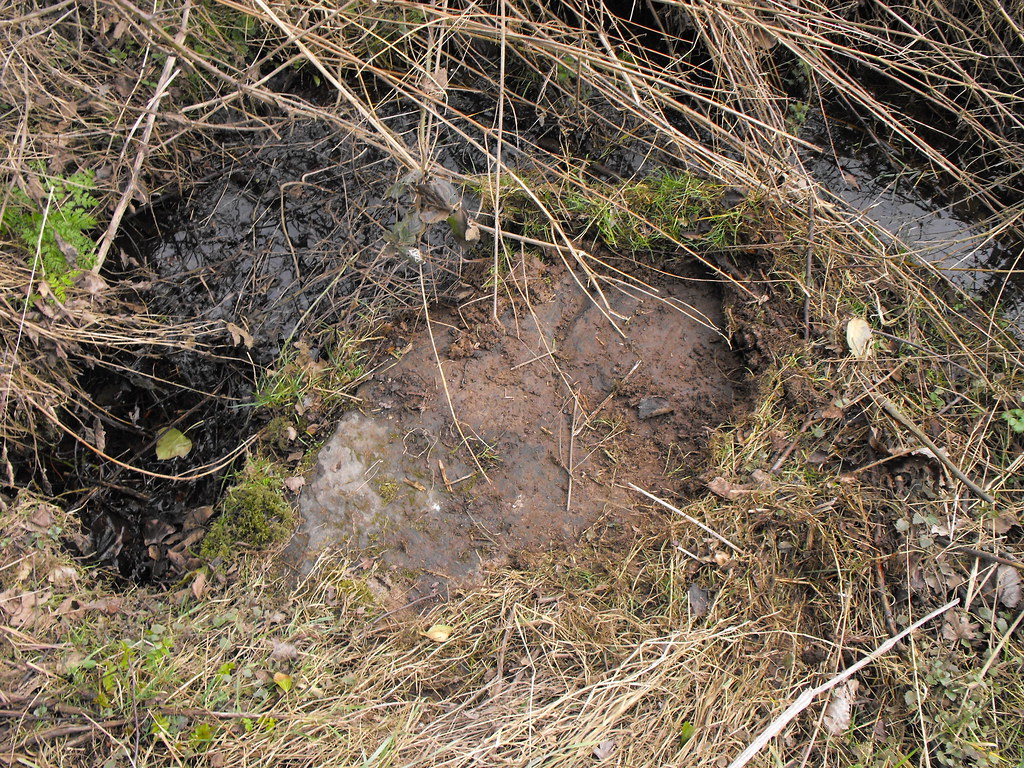
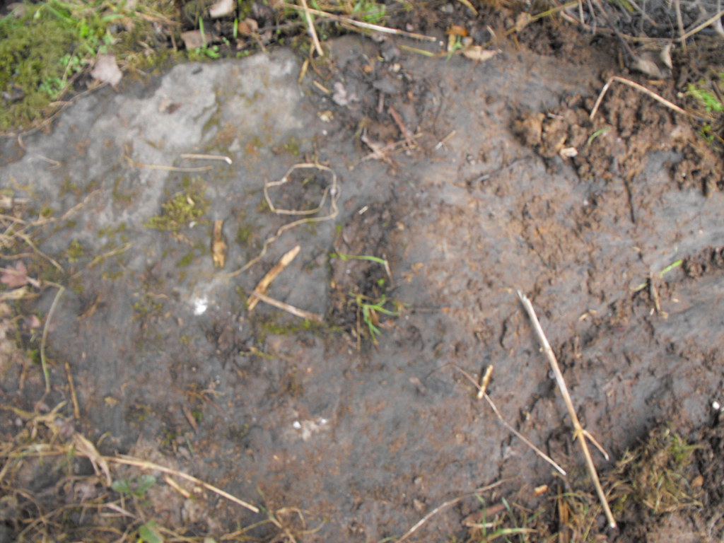
bullaun stone, assuming that it what it is.  The bullaun is not mentioned in the 
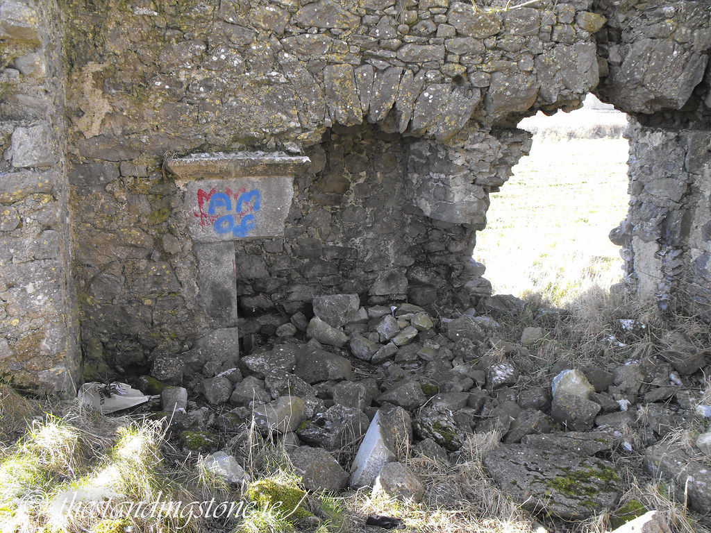
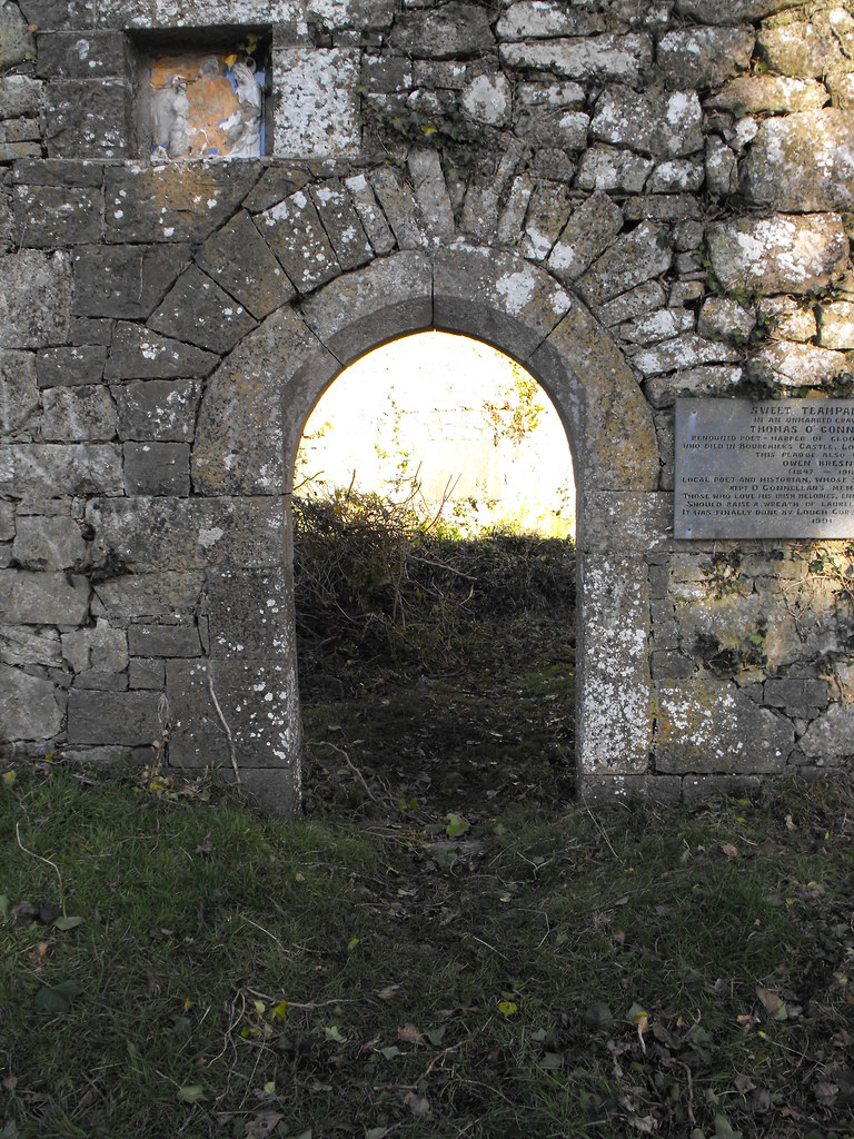
Archaeological Inventory for County Offaly and I can’t find mention of it anywhere so either it’s not a bullaun or I’m the first one to spot it.  Look at the picture below and you will see that it looks like a bullaun.  The reason for its being here is puzzling.  The nearest ecclesiastical site of only about 2m away so it is possible that it was brought from there.  Whatever the reason it is interesting and makes this site special.  However, the location of this site so close to Tullamore is a letdown.  The interior of the site is littered with broken glass and beer cans.  There is also a lot of graffiti both inside and out.  Its location right next to a modern housing estate and a railway line really emphasise that this castle had now been lost in time.  The world has moved on and the castle is slowly crumbling away as time passes. 

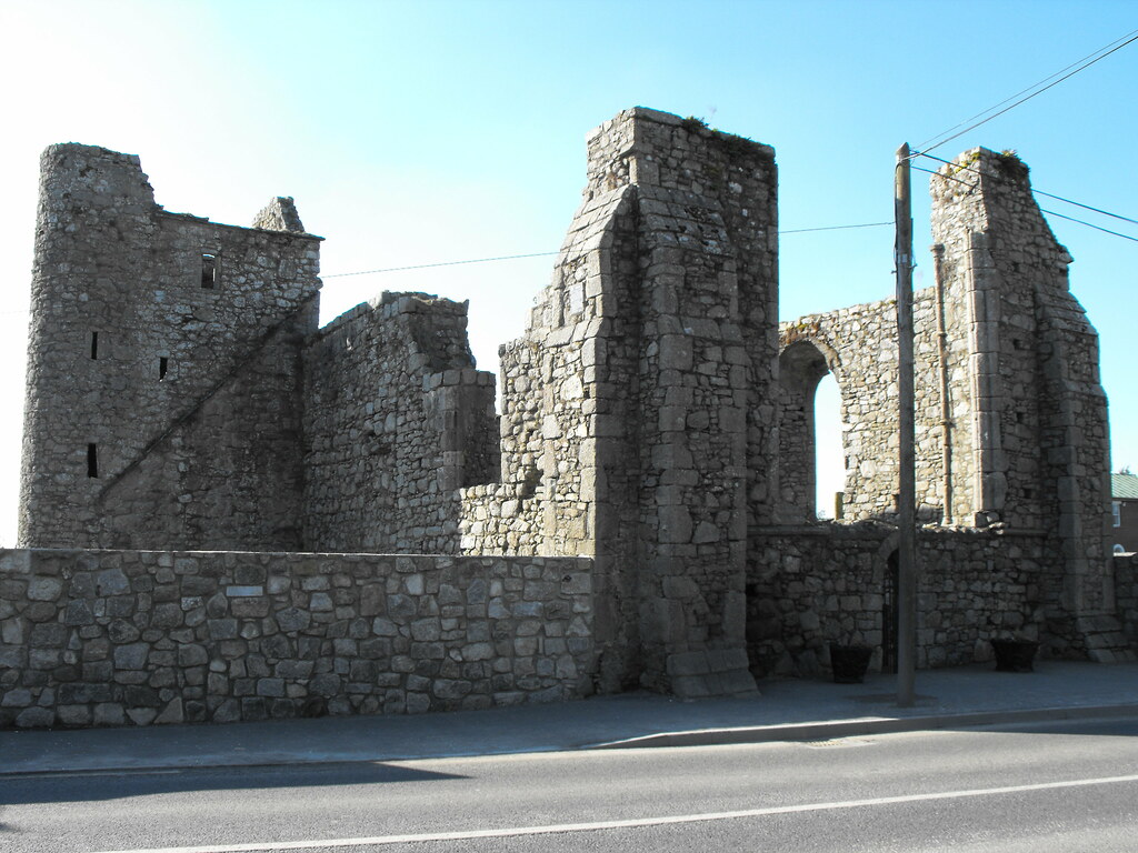
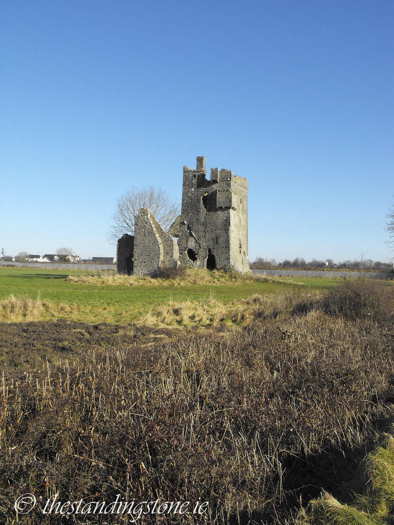
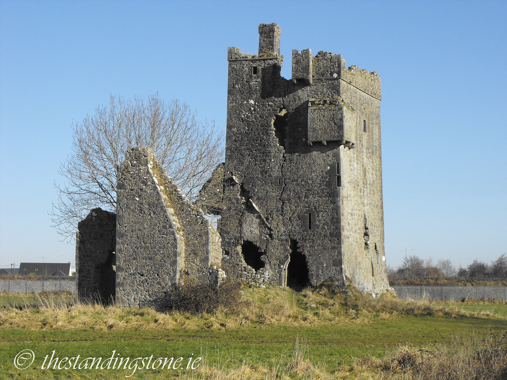
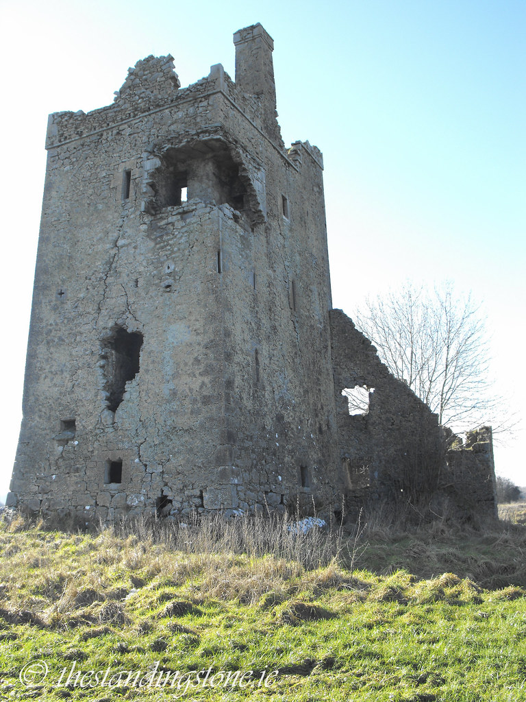
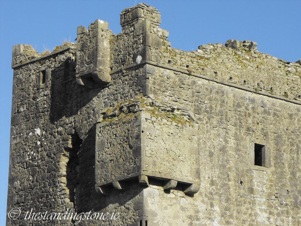
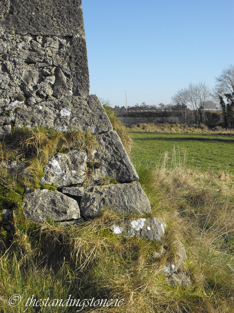
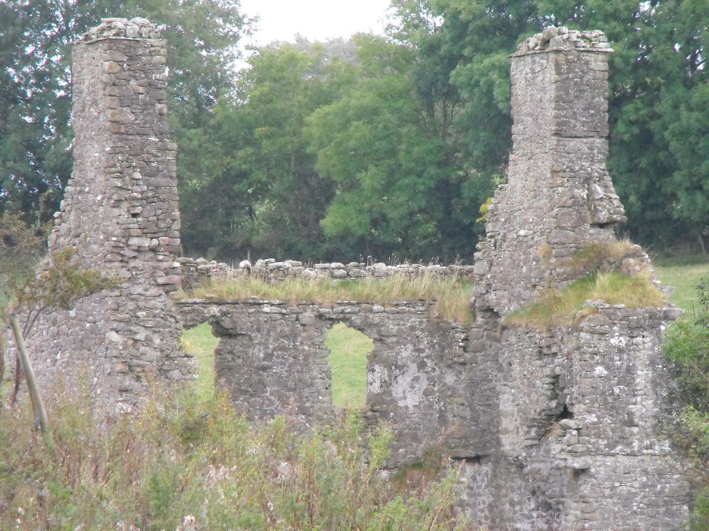
The castle was built in 1588 by John Briscoe of Crofton Hall, Cumberland.  It was four storeys high and measures about 7.5m x 9.8m.  It is about 20m high. This castle is highly defended and has a prominent
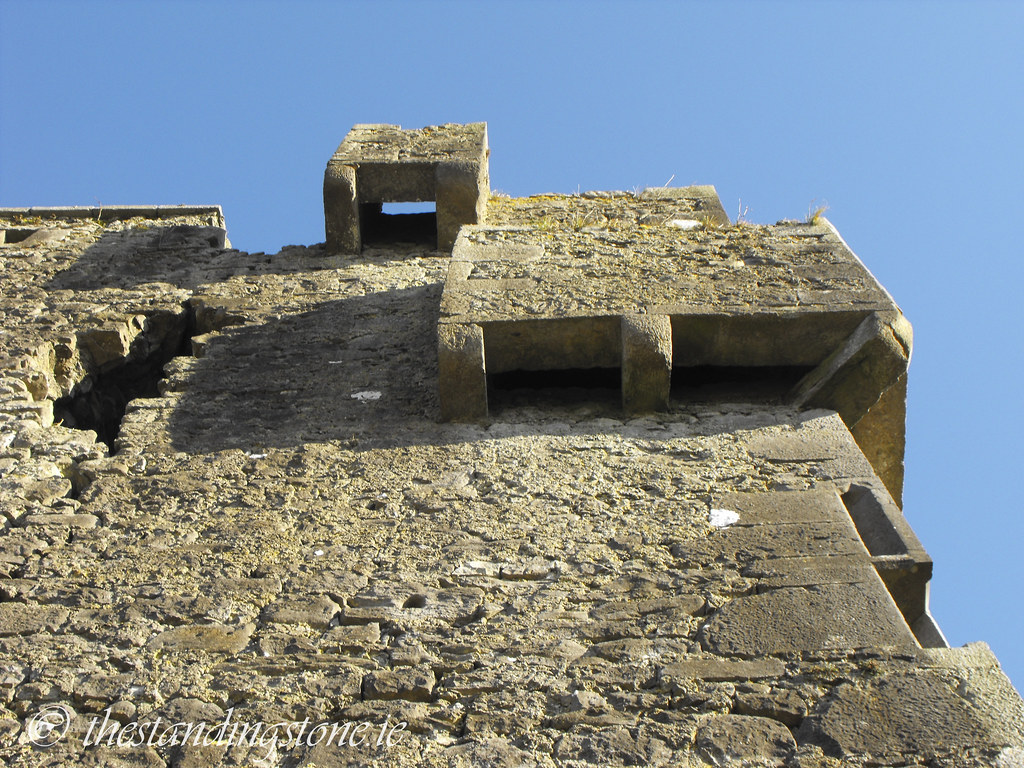
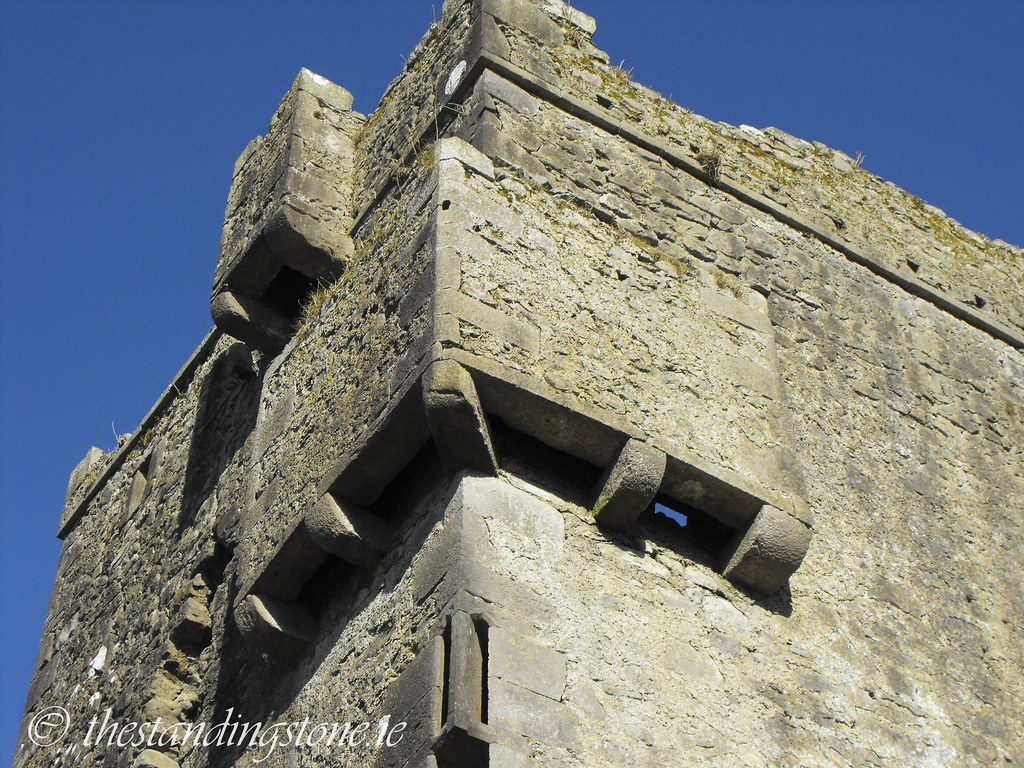
 base batter, two bartizans (one is now destroyed), 
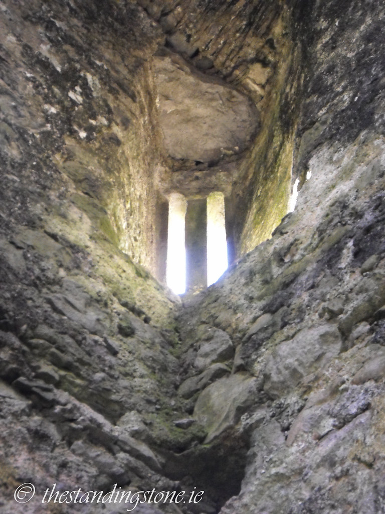
machicolation and many 
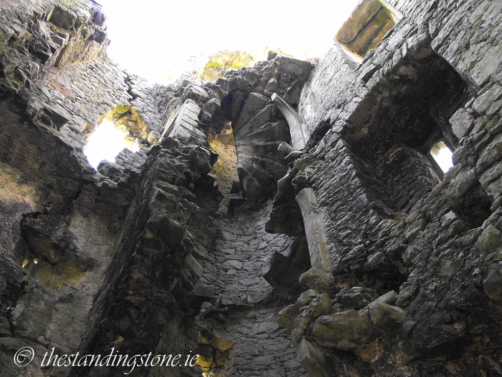
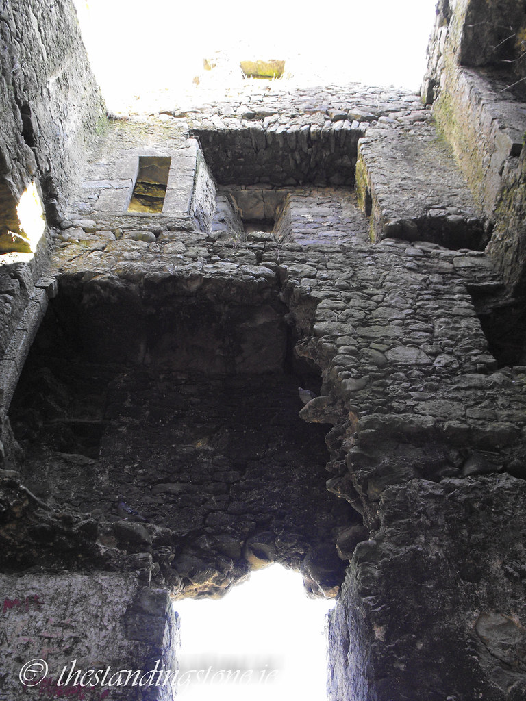
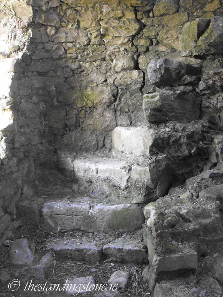
gun loops.  The spiral stairs is now destroyed with only about ten steps at ground level.  They are still in place above the third story but these cannot be accessed.  Partial remains of doorways survive on the spiral staircase which would have led into the now missing rooms.  Inaccessible 
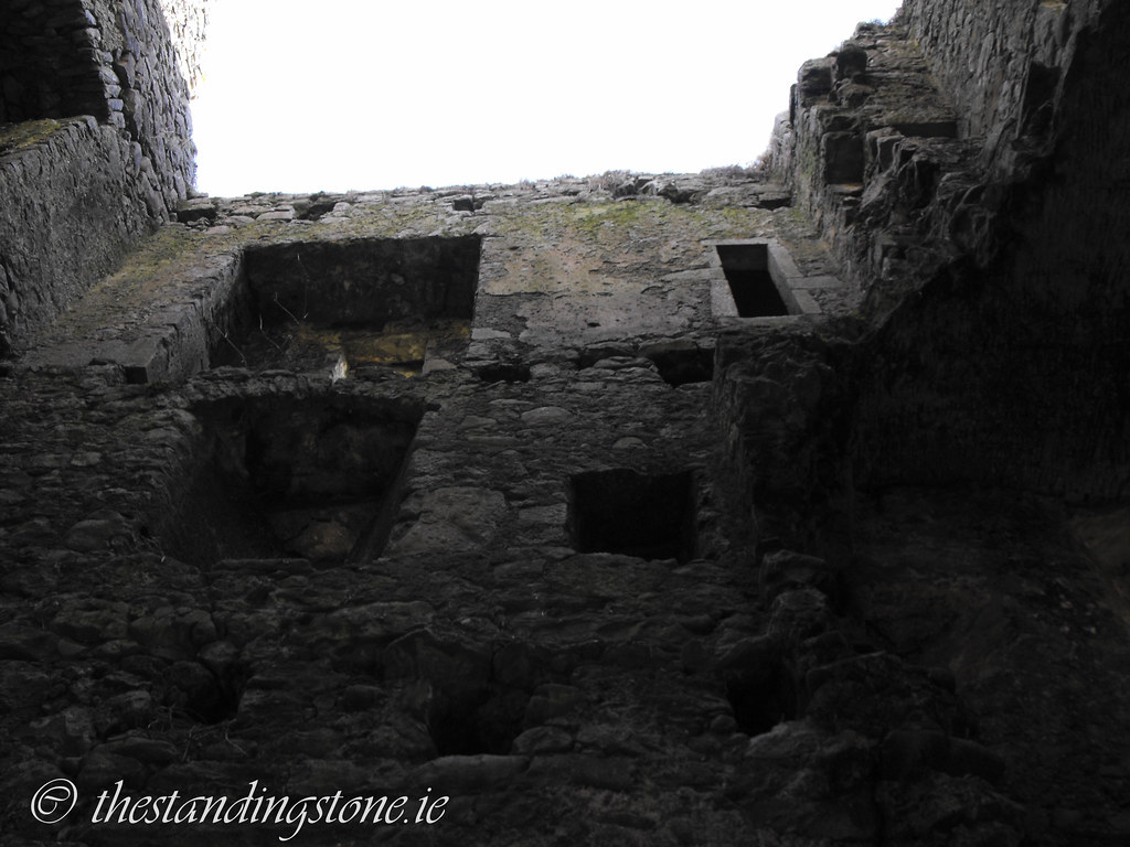
mural chambers survive on every floor and a fireplace and garderobe can still be seen.  The beginnings of a barrel vault in the second floor can still be seen.  The entrance to the castle is on the W wall.  Also on the W wall are the remains of a later house that was built onto the side of the castle.  A fireplace still survives in this later house – although there is some spray paint on it now.

The bullaun is about 1.5m long and has two large depressions in it.  It is located near the W wall of the castle next to the remains of the later house.

Difficulty – Easy to find along the canal but you have to duck under some barbed wire to get access to the field so be careful. Also there is a lot of broken glass and litter at the site.  This may not be a site to take small children to.

For more castles, click here.
For more bullaun stones, click here.
For more sites in Co. Offaly, click here.

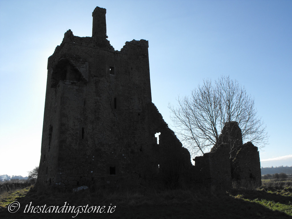
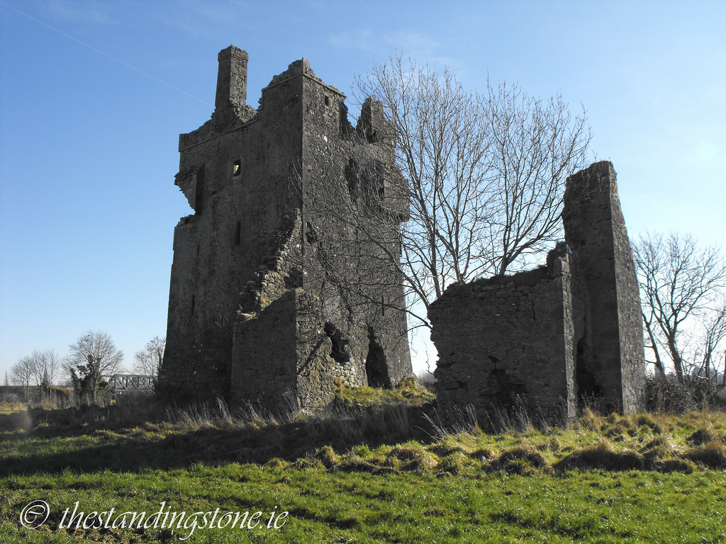
The castle as viewed from the canal.


Note the missing bartizan in this shot.


Machicolation and bartizan.


Gun loops.

Base batter.

The ruined entrance.

Fireplace in the attached house.  It is a shame about the graffiti.

Stood in the castle looking up.


Gun loops from the inside.

Inaccessible room.

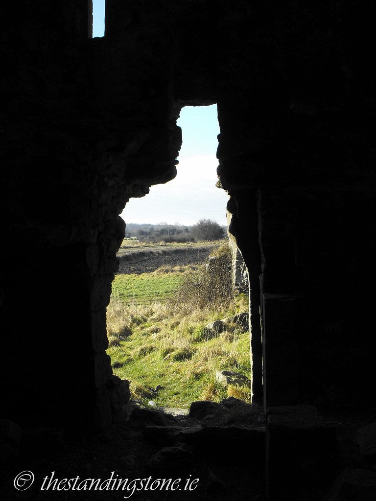
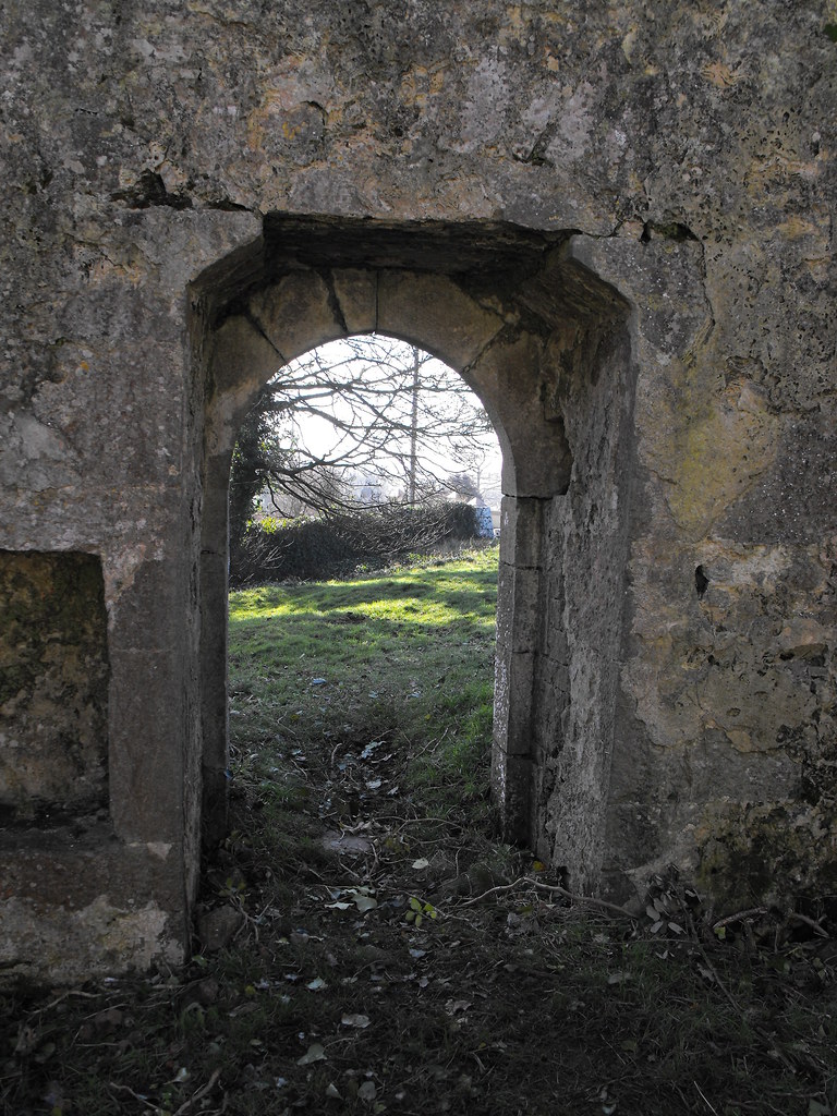
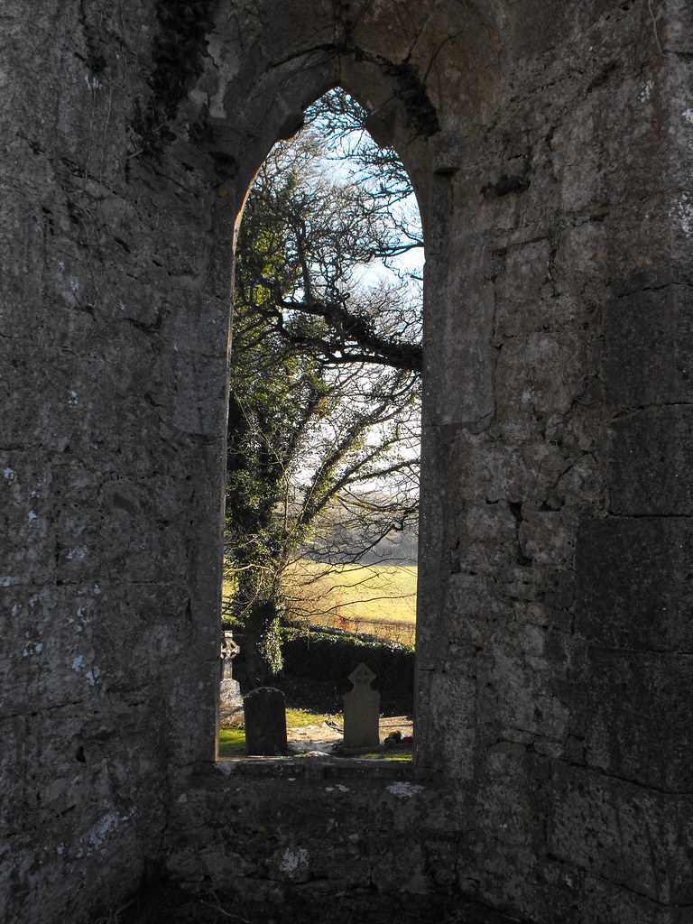
Looking out of the doorway.

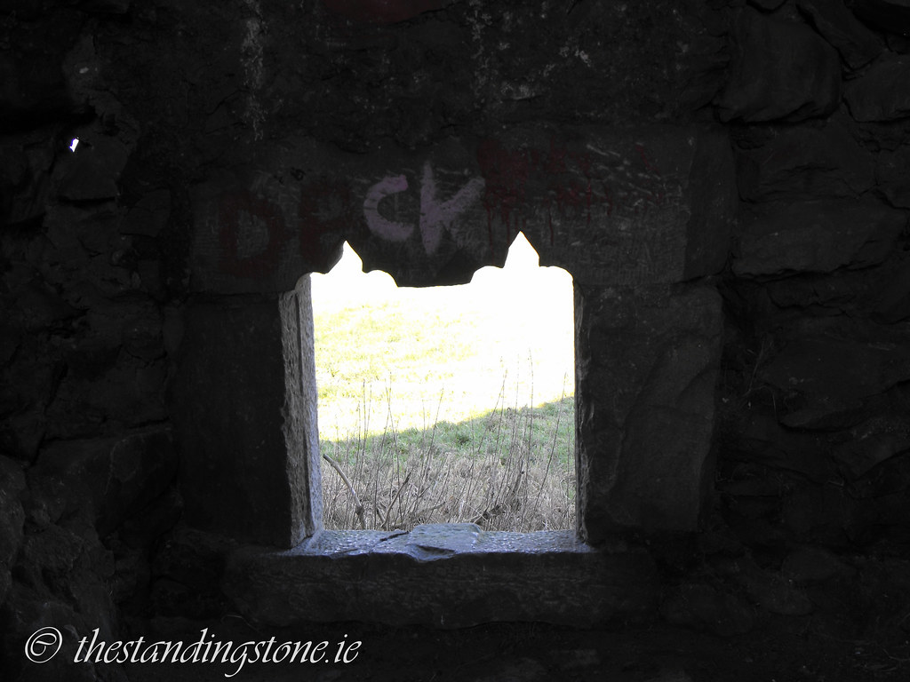
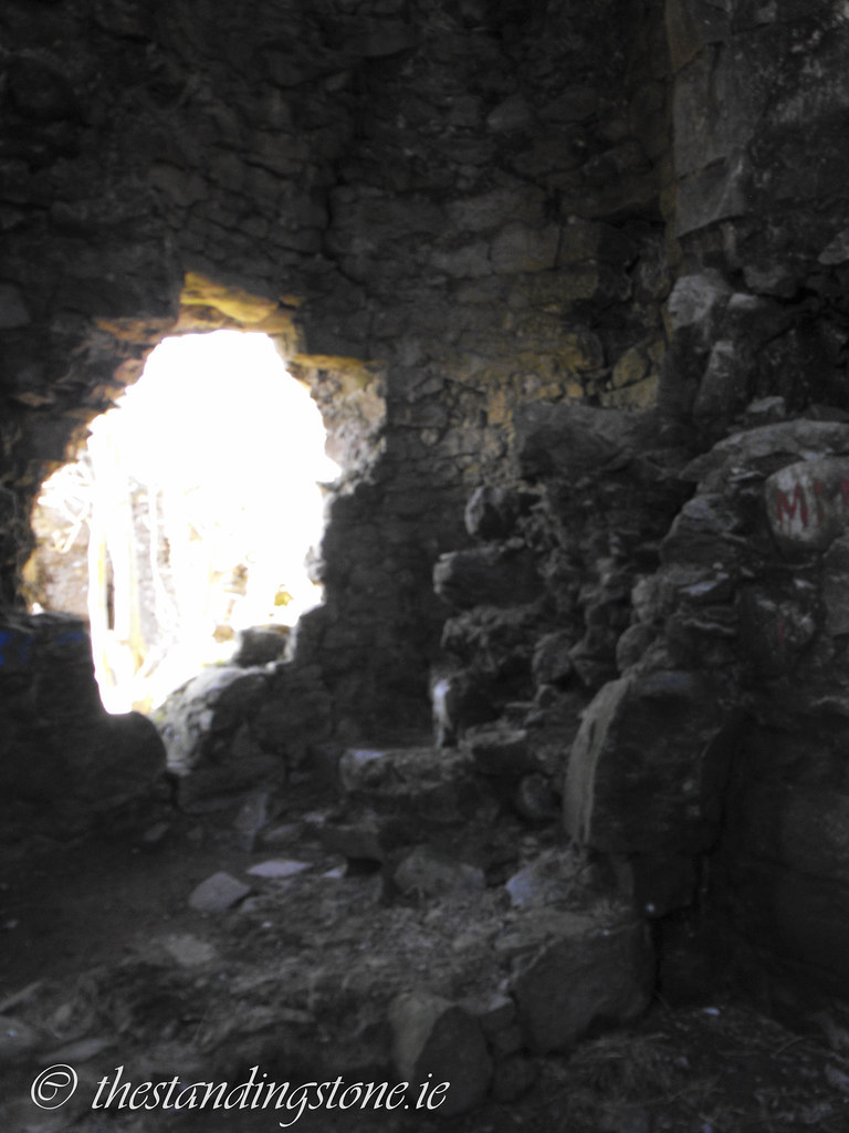
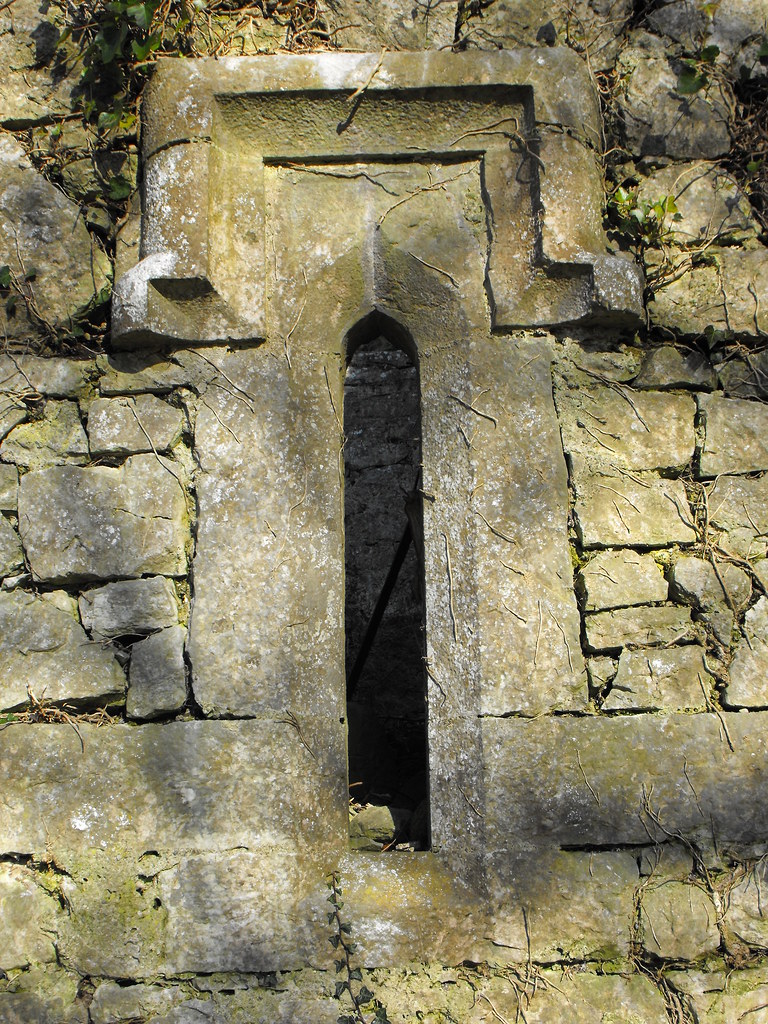
This window is later to the castle and does not match the narrow slits elsewhere.  I can only assume this was added in less threatening times. It looks as if it might have been quite nice but the graffiti really detracts from it.

You can see that the spiral stairs survive further up the structure.  Even if I could get up there I wouldn't trust them.

The remains of the spiral stairs at the bottom.


The puzzling bullaun.


View The Standing Stone in a larger map

Castledermot, Ecclesiastical Complex, Co. Kildare.

Location – In Castledermot in the grounds of a modern Church of Ireland churchyard. All of the sites here are in the graveyard and are easy to find.  I do not have GPS co-ordinates for each site so you will just have to go searching...but that’s half the fun sometimes.
OS: S 784 849 (map 61)
Longitude: 6° 50' 4.37" W
Latitude: 52° 54' 33.39" N
GPS: S 78404 84985 (Elevation: 84m – Accuracy: 5m)
See map at the bottom of the page.

Description and History – Because of the many things to see at this site I have divided them up and given them separate pages.  I will give the history of the site here and then talk about the individual sites on their own pages.
This really is a wonderful place.  There is so much to see here in such a small area.  There is a round tower, the restored remains of a Romanesque archway, two high crosses, a cross base, a Scandinavian hog-back grave marker, a holed stone and three cross slabs.  There are also some other unusual graves here.
This site first began as a small hermitage founded by St Diarmaid in 812.  He came here to escape the pressures of life but people quickly began to seek him out for his wisdom and a monastery grew up around him.  The Vikings plundered the site twice in the 9th century and the round tower was built in the 10th century and the monastery burned down in 1106.  All that remains of this foundation is the reconstructed Romanesque archway.  Click below to read more about the individual sites...and to see some pictures:
1.    The Romanesque archway.
2.    The round tower.
3.    The North cross.
4.    The South cross.
5.    The cross base, cross slabs, holed stone and hog-back grave marker.


Difficulty – This is an easy site to get to as it is in a still used churchyard.  It is also very easy to get around.

For more ecclesiastical sites, click here.
For more sites in Co. Kildare, click here.


View The Standing Stone in a larger map

Little Curragh, Barrow Cemetery, Co. Kildare.

This is a great site, or as I should say, sites.  There are multiple barrows here ranging from the tiny to the huge all across Little Curragh, NE of Kildare town.  I saw 10 barrows on the day I was there but there are many more there that I will have to search for.  Some are unfortunately lost under bushes until they are cleared but many are out in the open and easy to get to.  The numbering I have adopted here follows that of ‘The Modern Antiquarian’ and ‘Megalithomania’ for these barrows.  It will be easier for those of you reading about these barrows at those two sites as well.  There are five large barrows and some smaller ones.  Some are clustered together and appear to be satellites of the larger ones.  I visited the barrows in reverse order going from six to one and although this is in reverse order it is easier to view them this was because of parking.  There are two parking options.  Firstly you can park N of the Little Curragh at OS: N 754 144 or you can park at the end of the track way that runs from OS: N 740 145to OS: N 749 144 .  From here you can start at six and work your way around to one.  I would recommend the use of a GPS to work your way around here because some of the barrows are so small and so worn away that they are hard to spot.

Click below to view the barrows:
Little Curragh I
Little Curragh II
Little Curragh III
Little Curragh IV
Little Curragh V
Little Curragh VI

For more barrows, cairns and tumuli, click here.
For more sites in Co. Kildare, click here.

Newtown, Fortified House, Co. Offaly.

Location – At the Ballybrit crossroads, N of Roscrea on the R421, go straight on (instead of following the R421 to the left) and the fortified house is about 4km further on.  It is not visible from the road so bring your OS map with you.
OS: S 174 993 (map 54)
Longitude: 7° 44' 25.94" W
Latitude: 53° 2' 38.82" N

Description and History – Unfortunately a combination of bad weather, flooding and cattle kept me from getting too close to this fortified house.  From what I could see and photograph it is pretty ruined, but still worth a look as every fortified house I come across is unique.

The townland was granted to Sir William Sinclaire in 1621 who built the manor here. It became the property of William Parsons in 1637 and the land was seized from Laurence Parsons in the late 17th century and it became the property of John Carroll of Clonlisk.  All that remains of this house now are the two gable ends and the back wall.  The house was roughly 11m x 8m.  Fireplaces are still visible on the gable walls. There is evidence for a wall walk on the house and the surrounding bawn is still intact in places.  There is even evidence for a moat as well.  This appears to have been an impressive site.

Difficulty – Getting to this site depends on the recent weather.  The area is very marshy and prone to flooding.  It is also located in a cattle field and when I was there the field was full of very curious bullocks who immediately rushed at me when I climbed the fence.

For more fortified houses, click here.
For more site in Co. Offaly, click here.


That's as close as I could get.

Anatrim, Holy Well, Coolrain, Co. Laois.

Location – Located about 130m N of Anatrim church.  This one is really hard to spot as it is literally a gap in the hedge.  If you don’t know what you’re looking for you will not find it.  You can see the incised stone when the foliage is low in the winter.  In the summer months you will just have to go searching.
OS: S 295 924 (map 54)
Longitude: 7° 33' 38.68" W
Latitude: 52° 58' 53.69" N
GPS: S 29476 92296 (Accuracy: 6m)

Description and History – It is a little hard to find anything to say about this holy well.  It appears to be largely disused and unless you knew it was a holy well you would never know it was there.  Although I’m glad it is not encased in a modern concrete monstrosity I would like to see some kind of maintenance done on this site.  If the council go to the trouble of putting signposts up to this site then they should at least keep it tidy.  It is known as St. Kaban’s Well and is commemorated on 3rd November.  It is lined with dry stone masonry but it can’t be seen because of the undergrowth.  The stone is incised with a circle and two cup marks indicating that it is pre-Christian in origin.  The stone, however, is usually overgrown and you have to peel back the undergrowth to see the incision one the stone.

Difficulty – Easy to get to but hard to spot.  There are some stone steps down into it and it can be slippy when down in the well on the stone. Good luck.

For more ecclesiastical sites, click here.
For more sites in Co. Laois, click here.


This is what the well looks like most of the year.  Completely overgrown.

In the winter it's a little easier to see.  I scrapped what I could away from the stone and you can just make out the incision at the top part of the stone in this shot.

You can clearly see the incision here.  It curves towards it's base.

This shot is a little blurry but you can just make out the cup mark in the middle of the shot.

The slippy steps.

The New Church, Lough Gur, Co. Limerick.

Location – On the side of the road on the way to the Lough Gur visitors centre.

OS: R 642 400 (map 65)
Longitude: 8° 31' 38.43" W
Latitude: 52° 30' 37.07" N
GPS: R 64221 40037 (Elevation: 87m – Accuracy: 12m)

Description and History – This is an interesting ruin dating to the 15th century and was built by the Earls of Desmond. By 1642 it was listed as a ruin but was restored by Rachel, Countess of Bath in 1679 and this is when it became known as the ‘New Church’. A belfry was added at this time and the church was used for Protestant worship. In the 19th century it once again became a ruin and was repaired in 1900 by Count de Salis when the glazed Madonna and child was added. The bard, Thomas O’Connellan, is buried here.

As for the building itself it is quite plain but its setting on the shores of Lough Gur make it appear as if it is straight out of a postcard. It is a simple rectangular plan church measuring 17m x 6.4m with a nice arched window in E gable. The differences in stonework indicate the different phases of restoration and repair. Walking through the graveyard I tripped over a lump in the grass which turned out to be part of the arched window. It appears as if it was double arched but the masonry has been knocked out and is now scattered throughout the graveyard. On the N wall there is evidence for a second building, probably a sacristy, but there is no remains of it now apart from the markings on the N wall.

Difficulty – Easy to find although parking is a little difficult. Mind your step.

For more ecclesiastical sites, click here.
For more sites around Lough Gur, click here.
For more sites in Co. Limerick, click here.


Internal view of the doorway.

An external view.


A ruined tomb located in the interior of the church.


The glazed Madonna and child.

Possible evidence of a sacristy.

Lovely medieval window.

Architectural fragment in the graveyard.
 
View The Standing Stone in a larger map