Roscrea, Round Tower, Co. Tipperary.

Location – In the centre of Roscrea, opposite the remains of a Romanesque church and High Cross.  I suspect that all three sites are related and belong together as part of one ecclesiastical site but I will treat them separately as they all warrant individual attention.
OS: S 137 895. (map 60)
Longitude: 7° 47' 46.06" W
Latitude: 52° 57' 22.16" N
GPS: S 13779 89414 (Elevation: 92m - Accuracy: 7m) 

Description and History – The round tower is part of a larger ecclesiastical site in Roscrea which goes back to the 7th century and was founded by St Cronan.  The Roscrea brooch (in the National Museum of Ireland) and the Book of Dimma (in Trinity College Dublin) are from this foundation.  The original monastery was founded near Monaincha Abbey but was moved to Roscrea to make it more accessible as the town was on the ‘Slighe Dala’ which was one of the main roads leading from Tara.

The round tower is contemporary with the remains of the church and date to the 12th century and was struck by lightning shortly after construction.  The tower is roughly 6 storeys high and made of sandstone. There are three windows on the tower and one doorway which are all high up, of course.  The tower was 6m higher but was shortened after the 1798 rebellion after rebels used the tower to snipe at the castle.  Until 1812 it was used as a bell tower when the present Church of Ireland church was constructed and the Romanesque church demolished.

Difficulty – Easy to get to and the Roscrea museum is located in the old mills next door which has many interesting pieces.

For more round towers, click here.
For more sites in Co. Tipperary, click here.
For more sites in and around Roscrea, click here.


Damer House, Roscrea, Co. Tipperary.

Location – In the grounds of Roscrea Castle in the centre of the town. OS: S 136 893.
Longitude: 7° 47' 51.44" W
Latitude: 52° 57' 15.7" N

Description and History – Damer House is located within the curtain wall of Roscrea castle and was built in 1722 by John Damer who had recently purchased the castle grounds.  The house was intended to be a family residence but it appears that the family lived there only for a brief period if at all.  The house is built in the Queen Anne style and is constructed of locally sourced sandstone.  In 1798 the house became a British military barracks for 110 men.  In 1906 the house was turned into a school for boys (Mr French;s Academy).  The Roscrea Bacon Factory tried to buy the building in the same year to convert it into a factory but their attempt was unsuccessful.  In 1924 it became a sanatorium and in 1932 it reverted to being a school which became the buildings purpose until 1956.  Over the next 20 years the building fell into disrepair and was scheduled for demolition in 1973.  Luckily for us this was vehemently opposed buy the Old Roscrea Society and the building still stands.  The building has now been mostly restored and houses many interesting exhibits. 

The house is three storeys high over a basement and is simple in style with a finely carved wooden staircase.  An impressive feature of the house is the doorway with its carved Corinthian capitals and scroll designs.  I would suggest visiting this house after the castle and spend some time looking at the fantastic exhibits.

Difficulty –  Easy to find and traverse.

Nearby Sites:
For sites in and around Roscrea, click here.
For more sites in Co. Tipperary, click here.


The beautiful carved staircase.


Roscrea Castle, Co. Tipperary.

Location – In the very centre of Roscrea town on Castle Street.
OS: S 136 894 (map 60).
Longitude: 7° 47' 51.43" W
Latitude: 52° 57' 18.93" N
GPS: S 13651 89339 (Elevation: 95m - Accuracy: 9m) 

Description and History – Although this castle pre-dates the later medieval tower houses it looks and feels like one and may represent a very early development from the sprawling medieval castles to the later and more compact tower houses.  This multi-period site was in use from the 13th century until the 20th century and gives us a full history of Ireland under occupation.  Roscrea was an important ecclesiastical site before the Norman invasion and was a natural site for substantial Norman defences.  As part of subduing the midlands King John decided to build a castle at Roscrea in 1213.  Work does not appear to have begun at the site until the 1240’s during the reign of Henry III. The site of the castle belonged to the church and was confiscated by the Normans. The bishop of Killaloe opposed to this and threatened to excommunicate those building the castle.  He was bribed with land and work on the motte and bailey resumed.  The castle was intended to be a royal castle but was granted to the Butlers as they were very powerful in the region and had an important castle not far away at Nenagh.  In 1277 it was decided to rebuild the castle in stone and £634 was allocated for this with a further £1000 being spent to expand the castle with a man named John de Lydyard being placed in charge of the work.  The total expenditure for the castle cannot be calculated due to incomplete records but it appears that it was an expensive undertaking. The castle does, however, appear to have been built where the earlier timber castle stood and archaeological evidence indicates that the stone walls now stand where earlier timber walls stood.  The reason for this vast expenditure on the castle is largely due to the discovery of the silver mines near Nenagh and the fact that John de Lydyard was in charge of the mines also.

The purpose of this castle, apart from defence, appears to have been as a prison with many references to prisoners at the castle as well as many prisoner deaths. The building of the castle saw Roscrea rapidly grow in size from a small ecclesiastical town to a defensive town.  The urban centre of the town shifted from the monasteries to the around the castle.  For the next few centuries Roscrea remained peaceful and escaped large violence during the Gaelic resurgence largely due to intermarriage and good relations between the Butlers and the O’Carrolls.   During the Wars of the Roses in Britain in the 15th century, Butler power waned and the O’Briens of Thomond the Fitzgeralds of Kildare began extending their power towards Roscrea, both seeking to fill the vacuum.  As a result of the Butlers close relationship with the O’Carrolls the castle and its lands came more and more under O’Carroll influence and it even appears that for periods of time the O’Carrolls actually occupied the castle.  This tense political situation in the 15th century can be marked by a revolt of friars in 1477 which badly damaged the castle and resulted in the destruction of the friary after which the present friary was built.  However, Roscrea suffered under the O’Carrolls and the town became described as a ghost town although the records we have are English records and full anti-Irish racism. A decline seemed inevitable as many living in the town were Butler supporters and were even driven out by the O’Carrolls or left of their own accord.  The revolt of 1477 probably didn’t help matters either.  When the Butlers tried to get back their lands in the midlands their good relationship with the O’Carrolls broke down and war erupted between the two families.  After three wars the Butlers won out and set about repairing the severely damaged castle and town as a result of years of neglect and conflict.  However, during the rebuilding of Roscrea in 1568 there was a dispute among the Butlers. The tenth earl of Ormond, Thomas Butler (known as the Black earl) was based in Carlow and decided to shift his focus to Tipperary and this came at the expense of his younger brothers Sir Edmund Butler and Edward Butler.  Eventually hostilities broke out and Edmund and Edward marched on Roscrea, took the castle and resumed hostilities with the O’Carrolls. This was the beginning of a revolt and the brothers tried to overthrow their brother and royal power in Ireland. They were unsuccessful and the Black earl soon regained power.  The castle was then put up for rent by the earl and saw many tenants over the coming century including many Butlers from other branches of the family. By 1596 the Butlers has driven the O’Carrolls out of the Roscrea area.  The first half of the 17th century was relatively peaceful for Roscrea and the castle passed from Butler to Butler.  However, in 1649 the castle was taken by the O’Neils and came back under Irish control – it was quickly retaken by Cromwellian forces in 1650.  The castle was garrisoned under Cromwell and was one of the castles listed for destruction in 1692.  Although many castles were unfortunately destroyed Roscrea was spared this fate and was allowed to stand.

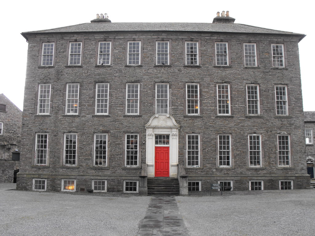
After centuries of control the Butlers sold the castle and town to Robert Curtis of Inane in 1703 who in turn sold it to John Damer in 1722.  Within the castle courtyard the Damers built their family home, Damer House (which I will be dealing with separately).  From the early 17th century there was a permanent barracks in Roscrea and the castle eventually was used for this purpose from 1798 onwards with roughly 350 men stationed there. By this time the castle was in poor repair with its gatehouse blocked up the roof caved in. The roof was repaired in 1850, although by the turn of the 20th century the castle appears to have been completely abandoned.  It became a National Monument in 1908 and came under the care of the county council after the War of Independence in 1922.  The whole site, including Damer House was handed over to the state in 1986 who have conserved and restored the castle.

I commend the OPW for their excellent work that has been done here.  The castle is beautifully preserved, as are the grounds, and elements such as the machinations of the gatehouse, which have long since rotted away, have been restored.  This is a 
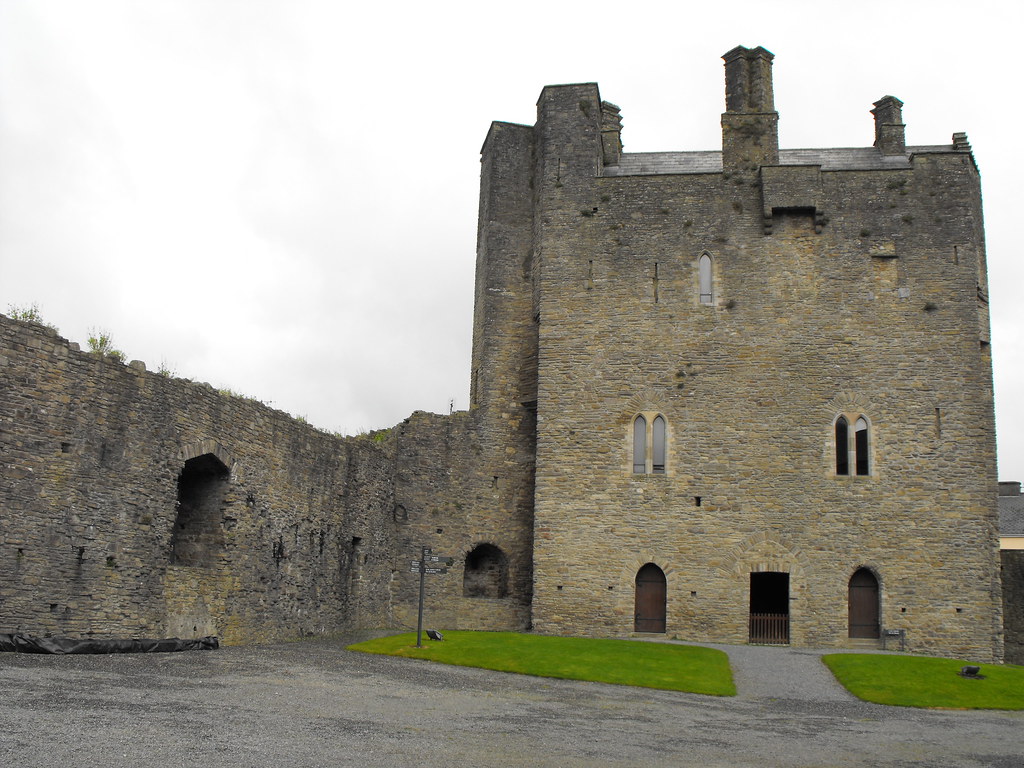
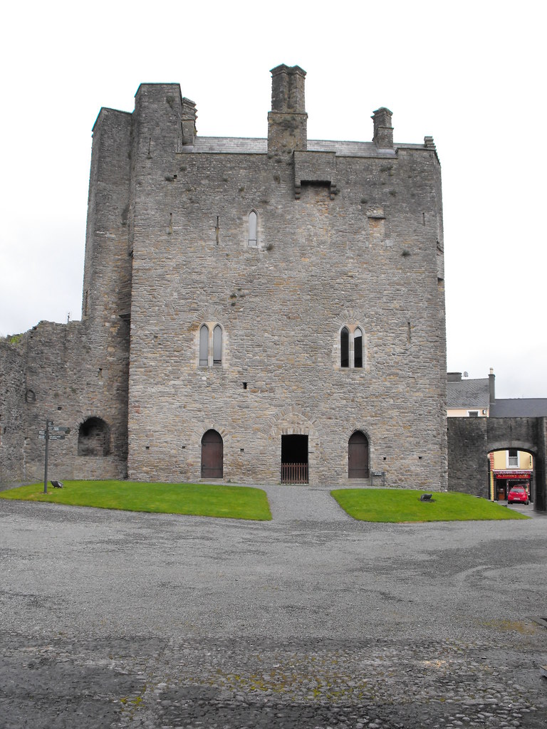
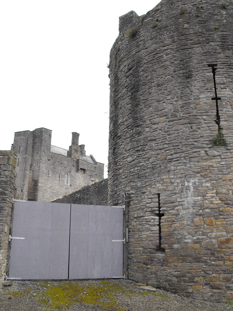
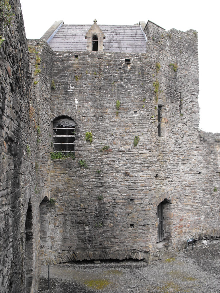
keepless castle and the emphasis is on the gatehouse which serves as the main residence.  The 
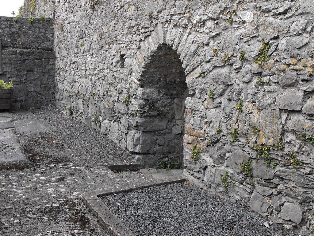
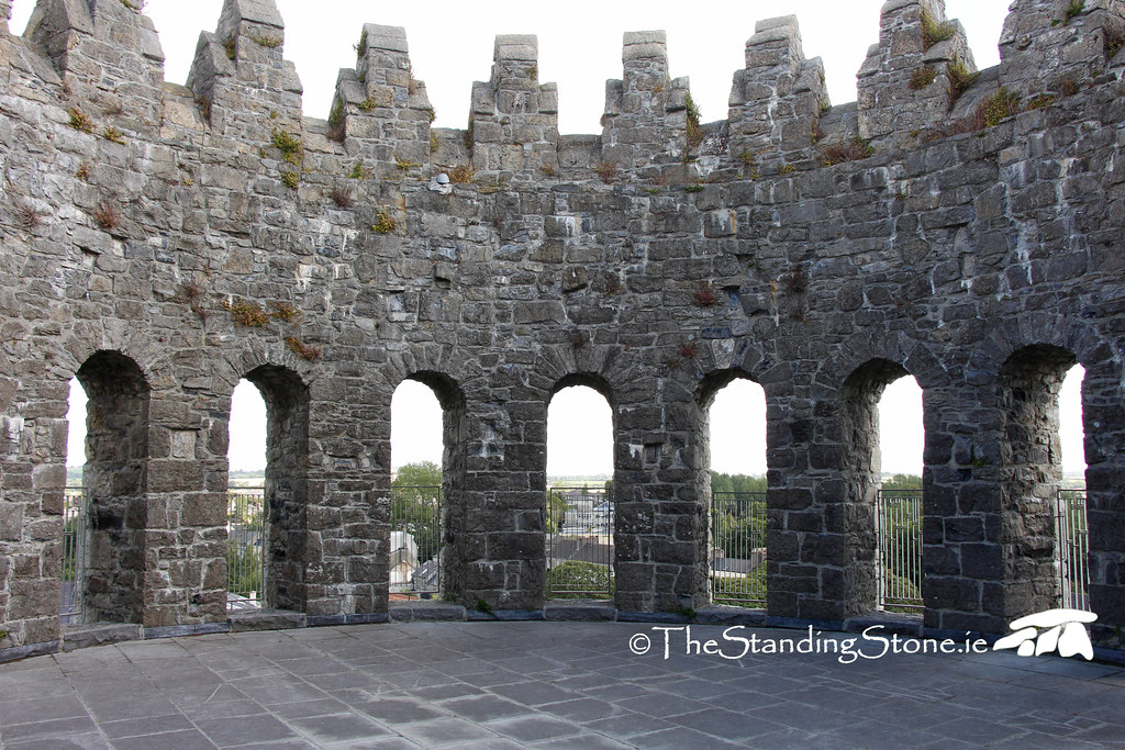
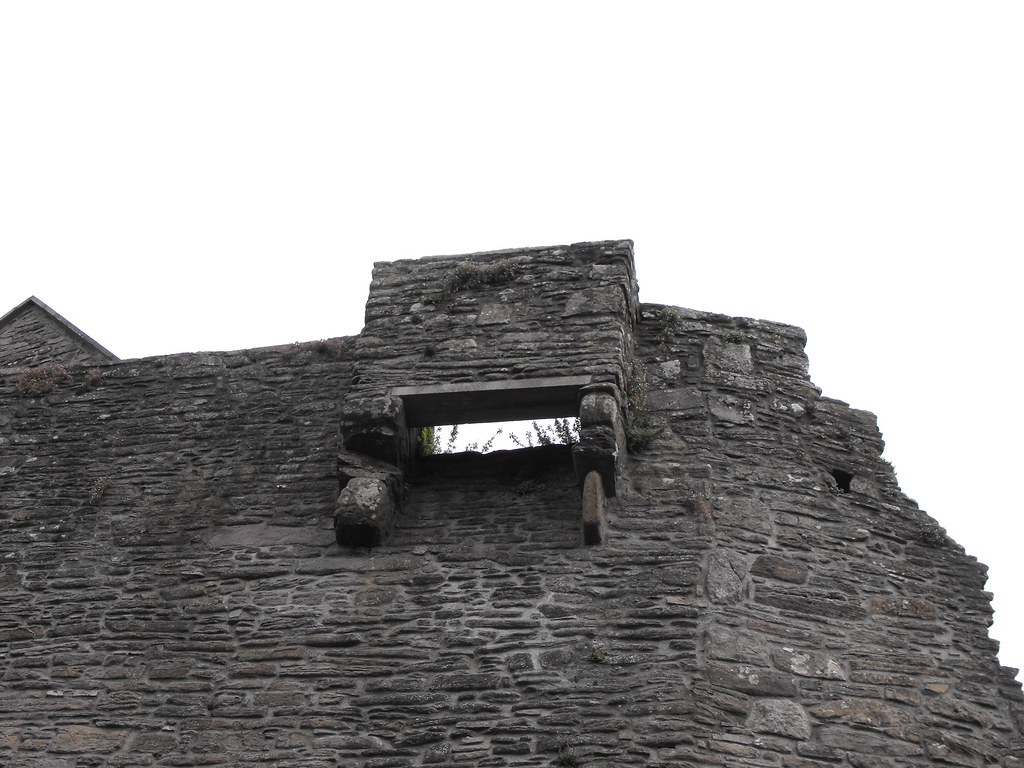
curtain wall the E and W towers also survive. The castle is 17.2m x 11.5m and three storeys high with 18th century chimney stacks and a 19th century slate roof.  A river protected the castle on the E side and moat on the other sides with access to the castle via a 
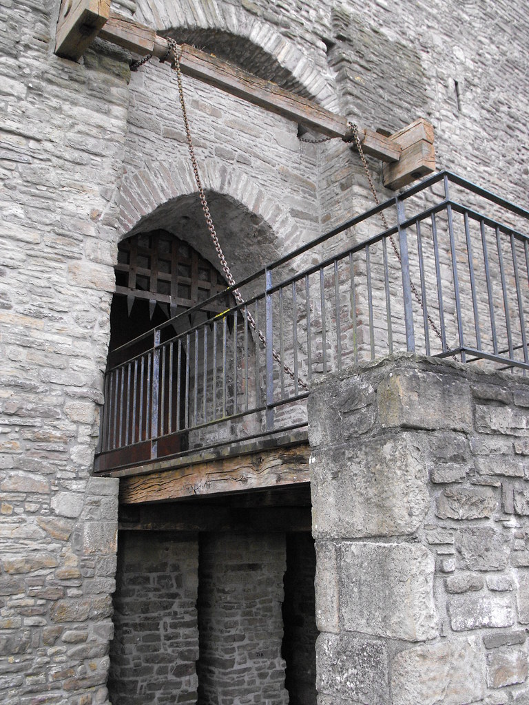
drawbridge.  The entrance to the gate house has a 
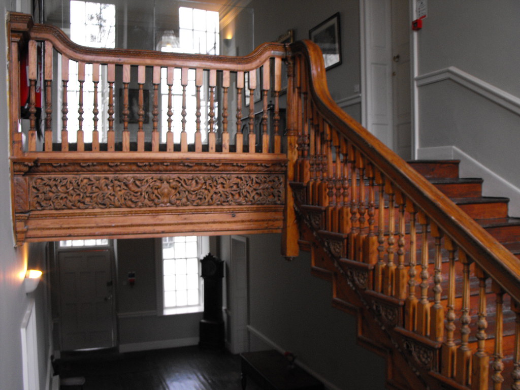
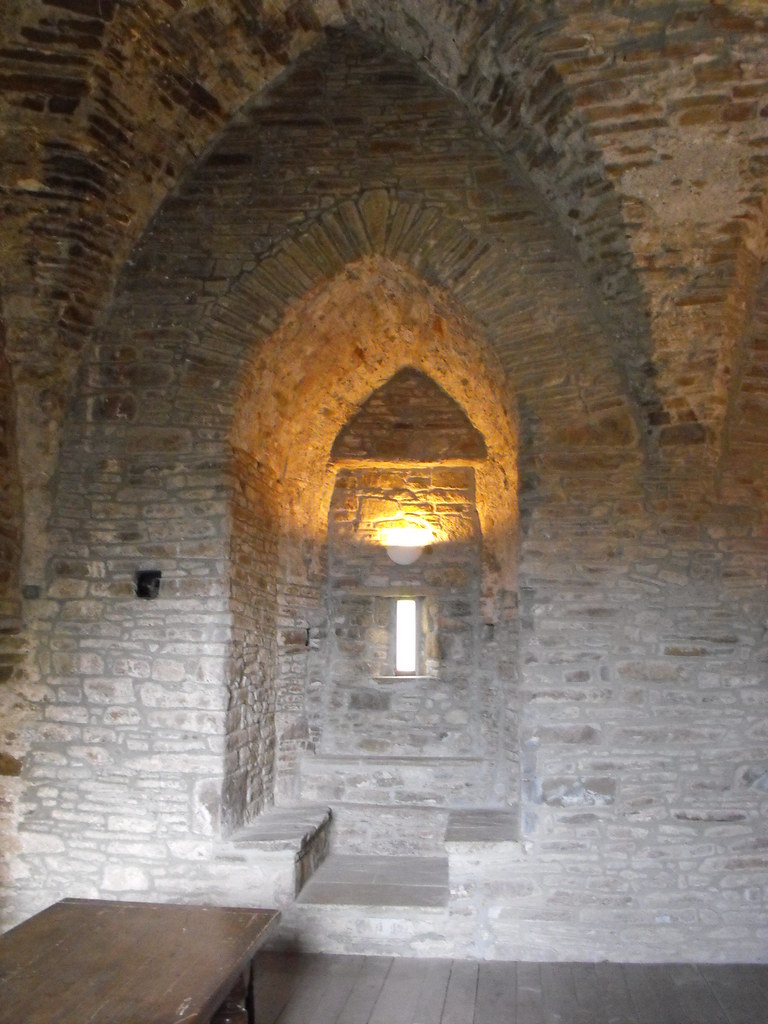
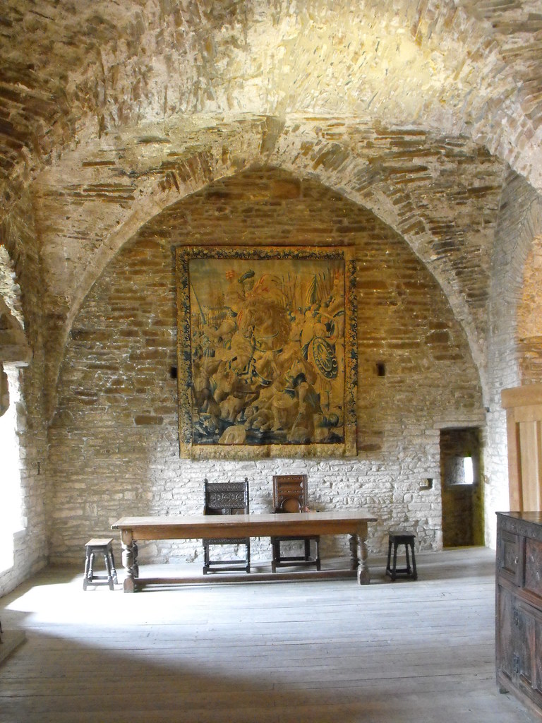
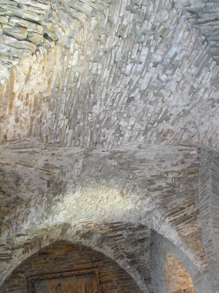
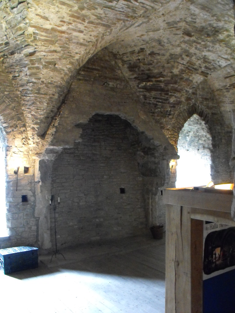
barrel vaulted ceiling which was largely collapsed before it was restored recently.  There is a basement prison on the ground floor that can only be accessed through a trapdoor.  It is inaccessible today.  A spiral staircase site in the E corner of the tower and through this all floors are reached.  The staircase differs to the later staircases of tower houses in that it is wider and the steps made of many smaller stones as opposed to one large block.  There is much more skill in the making of the steps this way and the craftsmanship is wonderful to see.  The main hall of the castle is on the second floor and is one of the most impressive castle halls I have seen mainly because of the 
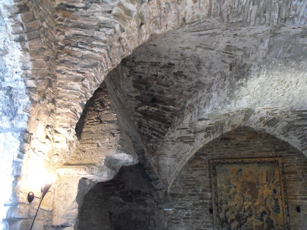
groin vaulted ceiling which is very well preserved.  Lancet windows light the room and there is a large fireplace in the centre of the S wall.  The fireplace with dogtooth capitals and has large canopy which is partially broken.  The drawbridge was controlled from this room and a 
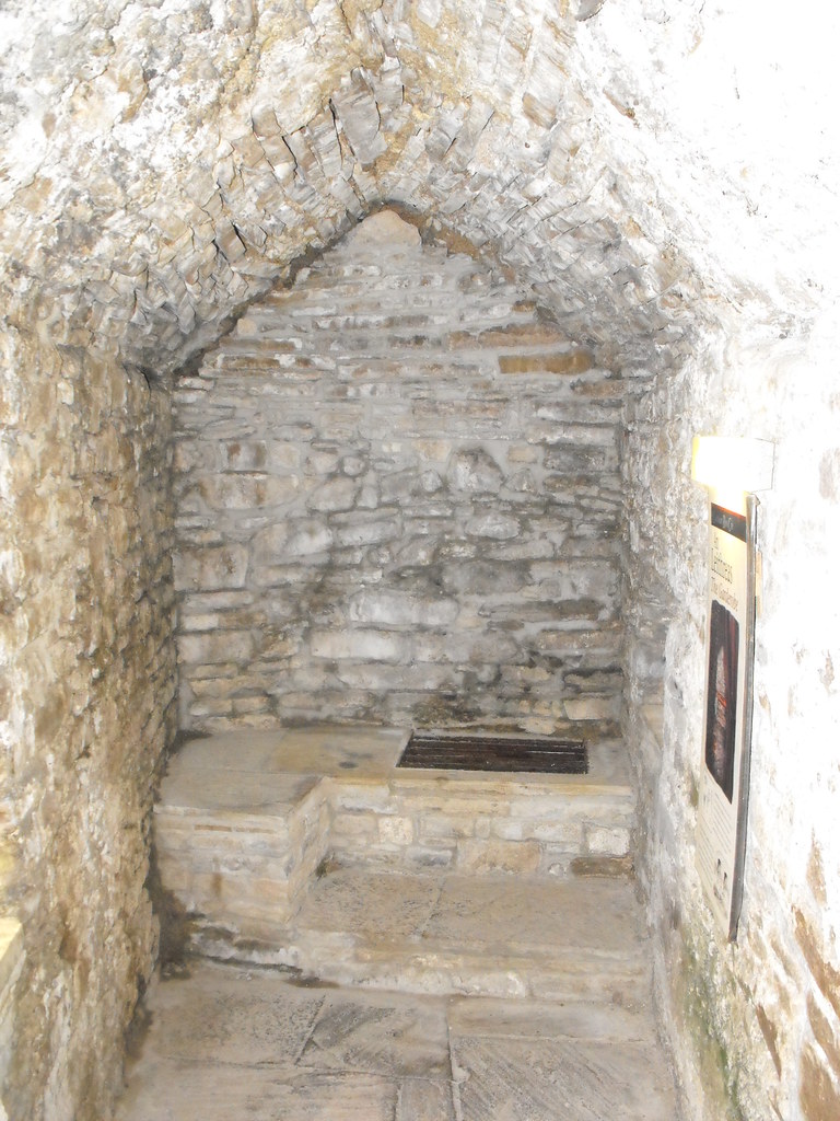
garderobe is also located on this floor hidden in a mural passage.  A now inaccessible (to the public) spiral staircase in the NW corner of the tower leads to a wall walk level and begins on this level.  The third floor was added in the 17th century. Outside the curtain wall is defended by many large cross-loops as well as the two towers.  The W tower is three storeys high and is unfortunately not open to the public as is the E tower which is two storeys high.  Impressive stucco plaster is apparently located in these towers and the E tower has a vaulted basement.

This castle is fantastic and very well presented with good facilities that are inexpensive.  I thought I wouldn’t be there long but ended up spending most of the day there – mainly staring at the groin vaulted ceiling.

Difficulty – Easy to get to and get around.  Spiral stairs are always tricky for those of us that are cursed with big feet.

Nearby Sites:
For more sites in and around Roscrea, click here.
For more sites in Co. Tipperary, click here.
For more medieval castles, click here.

View of the castle and gatehouse from castle street.


Close up of the restored gatehouse.


View of the castle from behind the E tower.


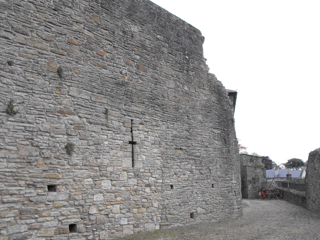
The curtain wall with cross-shaped loop.


Defensive machicolation.


The E tower.


View of the castle from Damer House.

 
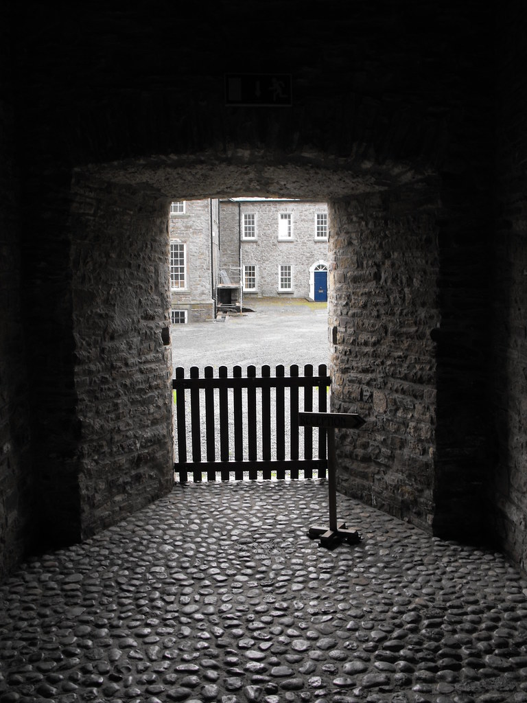
Looking toward Damer House from the gatehouse.


The beautiful groin vaulted ceiling on the first floor.


Lancet window on the first floor.


The damaged sloped chimney cover.


The garderobe behind the main hall on the first floor.


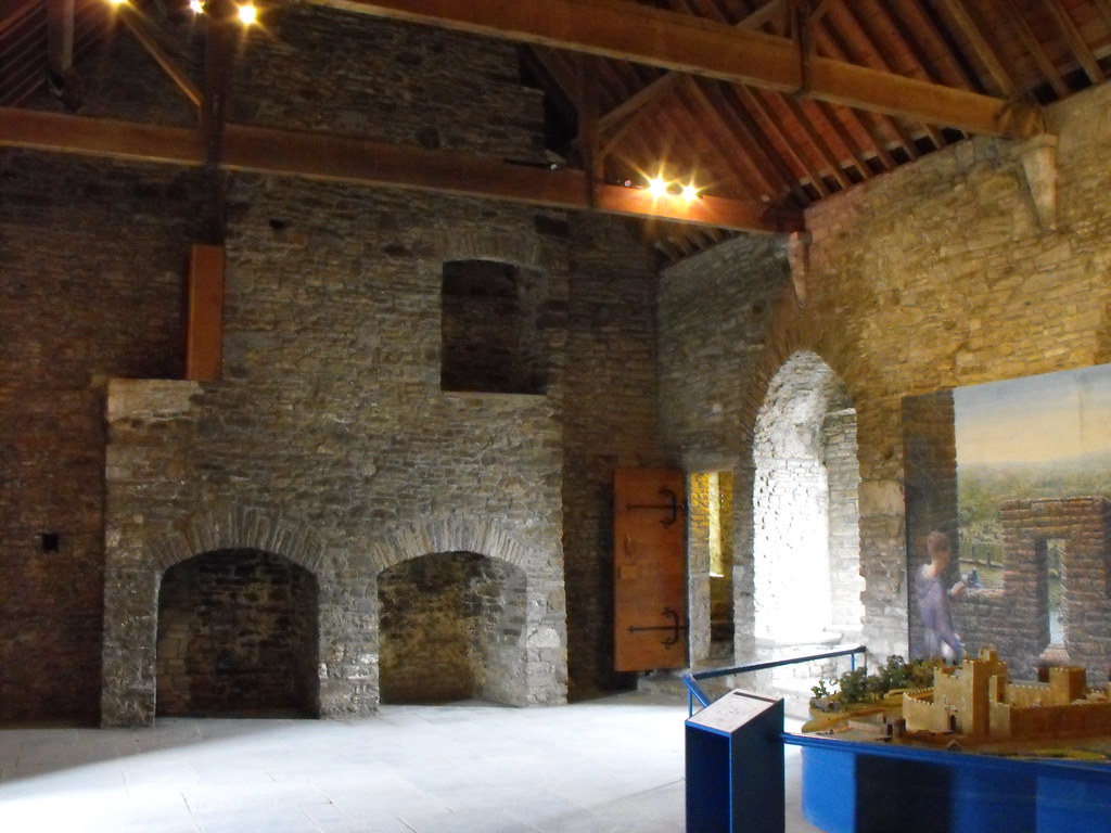
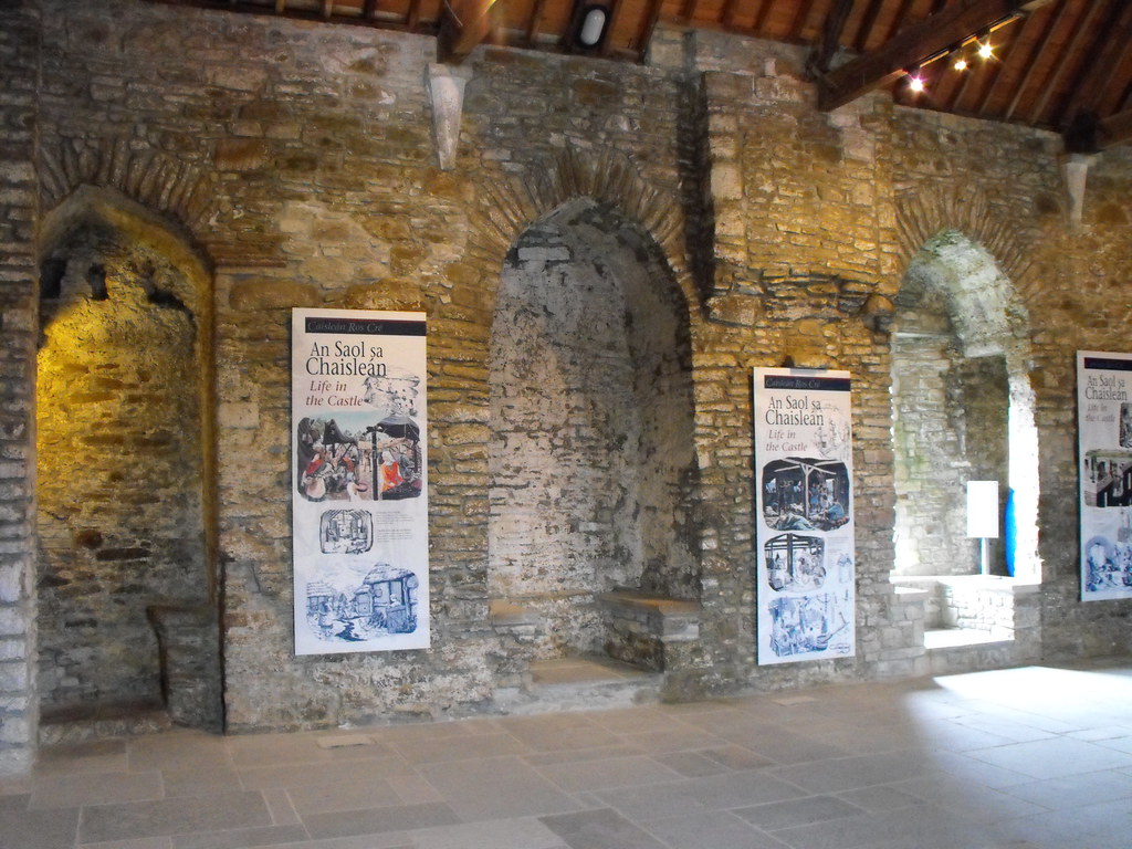
The second floor which serves as a partial museum.


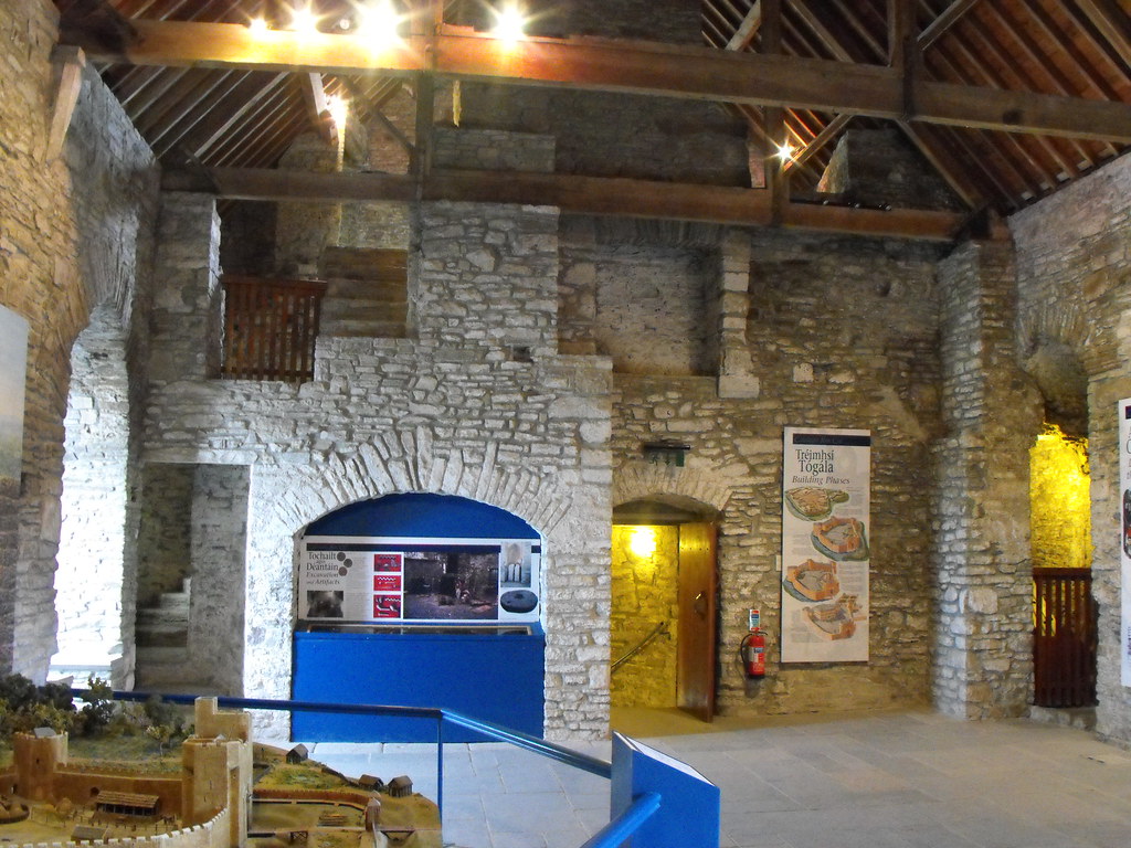
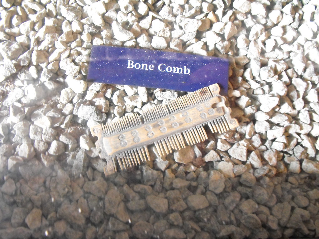
One of the many archaeological finds on display in the castle.

Manger, Cist Tomb, Co. Laois.

Location – OS: S 597 872  (map 61).  Located not far from where the N80 and N78 intersect.
Longitude: 7° 6' 43.44" W
Latitude: 52° 55' 56.43" N

Description and History – I particularly like this site, mainly because it is the only megalithic site of worth that I have found in county Laois.  However, it is still a worthwhile site in its own right even though it is largely ruined.  The cist tomb is now wedged between a field fence and the road and is largely forgotten about.  In fact you could drive and walk by it without even knowing it was there.  A large stone slab 2.5m x 2.2m and about 0.3m deep rest on some small orthostats and a drystone wall at the rear.  The slab has slipped somewhat but you can still see what it must have been like.  The chamber is about 0.8m deep.  The tomb sits at the edge of a now in-filled quarry and faces the NE.  As with many cists this was once underneath a barrow or cairn but this has been removed, probably during quarrying activity.  It has been reported that many other cists were scattered nearby but have been removed.  The site may have been of some importance and much larger.  An account of the site from 1849 says that this tomb was buried and surrounded by a kerb of standing stones.  It is sad that what was obviously such an impressive burial monument that was still intact 150 years ago is now ruined and left to fall to pieces on the side of a country lane.

Difficulty – This tomb is right on the side of the road but can be easily passed, particularly in the summer months.  Keep your eyes peeled.

For more Neolithic tombs, click here.
For more sites in Co. Laois, click here.

 
The supporting orthostat. Note that the slab has fallen off the stone.


The dry stone walling inside the chamber.


As seen from the road.

Clashagad Upper, Rath, Co. Offaly.

Location – On the N7 just E of Dunkerrin OS: S 072 850 (map 59). The rath can be seen from the road.
Longitude: 7° 53' 34.64" W
Latitude: 52° 54' 57.03" N

Description and History – This rath is only one among many in this region and I will cover the rest in this area over time.  I had not intended to visit this site but happened to see it from the road while passing one day.  It is in flat land and is roughly 26m in diameter and has an earthen bank about 0.7m high and 3m wide.  There is an external fosse and an entrance to the E.

Difficulty – Easy to find as it can be seen from the road, but the field does get flooded in the bad weather.  It was too mucky on the day I was there for me to get close but there is really nothing overly remarkable about this site.

Nearby Sites:
Ballynakill, Fortified House, Co. Tipperary.


Cumber Upper, Holy Well and Bullaun Stone, Co. Offaly.

Location – At the bottom of the S end of Knocknaman hill in the foothills of the Slieve Bloom mountains. OS: N 203 027 (map 54).
Longitude: 7° 41' 49.5" W
Latitude: 53° 4' 28.44" N

Description and History – This is a lovely Holy Well in a great location in heavily forested land.  The close proximity of a barrow about half a mile away at Forelacka indicates that this was an important area in ancient times as Holy Wells often predate Christianity.  The canopy that surrounds it now is modern but fits the natural spring.  As is common with Holy Wells the face of saint is represented above the well.  A large bullaun stone sits to the left of the well in the undergrowth and was found in a field nearby.  The stone has two large depressions in it and may be associated with the well.

Difficulty – No walking through muddy fields is necessary here as it is located on the side of the road.  The only problem is finding it as it is tucked away in the hills.

Nearby Sites:
Forelacka barrow (forthcoming)
Glenafelly, Standing Stone.


The bullaun stone.

Nenagh Friary, Co. Tipperary.

Location – OS: R 872 792 (map 59). Located in the centre of Nenagh, not far from the castle and near the shopping centre.
Longitude: 8° 11' 24.27" W
Latitude: 52° 51' 49.01" N

Description and History – The Franciscan friary was founded here by the Bishop of Killaloe, Donagh O’Kennedy, in 1250AD. It was the chief house of the Irish friars and a provincial synod was held there in 1344. The friary was destroyed during the reign of Elizabeth I and then rebuilt and subsequently suppressed during Cromwell’s Ireland campaign. The present remains are a large rectangular church aligned E-W roughly 43m in length and 10m wide. Portions of the Sacristy survive along the E end of the friary. The Sacristy measured 10x4m. Along the N wall of the church are 15 lancet windows which are very impressive. The building must have been spectacular when it was complete. The church is well kept and maintained today and is well worth a visit when in Nenagh. I will revisit this church when I go back to the re-opened castle as there are many architectural features that I missed on my initial visit.

Difficulty – Easy for anybody to traverse. The friary is not open to the public internally but you can go to the tourist office on the main street and they will give you the key if you wish to go inside.

Nearby Sites:


The E gable end.


Note the large lancet windows along the wall.


The interior of the friary.


Small arched doorway along the S wall.

Nenagh Castle, Co. Tipperary.

Location – The castle is located right in the centre of Nenagh town and cannot be missed towering above the other buildings.

OS: R 872 794 (map 59). 

Longitude: 8° 11' 24.3" W
Latitude: 52° 51' 55.48" N

Description and History – In its heyday, Nenagh Castle must have been one of, or possibly the most impressive castle in Ireland. The imposing tower that remains today was originally one of five towers, plus connecting walls. It must have been a fantastic sight. The castle was built between 1200 and 1220AD and was the chief residence of Theobald Walter and the main seat of the Butler family until the early 14th century when the castle came into Mac Ibrien hands. It reverted to Butler control in the early 16th century in 1533 under Piers Butler, Earl of Ossory. In 1332 ‘prisoners took the castle of Nennogh and the gates there were burned; which was recovered and the prisoners kept.’ At the same time the castle was described as ‘...a castle surrounded with five towers, a hall, a house beyond the gate, a kitchen with stone walls roofed with shingles.’ Following the Williamite wars Nenagh castle was dismantled so that it would not be used again in any future conflicts. A landowner named Solomon Newsome tried to blow up the remaining portion of the castle in the 18th century but was unsuccessful. A large hole in the N wall represents this effort. The castle was five sided in plan with five large towers, thought to be the largest towers in Ireland and Britain. There was also a large twin-towered gatehouse and a large wall surrounding the castle. Only fragmentary ruins remain of the 5 towers as well as portions of the large wall and gatehouse. The main remaining feature is the keep which stands 4 storeys high with a castellated top that was added in the 19th century.


Difficulty – Easy to find as it is located in the centre of Nenagh town. It is due to re-open in early 2010 so I would advise ringing the tourist board first to make sure that it will be open when you get there.


Date of Visit: My first visit was on 29th August, 2009. The first two pictures are from this date. The rest of the pictures come from my return visit on 14th August, 2015 after conservation works were completed. 

For more sites in Co. Tipperary, click here.
For more castles, click here


This was as close as I could get to the castle.


One of the plunging sandstone arrow-loops.

The base batter.


The castle has very deep embrasures. 


The 19th century crenellations.