Clonenagh, Church, Cross Slabs and Holy Tree, Co. Laois.

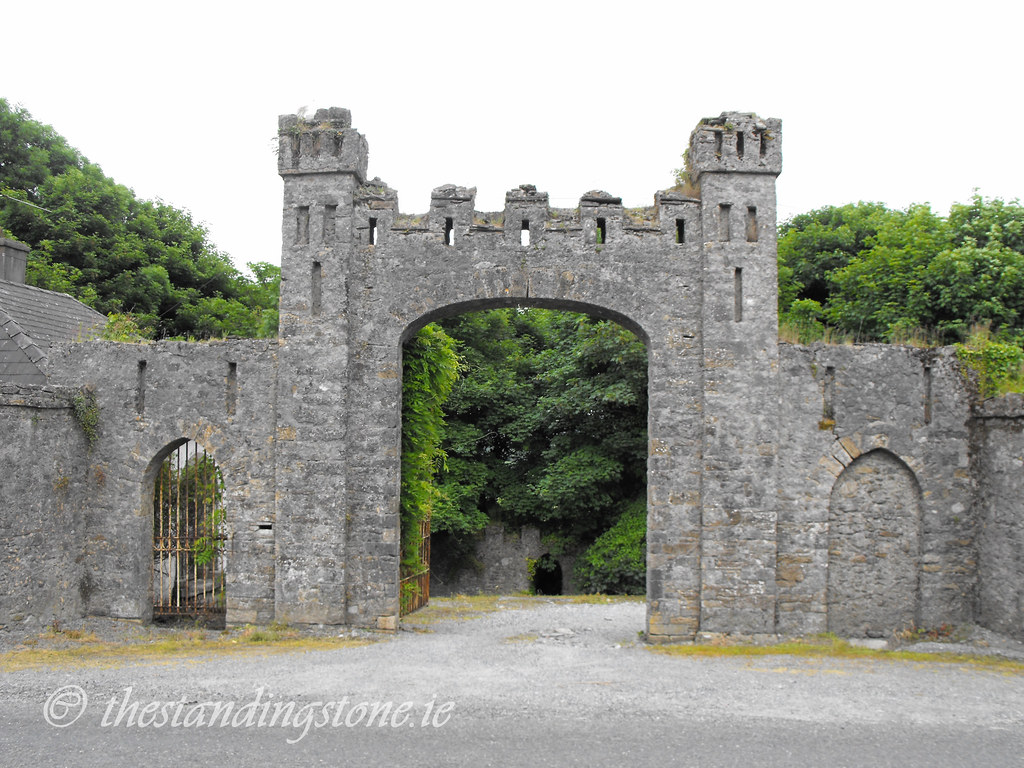
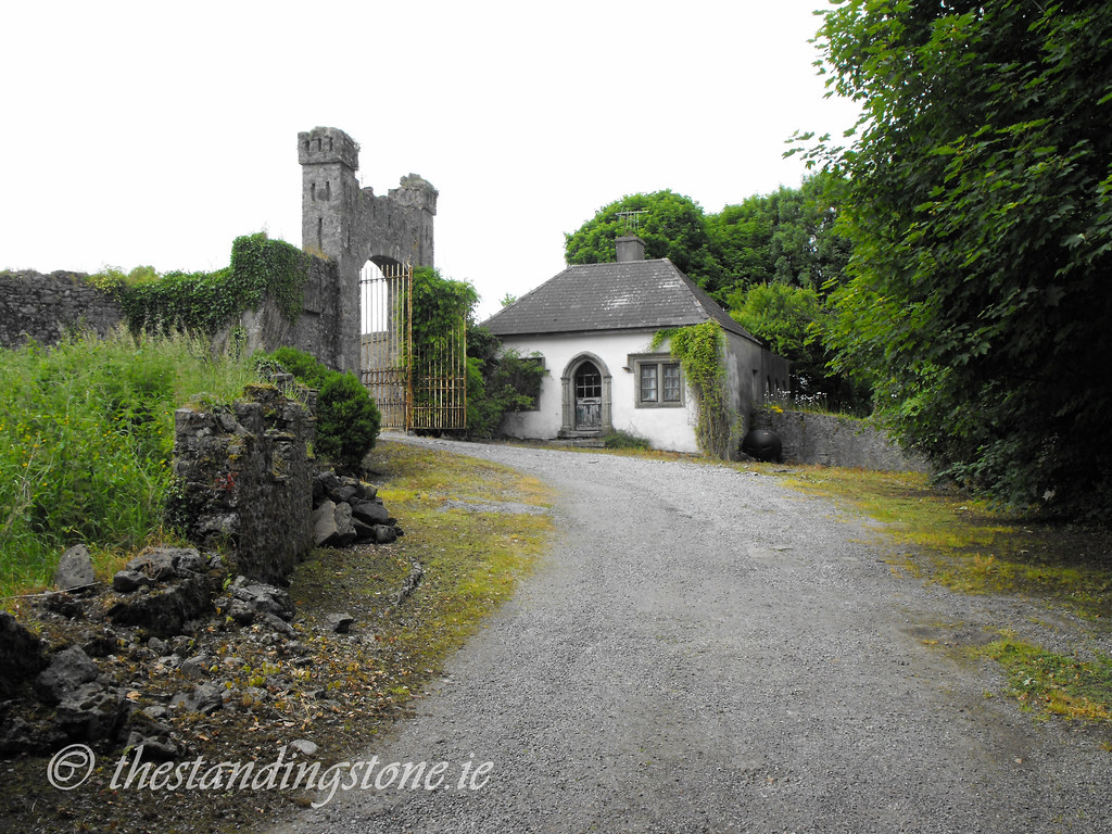
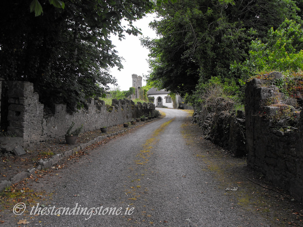
Location – On the N7 between Mountrath and Portlaoise.  The church is located on one side of the road while the cross slabs are on the other along with the holy tree.  Parking is easy here. 

The church is located at:
OS: S 387 956 (map 54)
Longitude: 7° 25' 24.17" W
Latitude: 53° 0' 35.1" N

The cross slabs are located at:
OS: S 389 958 (map 54)
Longitude: 7° 25' 13.35" W
Latitude: 53° 0' 41.52" N

The holy tree is in the lay-by near the cross slabs.

See map at the bottom of the page.

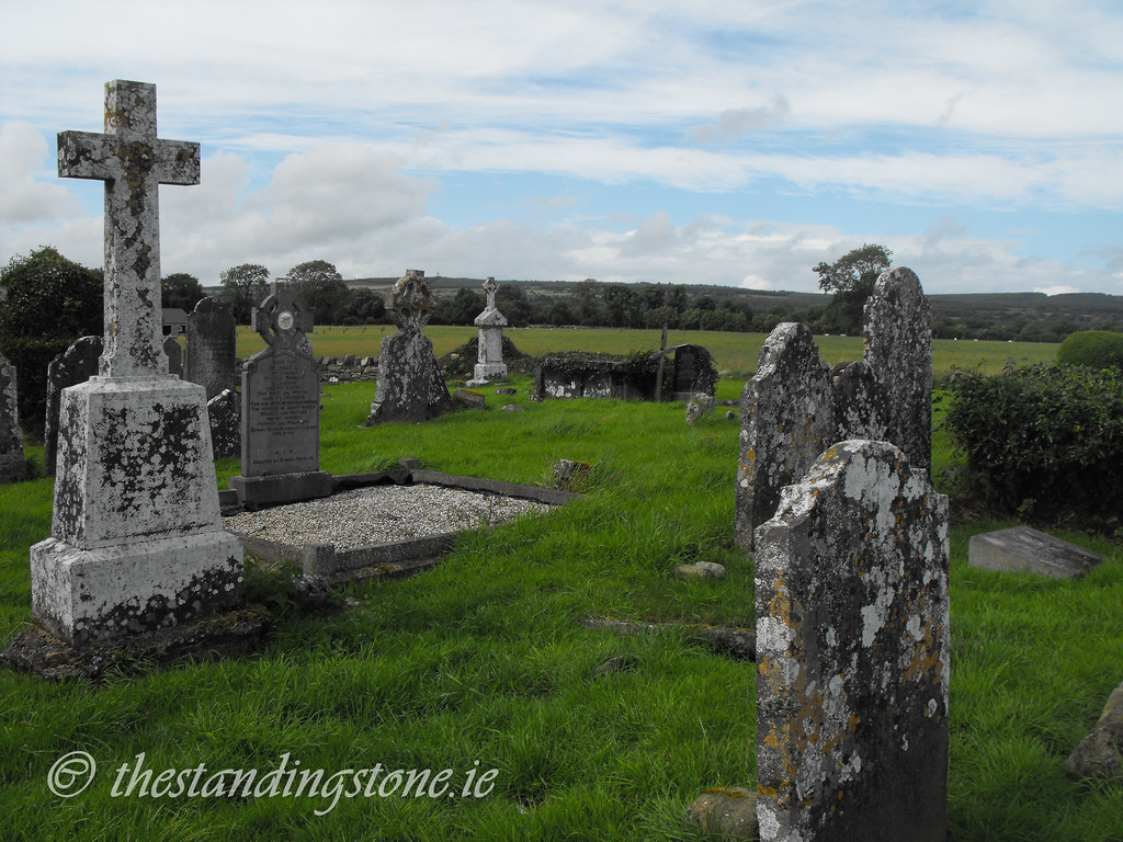
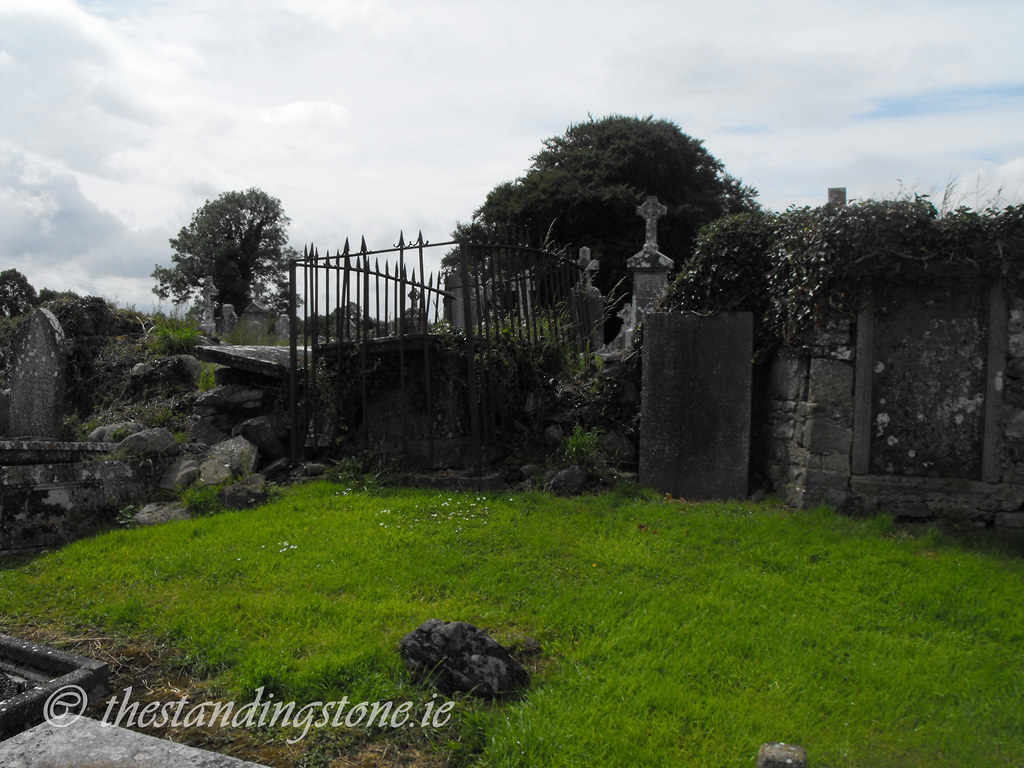
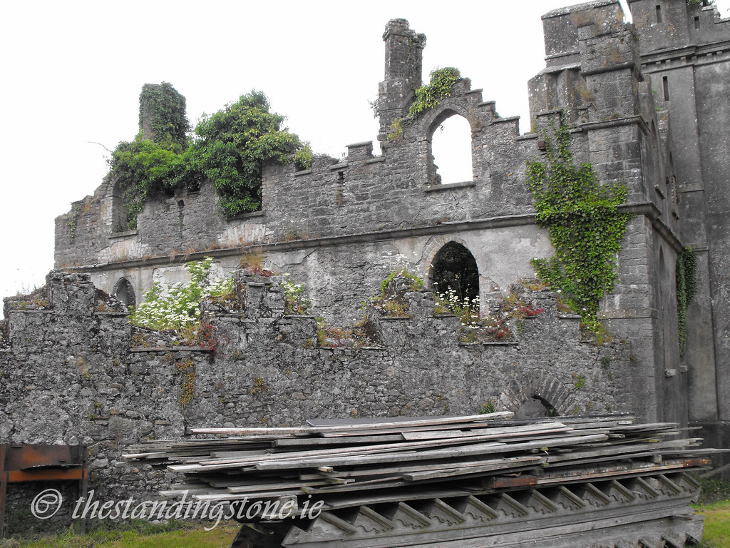
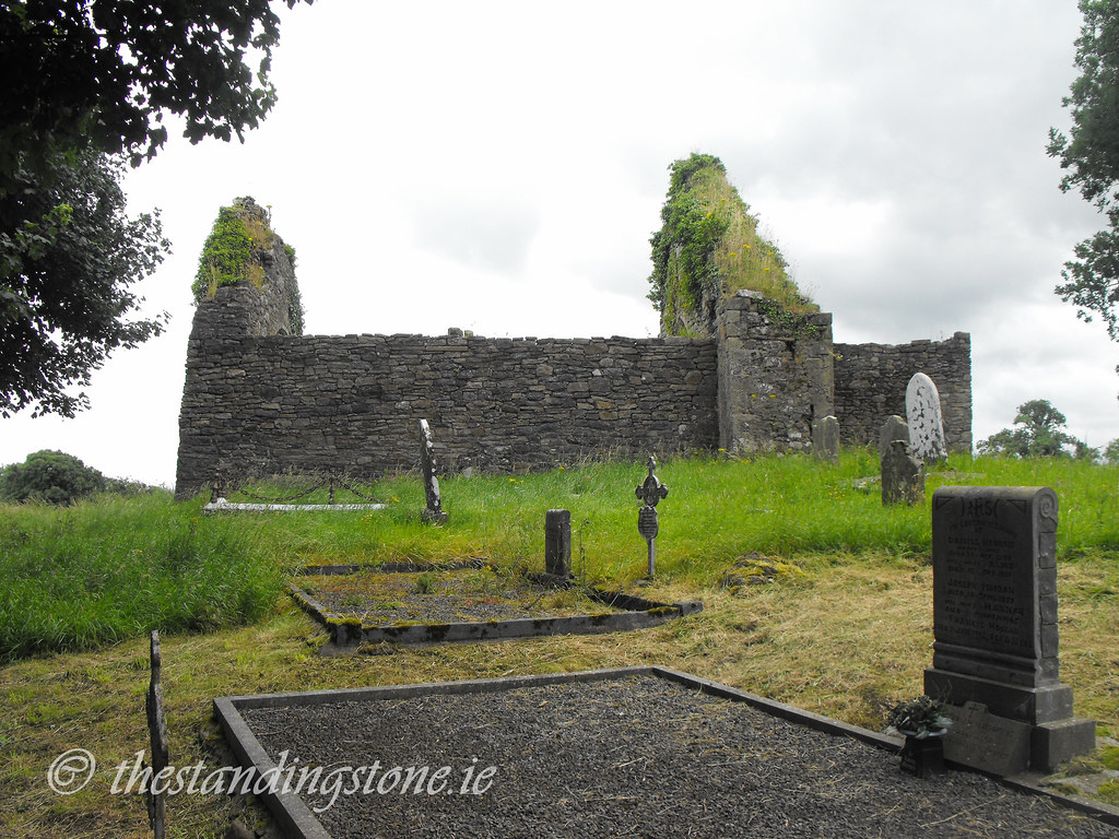
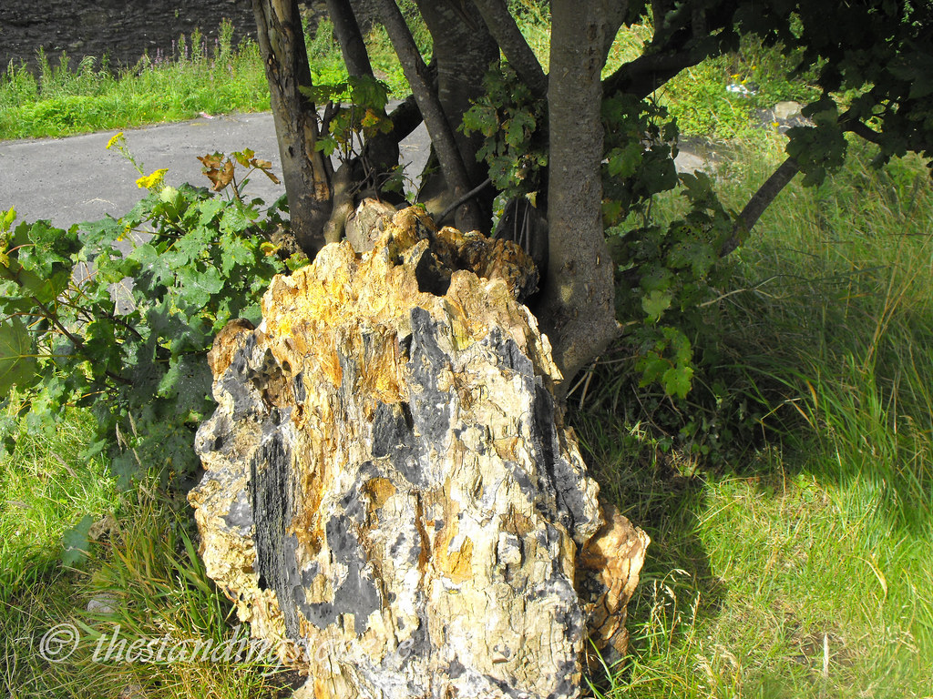
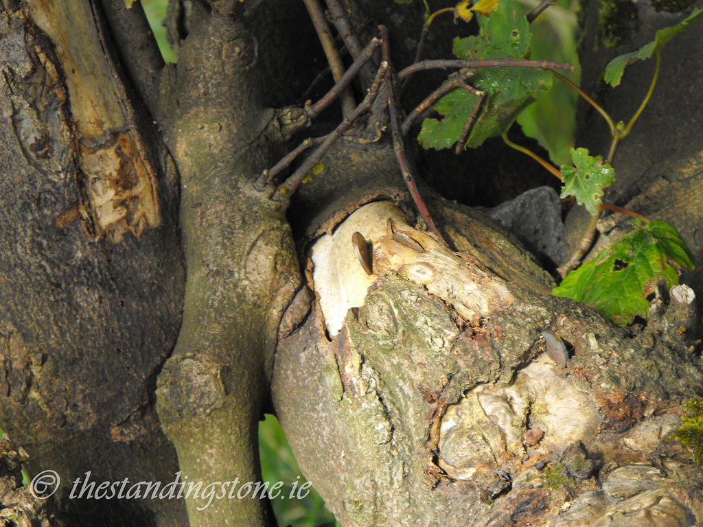
Description and History – Little remains now of this once important ecclesiastical site. Now divided by the N7 this is all part of the one complex allegedly founded in 548 by St. Fintan.  Nothing remains of the original structure which was destroyed in 838 by the Vikings.  The site was plundered again in 937 by the King of Cashel and the Danes of Waterford.  Legend says that 7 churches have been located at this site in its history with the remains of one still there and archaeological evidence for 2 others.  The present remains are of a 15th century church which was later used as a Protestant church and the graveyard is still used mainly by Protestants.  A holy well, now destroyed, was associated with the site as is the holy tree located here.  Before the tree collapsed some years ago, the water that collected in the trunk was thought to have healing properties.  The tree collapsed due to severe metal poisoning.  It was traditional to hammer coins into the tree as a votive offering. Fortunately new branches have started to grow from the remaining stump, but the coins still persist.  I would advise that you don’t hammer coins into the tree and pull out any that you can.

As you would expect of an important site there are many stories surrounding the complex.  One interesting story is about a Protestant minister, Rev Sandys, who, after appearing drunk in the pulpit was expelled from the Church of Ireland.  He, however, convinced his parishioners that he was still the serving minister and began to offer marriages at any time for the price of 1 pound.  He didn’t even require witnesses in order to write out a marriage certificate.  Eventually, nearby ministers made sure that Sandys was found out and he was sentenced to death which was reduced to a short term of imprisonment.  He was forcibly removed from Clonenagh.  As a form of revenge on the Church of Ireland he eventually became a Catholic priest.

Two interesting stories involve St Fintan himself.  One tale is that St Fintan would quarry the sand for the building of the church late at night from the Downs in Portlaoise.  The local people wondered where he got the sand from and one man set to find out.  One morning he saw Fintan returning from the Downs with his horse who he was guiding with a stripped holly branch.  The man asked Fintan where he got the sand from.  Fintan was so angered at this display of mistrust that he turned the horse into stone and threw the holly stick down which grew into a holly tree.  The location of this stone horse is rumoured to be between Clonenagh and Ballyfin but locals who know of its location will not divulge its location to others.

The second tale is that one day Fintan was returning from the Downs once again with his cart full of sand and met a woman who was building a house.  She asked for some sand but Fintan refused saying he needed it for his church.  She asked if he would give a thimbleful to her and he agreed and when the thimble was full all the sand was gone.

Onto the church and cross-slabs...

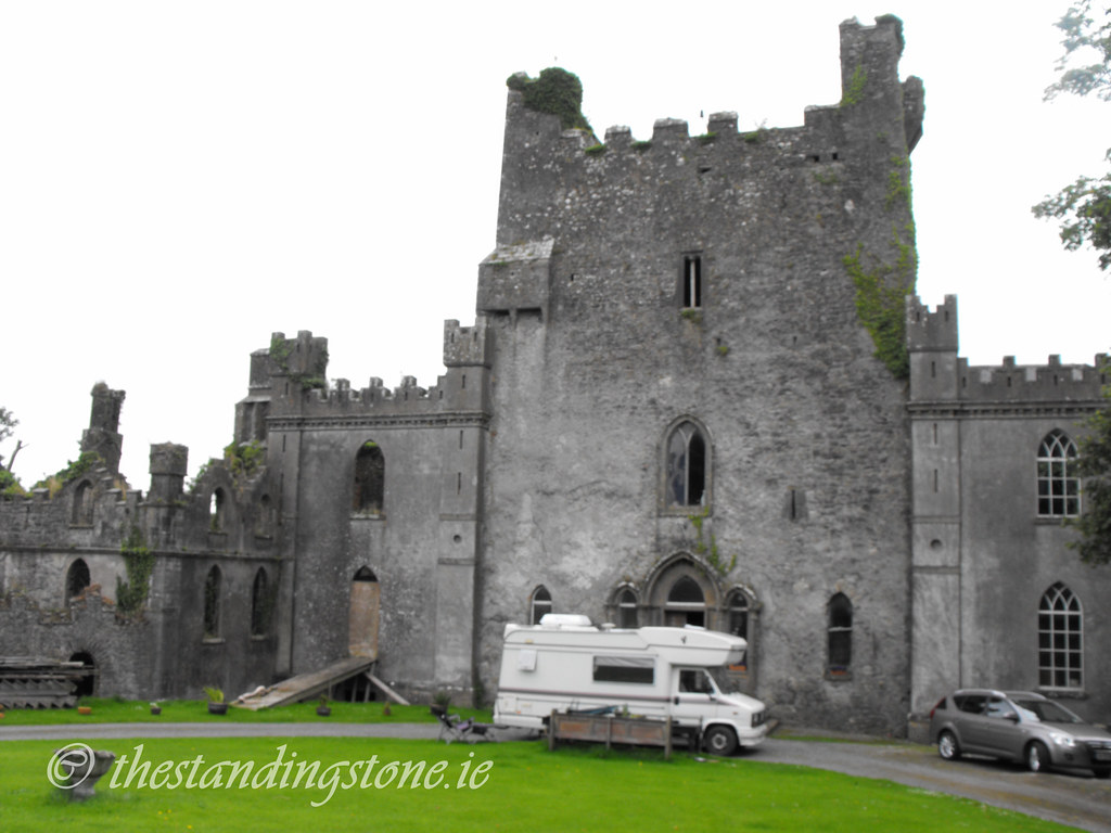
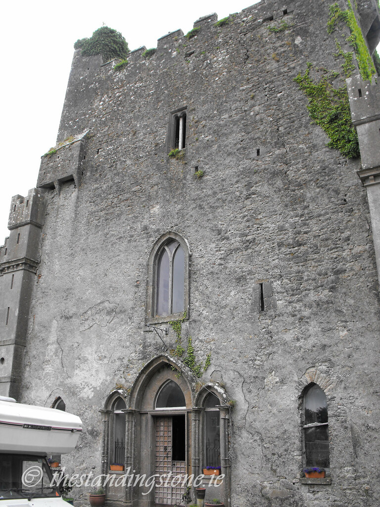
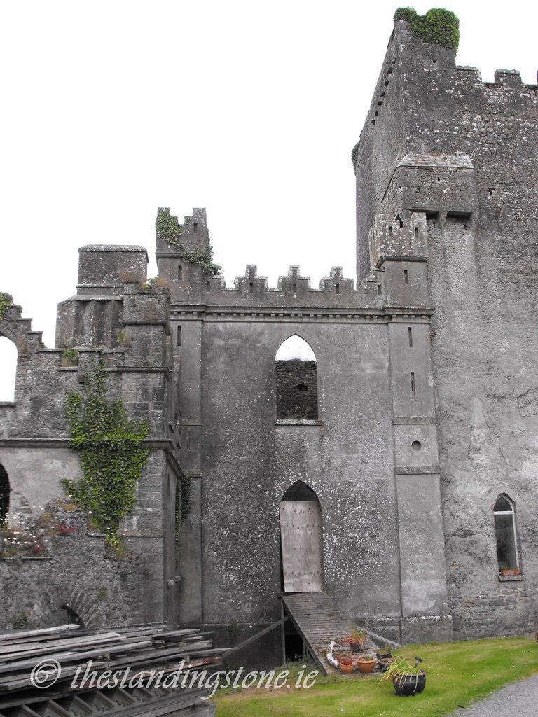
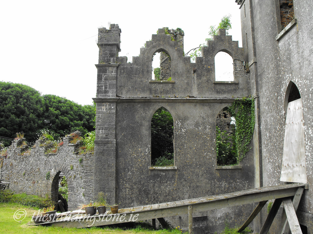
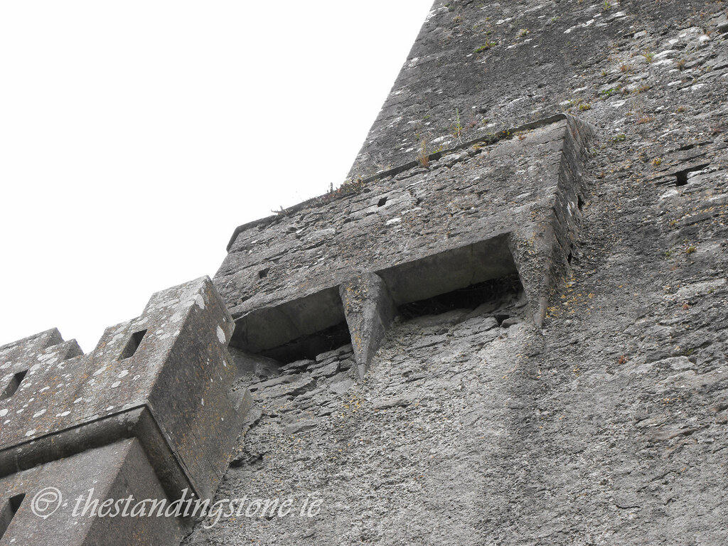
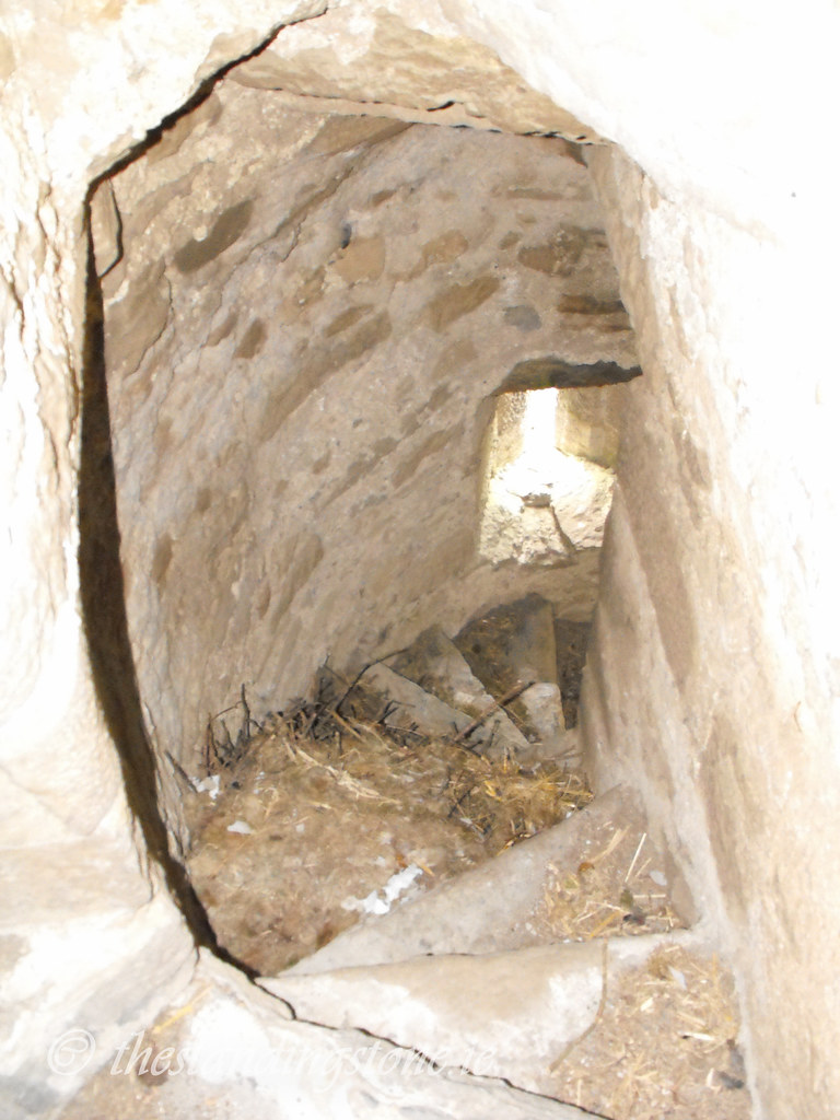
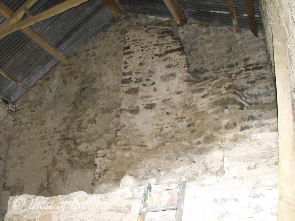
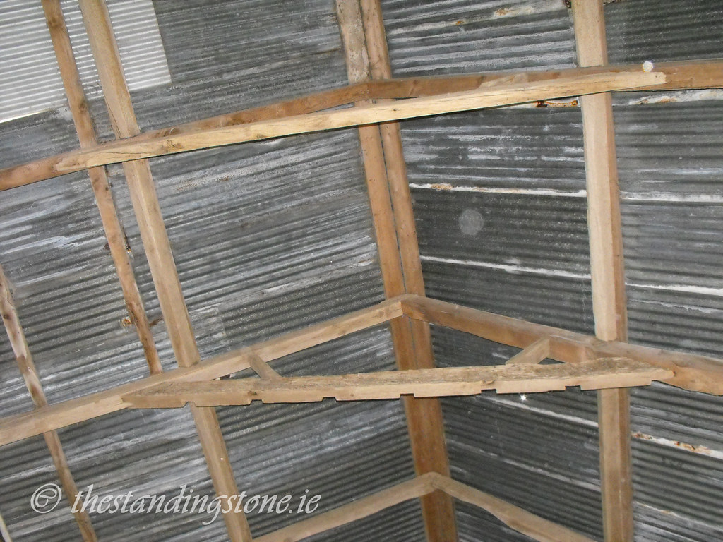
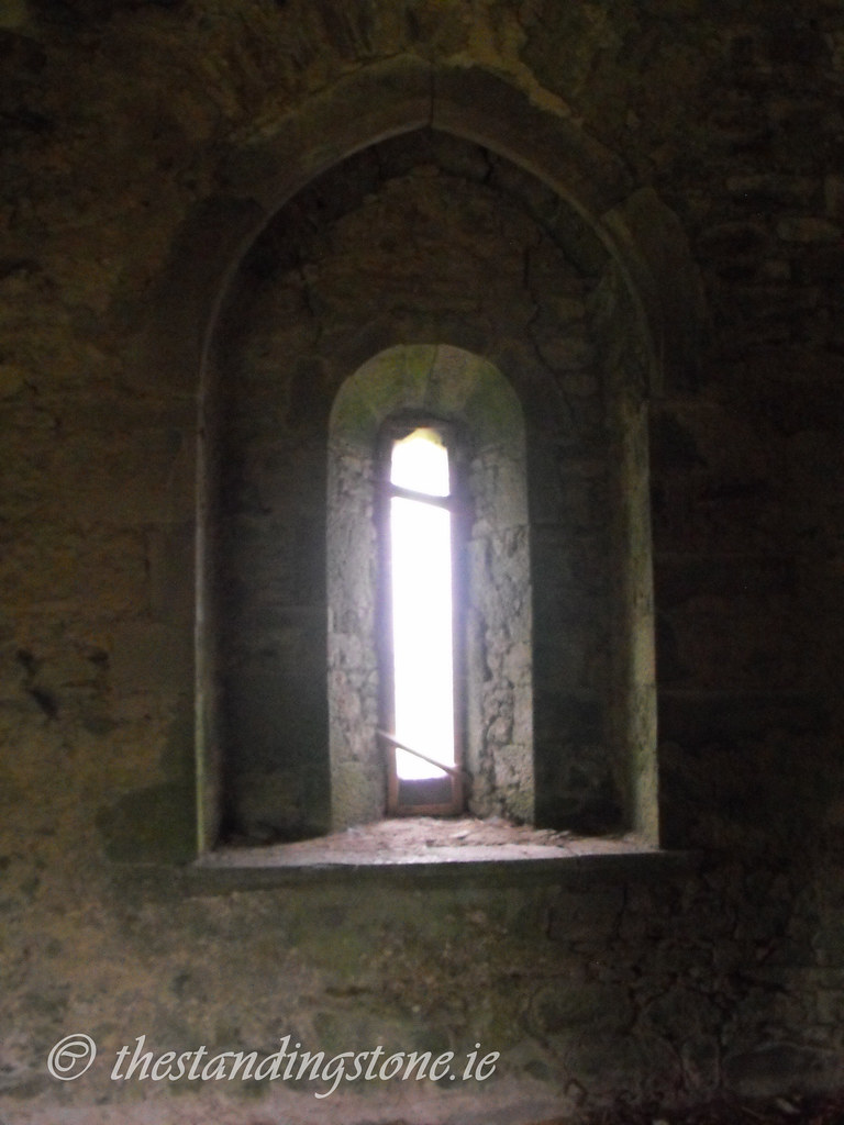
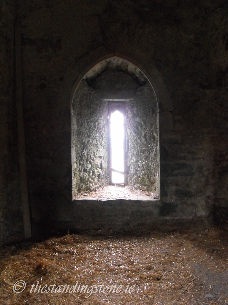
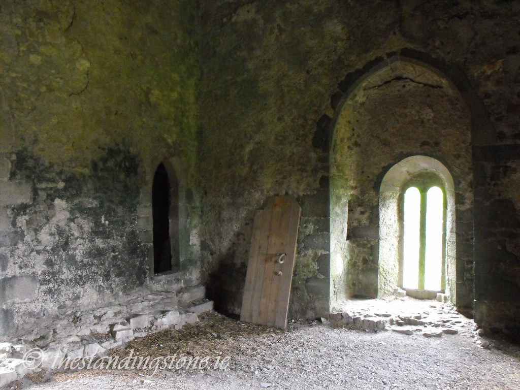
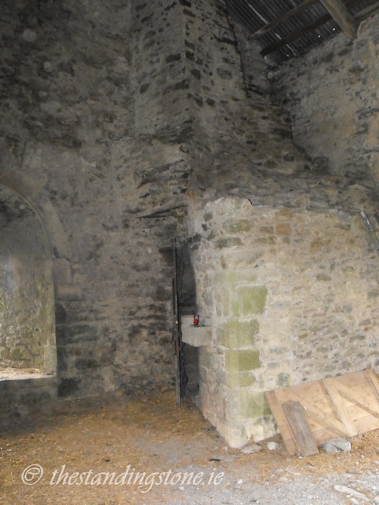
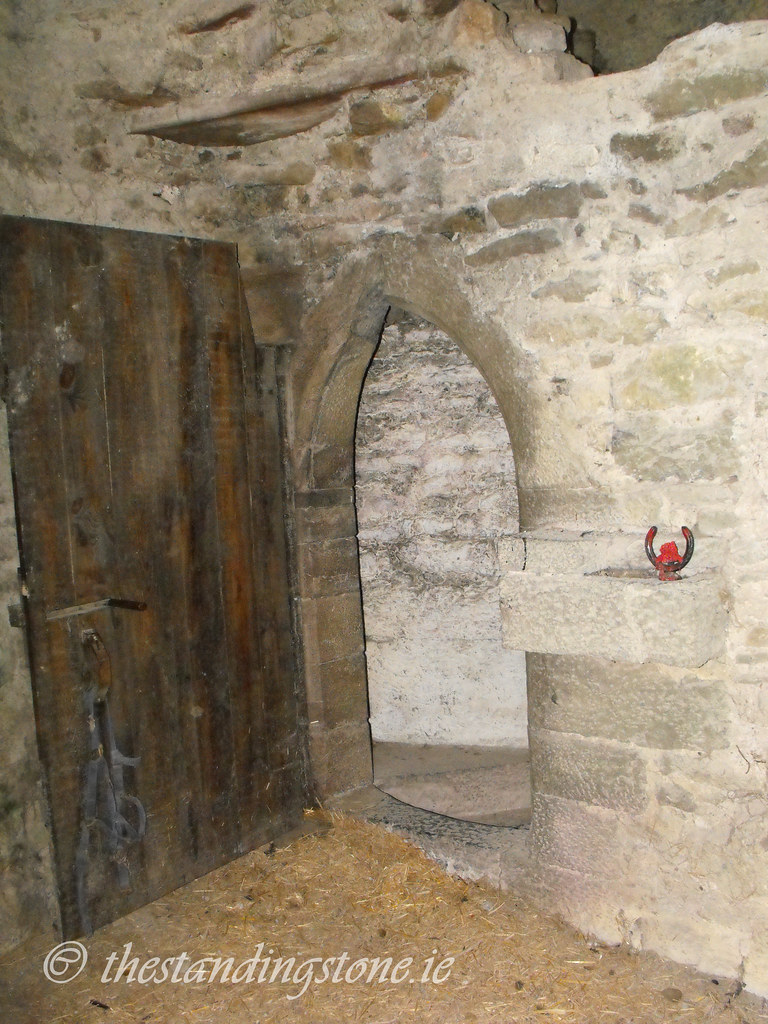
Church – Dating to the 16th century, little now remains of this sandstone and limestone building. It is roughly 9m in length and 6.5m wide.  Around the arches there are some fine examples of hammer-dressed limestone.  In the surrounding churchyard is a stone carved with a human face and another with a skull and crossbones.  I was unable to locate these two stones.

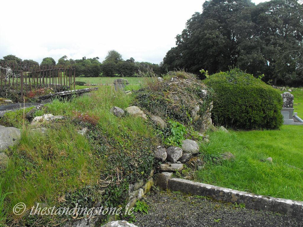
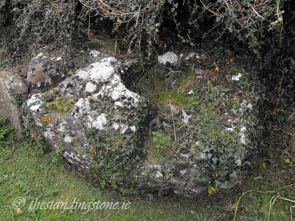
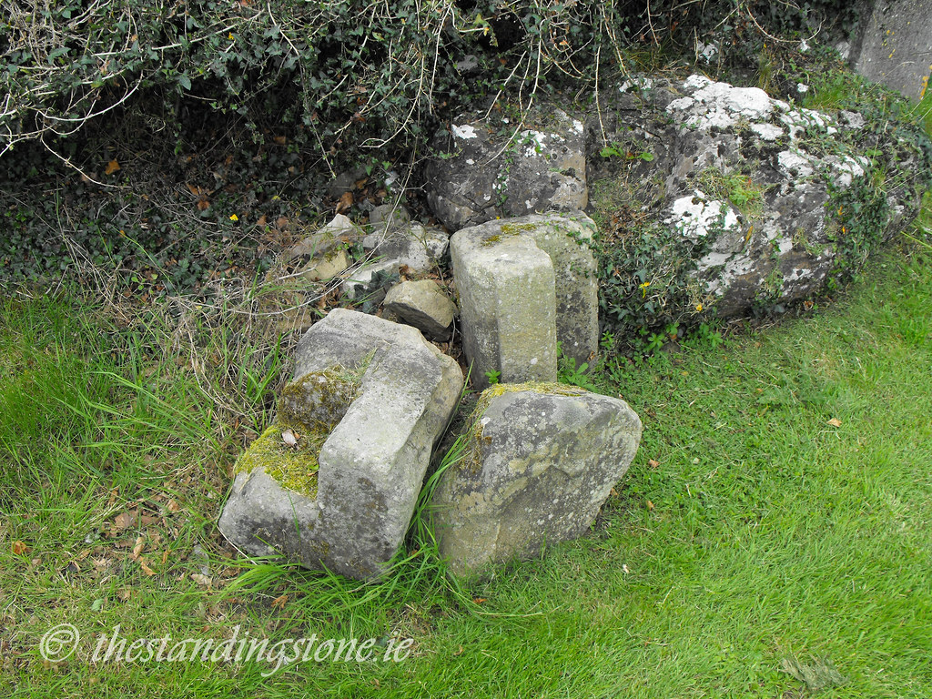
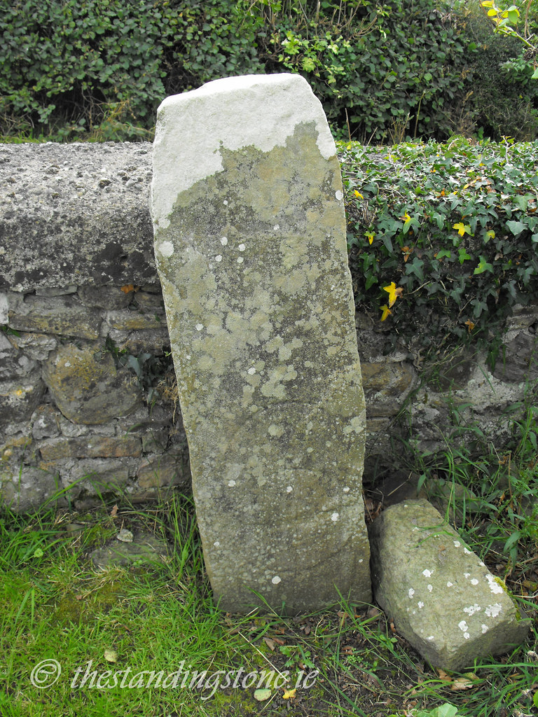
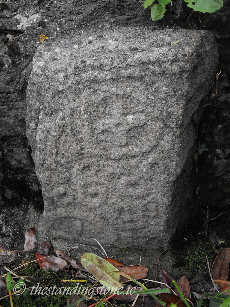
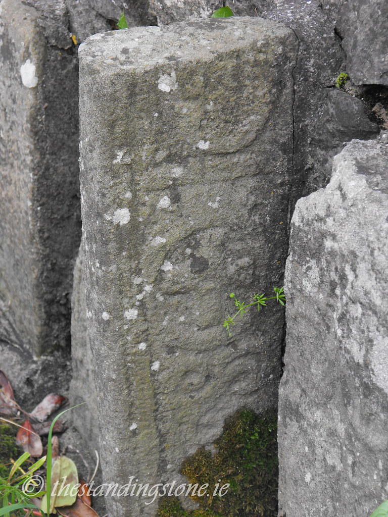
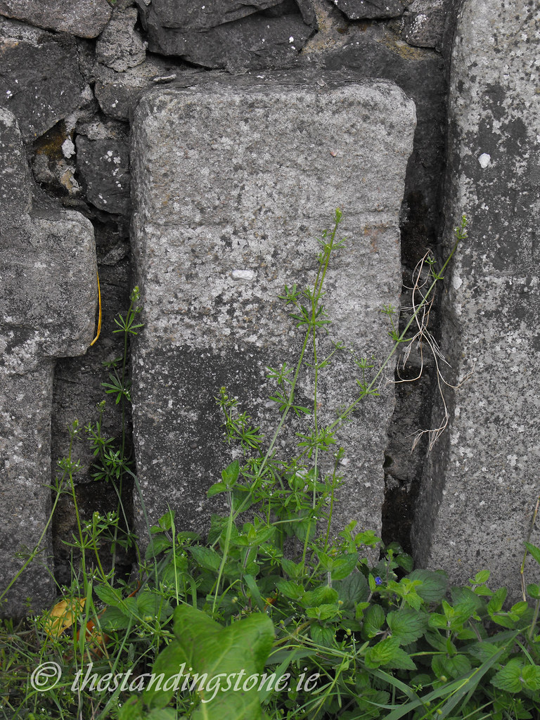
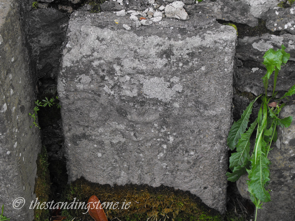
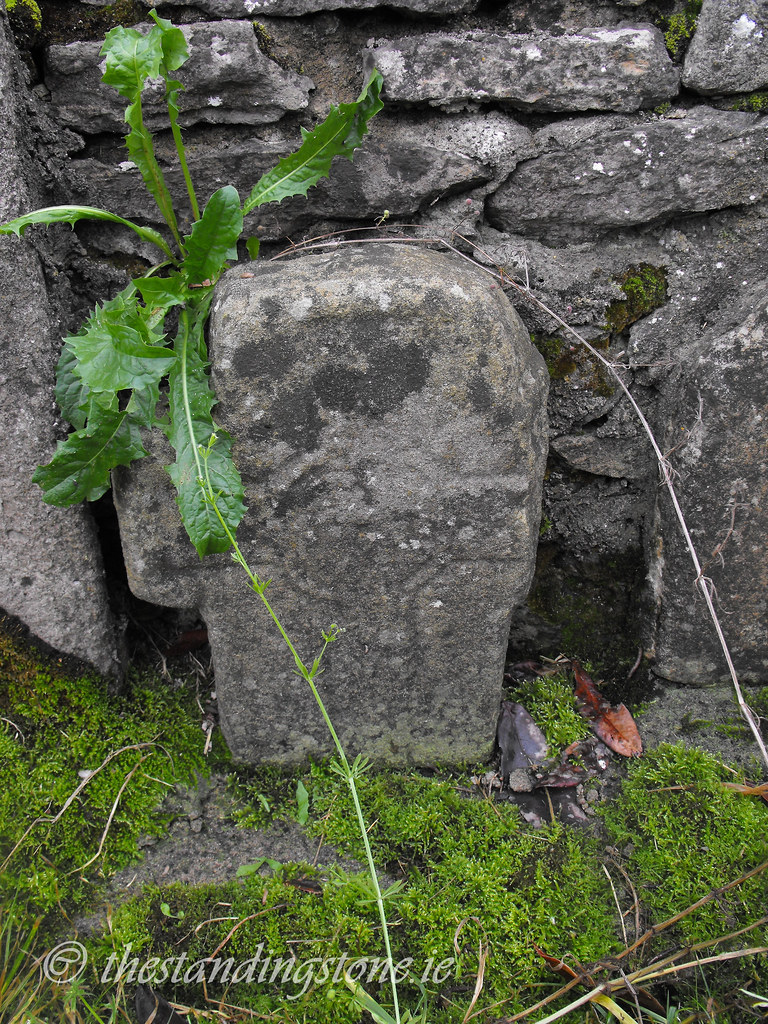
Cross Slabs – These recently discovered stones are a wonderful sight and give you a glimpse into the art of the early church in Ireland.  These stones date to the 6 and 7th centuries and have a variety of decoration on them.  The standard cross within a circle design is visible on many stone as are some simplistic cross designs.  On some stones there are some more modern designs carved onto the early stone and these designs date to the 17th century.  These stones are rare in Laois and are important for the county.  However, there are fast eroding and when compared to photographs taken only 15 years ago the amount of erosion is shocking.  As a matter of conservation they need to be removed to the safety of a museum.  The graveyard in which they are kept is poorly maintained and the stones are surrounded with rubbish that had been thrown in by people stopping in the car park. These stones will not be around much longer unless conservation work is carried out.

Difficulty – These two sites are easy to get to and are located directly on the N7.  Be careful of the traffic as cars race around this area.  The graveyards are poorly maintained and there are many low grave markers that can be easily tripped upon.

For more ecclesiastical sites, click here.
For more sites in Co. Laois, click here.


This is a lovely pointed window in the church.

The cross slabs.


The holy tree...what's left of it anyway.

Coins are being driven into the branches causing the tree to rot from copper poisoning.


View The Standing Stone in a larger map

Knockalton/Lisbunny, Standing Stone, Co. Tipperary.

Location – Near Nenagh, just off the R445. The OS map is slightly off in its placing of the monument. It is actually quite near the road and located in a different field. Just ask a farmer and they will point you in the right direction. It is in a field opposite a two storey farmhouse. This site boarders two townlands and can be said to be in both Knockalton and Lisbunny.
OS: R 895 785 (map 59)
Longitude: 8° 9' 21.23" W
Latitude: 52° 51' 26.54" N
See map at the bottom of the page.

Description and History – Little seems to be known about this standing stone and I suspect that it maybe modern in origin although that is just a hunch. There appears to be nothing else in the locality that would indicate an ancient origin. The stone is of limestone and is 2.15m high and between 60 and 80cm wide, depending on the side. It is rectangular in plan. If it is ancient then it is very well preserved.

Difficulty – The only difficulty of this site is finding it because of the misplacement on the OS map. Once there all you have to do is hop a fence and go under the electric wire. The field was full of cattle while I was there but they left me alone.

For more standing stones, click here.
For more sites in Co. Tipperary, click here.


View The Standing Stone in a larger map

Carrigeen, Stone Row, Co. Tipperary.

Location - At the foot of the Arra Mountains near Nenagh in the townland of Carrigeen and sometimes listed as being in Barbaha townland.  
OS: R 778 762 (map 59)
Longitude: 8° 19' 46.04" W
Latitude: 52° 50' 10.85" N

Description and history - This stone row is really very nice and not nearly well known enough.  It is located on poorly drained pasture land and is only one of many things to see in the local area.  Although one stone has collapsed and none are standing as they once were they provide a glimpse into a once vibrant ritual landscape as the proximity of a stone circle and many barrows indicate. These stones probably date to the Bronze Age and are spread out over 8m in length with the highest measuring 1.9m in height. Packing stones are visible around the base of all the stones. It can get a little boggy around the stones as cattle roam around them but it looked as if the stones had been free of cattle for some time and the little bog they sit in was all but dried up. I would like to go back here and get some more photographs.  On the day I went I moronically left my camera at home and relied on my sister-in-law to do the photo taking.

I returned a few years later to the stone row - this time with my camera - and one of the stones had collapsed, meaning only two now remain standing. 

Difficulty - This monument is located on private farm land and is only accessible through the farm's trackways.  You, therefore, need to obtain permission from the owner. But it is well worth it.  The trackway leading to the farmhouse is poor and unless you have a four-wheel drive or a sturdy car I suggest you park at the entrance to the trackway and walk. Around the stones can be quite muddy to wear good boots. Another way to reach it is to park at forestry nearby and trek over the fields. 

For more standing stones, click here.
For more sites in Co. Tipperary, click here.


Photo taken by Vicky Nelligan in 2009 and shows three of the four stones standing. 

From a similar angle in 2015 showing the end stone fallen.

The first glimpse of the stone row as you move across the field. 


View The Standing Stone in a larger map

Old Kyle Church, Bullaun Stone and Cross Slab, Co. Laois.

Location – Near Borris-in-Ossory.
OS: S 233 901 (map 54)
Longitude 7° 39' 11.07" W
Latitude 52° 57' 40.89" N
GPS: S 23349 90130 (Accuracy: 7m)
See the map at the bottom of the page.

Description and History - Little remains of the church on this site but the cemetery is still in use and some of the older graves are worth seeing in their own right. A church was originally founded here in the 6th century by St Molua, of which no remains survive. The present remains are medieval in date and consist of portions of the S and E walls which are roughly 1m in height. The N and W walls are grassed over and lower but can still be made out. A bullaun stone sits in the graveyard, next to which are some small portions of the Romanesque doorway to the medieval church. St Molua's grave and two early Christian cross slabs are also located in the graveyard but I was unable to locate the grave of the saint and one of the cross slabs. The cross slab that I did find is about a meter tall and has a cross within a circle design on the base. If you find the grave of the saint or the second cross slab let me know.


The following is taken from Notes and Queries, June 10, 1882. "ST. M'LOO'S STONE. - In the district of Ryle (sic) in the Queen's County in Ireland there exist a grave, a trough, and a stone with which the name of St. M'Loo is connected. His grave and his trough are in a small old burial-ground, in the middle of which stands a ruin, apparently of a chapel, but there seems to be no tradition connecting the name of the saint with this ruin.

The grave is 11 ft. long, and faces differently from the graves around. On the assumption that St. M'Loo was the priest, two explanations of this are given in the locality - the one that the priest may more easily stand in front of his flock to present them on the Resurrection Day ; the other, that he may occupy the most conspicuous place to bear the Divine indignation should he have proved unfaithful to his trust.

St. M'Loo's grave is at one end of the burialground, and his trough at the other. The trough is of hewn stone, 2 ft. long by 1 ft. broad, and is overshadowed by a small white-thorn tree. Many resort to this trough to be cured by its holy water of their various diseases, and every one who comes attaches a piece of rag to the little tree. The trough is never empty, and is said to be miraculously filled. Interments still take place in Kyle graveyard, and often at Roman Catholic funerals, when the body has been laid in the grave, all the mourners gather round the trough and pray there.

St. M'Loo's stone lies in the middle of a field opposite to the burial-ground, from which it is separated by the high road. Tradition states that the saint knelt so often upon the stone to weep and pray that he wore five holes in its surface - two by his knees, one by his clasped hands, and two by his tears. The holes worn by his tears are on the right side of the stone. The circumference of the stone is 15 ft. 11 in., its length 5 ft. 7 in., its breadth 4 ft., and its depth 3 ft. There are on the sides traces of what appear to have been cup and ring marks. The usual unwillingness to disturb such relics prevails, and the people believe that a blight would fall upon any one who ventured upon such desecration. Who, then, was St. M'Loo ?"

M'Loo obviously is a form of Molua.

Difficulty – Apart from the twisty road this site is easy to get to.

For more ecclesiastical sites, click here.
For more sites in Co. Laois, click here.


The wall footings of the old church.


The massive bullaun stone.  It's a shame it's not kept in a better condition because this is a great stone.

Some architectural fragments from a Romanesque doorway.

The cross slab.

You can just make out the design of the cross here.

This fragment is particularly beautiful.


There are interesting little stones like this all over the graveyard.


View The Standing Stone in a larger map

Leap Castle, Co. Offaly.

Location – On the R421, N of Roscrea.
OS: S 129 975 (map 54)
Longitude: 7° 48' 27.77" W
Latitude: 53° 1' 41.04" N
GPS: S 12823 97539 (Accuracy: 5m) - Reading taken at the entrance gate.
See map at the bottom of the page.

Description and History – The first time that I visited Leap castle I was unable to get inside, but I was determined to go back and update and expand this post as Leap castle is somewhat famous amongst certain circles and has earned itself the epithet of ‘the most haunted castle in Ireland’.  This ‘haunted’ reputation has somewhat distracted from the beautiful castle that this is.  In the manner of Loughmoe castle in Tipperary, Leap is a modified tower house that has been converted into a later fortified house.  Unusually, portions of the castle are still habited by musician Sean Ryan and his family who are undertaking restoration work. and have owned the castle since 1991.  The original tower house is clearly visible in the centre, while the later additions are in a ruinous state (it seems that even by the 17th century they didn’t make them like they use to).  Constructed in the late 15th century or early 16th century, Leap castle has had a turbulent history.  Built by the O’Bannon clan it later became the principle seat of the O’Carrolls. The castle was attacked early in its history in 1514 by the Earl of Kildare who, unsuccessfully, tried to seize the castle.  It was attacked for a second time in 1516.  In 1558 the castle was deliberately set on fire and ruined to prevent it being captured by Elizabethan forces, who decided to occupy the castle anyway.  It was recaptured by the O’Carrolls less than a year later.  The castle was altered during the 17th century when the castle was occupied by the Darby family.  They extended the castle and added the Jacobean house to the N face of the tower house. A later Georgian house was also added.  I will reserve a description of the inside of the castle until I finally get in there.   The castle was finally destroyed by 30 bombs and 20 cases of petrol in 1922 during the civil war.

The entrance to the castle is quite interesting and dates to a period of rebuilding in the late 16th century. I've never seen an entrance to a tower house before that was so grand and richly carved. When you enter the castle's ground floor you are faced with a large recess in the E wall that belongs to the castles original entrance. It is now a large window. Passages off this first floor lead to the two, more recent, wings. The first floor, like the ground level, has been restored and has a fine medieval fireplace although there is no carving on it. There is a small gallery overlooking the first floor that is reached through the spiral stairs. The top floor is the so-called bloody chapel where many people have died.  The oubliette is a great feature or the castle and it is not often that one is so easily accessible. The windows all appear to be later insertions into the castle but are fine late medieval examples of Gothic revival architectures. If you head up here watch your step it is easy to trip and I nearly fell through the machicolation which is covered with straw. A modern tin roof covers the top floor. The wings of the castle are from a later date and the S wing is private and occupied by the Ryan family. The N wing is derelict and too dangerous to enter. This is a shame because there is a fine Jacobean fireplace in there. I hope it can be salvaged before it succumbs to time and collapses.

For those of you who know Leap castle for its many appearance on TV ghost shows there are many stories surrounding the castle.  Its haunted reputation goes back to the 17th century when servants of the Darbys would not enter the upper parts of the castle because of ghosts associated with the O’Carrolls, who, according to local legend, would throw enemies to their deaths from the top of the castle.  An account survives from the 17th century from Mrs. Jonathan Darby and her alleged encounter with a type of ghost called an “elemental”.  It runs as follows: “The thing was about the size of a sheep, thin, gaunt and shadow in parts.  Its face was human, or to be more accurate, inhuman, in its vileness, with large holes of blackness for eyes, loose slobbery lips, and a thick saliva dripping jaw, sloping back suddenly into its neck.  Nose it had none, only spreading cancerous cavities, the whole face being a uniform tint of grey.  This too was the colour of the dark coarse hair covering its head, neck and body.  Its fore arms were thickly coated with the same hair, so were its paws, large loose and handshaped and as it sat on its hind legs, one hand or paw was raised, and a claw like finger was extended ready to scratch the paint.  Its lustreless eyes, which seemed half decomposed in black activities, and looked incredibly foul, stared into mine, and the horrible smell which had before offended my nostrils, only a hundred times intensified, came up into my face, filling me with a deadly nausea.  I noticed the lower half of the creature was indefinite and seemed semi-transparent at least, I could see the framework of the door that led into the gallery through its body.”  Mediums and ghost hunters are frequent visitors to this castle now in search of the elemental and other ghosts.  Another ghost is apparently of one of the O’Carrolls who was a priest and was killed saying mass by his brother in the chapel room.  Other ghosts are associated with the oubliette in the top floor in which three carts full of bones were removed in the early 20th century where people had been thrown to their deaths onto the metal spikes below.  If you like ghosts you will enjoy this castle.  If, like me, you are a sceptic, you will still enjoy this castle for its architecture and history. Although this castle is known as the most haunted castle in Ireland you will be disappointed to read that I didn't see, hear or feel a thing. It seemed like a normal castle to me. However, even though I'm not a believer in the supernatural I must admit that all the ghost stories did pop into my head as I went up the pitch black spiral stairs. I was glad I had remembered my torch. 

Difficulty – Not difficult to find at all as it is on the side of the road.  Access is not through the house in front of it but rather through the gated driveway a little further down the road.  This castle is still a residence so don’t just walk in, ask permission. Entry to the castle is by appointment only so please respect this. The Ryan family have done fantastic work in restoring this castle so the least the rest of us can do is respect their privacy. If you wish to view the castle you can contact Sean Ryan by email at seanfryan@oceanfree.net or you can contact him via telephone at +353868690547

For more castles, click here.
For more sites in Co. Offaly, click here.
Main entrance to the castle.

The gate house.

Defensive walls.


Part of the later additions to the castle.

The phrase "they don't build them like they use to" springs to mind. The later additions are in a much worse condition than the original tower house.


Machicolation.

On the ground floor.

This is where the original entrance was in what is now the rear of the castle.

One of two windows on the first floor.

The second window.

The barrel vault has been nicely restored and doesn't seem to get too much damp rot.

Remaining fireplace.


The spiral stairs leading up to the bloody chapel.


Beautiful craftsmanship.

Looking down on the ruined later parts of the castle.


Looking into the oubliette.

Inside the bloody chapel.

The newly inserted tin roof.


The stairs in the corner lead to an outside wall walk.


View The Standing Stone in a larger map