Location – Just off the R505 directly to the west of the Rock of Cashel and clearly visible from there.
OS: S 06965 40786
Longitude: -7.8981078
Latitude: 52.518702
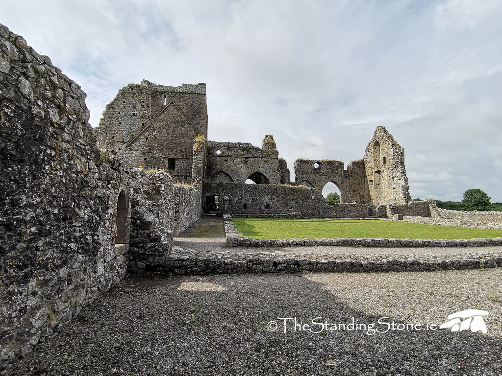
Description and History – Hore Abbey, otherwise known as St. Mary’s Abbey of the Rock, sits in a low field to the west of the Rock of Cashel. The name ‘Hore’ likely derives from the Irish word for Yew Tree, Iubhair, although other origins have been suggested including deriving from the term a ‘hoar frost’ or even from an old word for grey because of the colour of the monks’ robes. While it was constructed in the latter half of the 13th century there is significant folklore attached to its founding. Folklore says that it was originally a Benedictine monastery, but that the Archbishop David MacCarwell had nightmares that the monks were plotting against him and intended to behead him. He then removed the Benedictines from Cashel and replaced them with Cistercians. While the story is certainly apocryphal it is an interesting insight into how the politics and society of the day can be misinterpreted. MacCarwell’s expulsion of the Benedictines from Cashel seems to have caused some resentment in the town, particularly from the Anglo-Norman residents of the town, as MacCarwell favoured the Irish and gave generous endowments to the abbey including lands, mills, and even gave two flagons of ale to the monastery from every brewing in the staggering 38 breweries in Cashel. This all came at the expense of the Anglo-Norman residents of the town and caused significant resentment, and was considered an unnecessary interference by the archbishop.
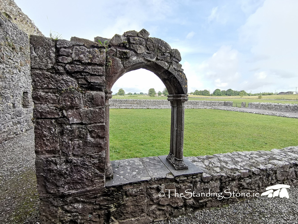
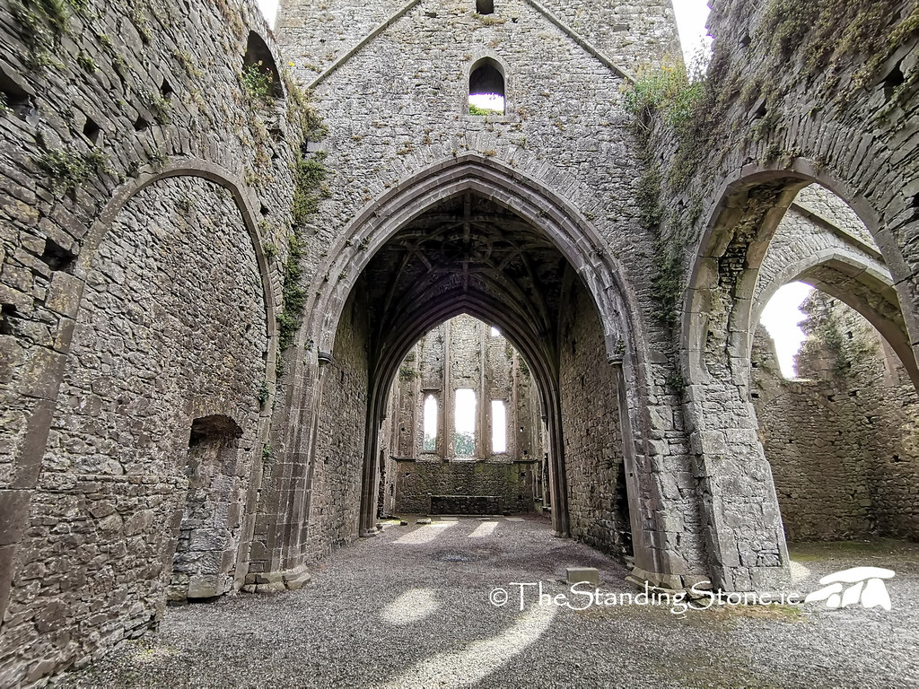
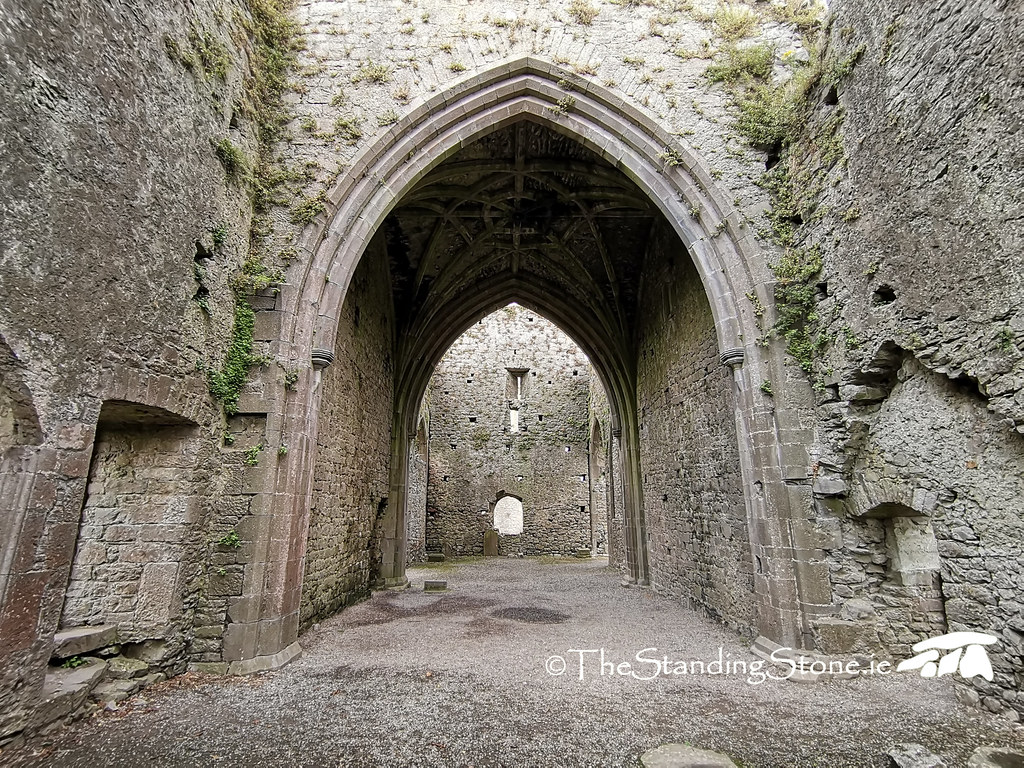
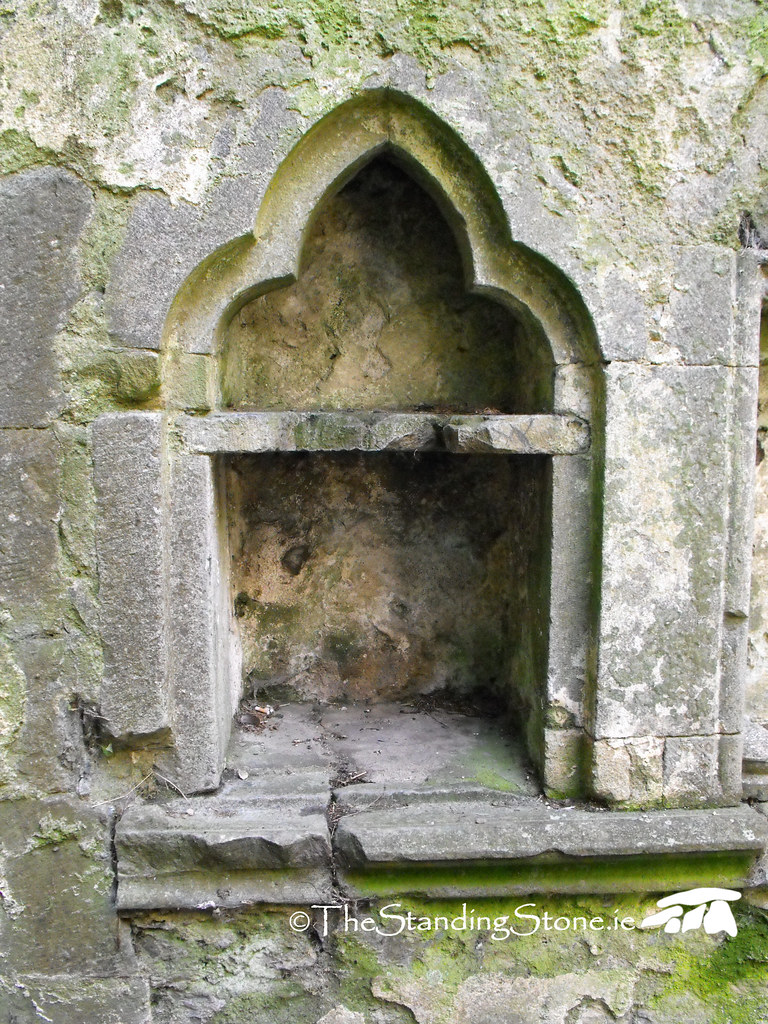
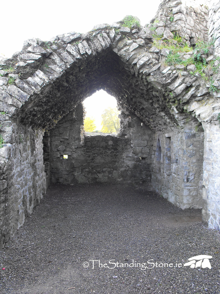
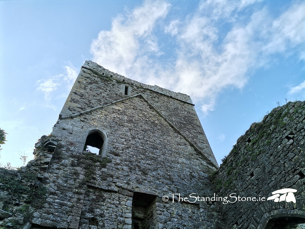
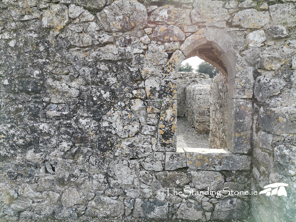
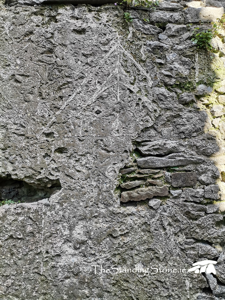
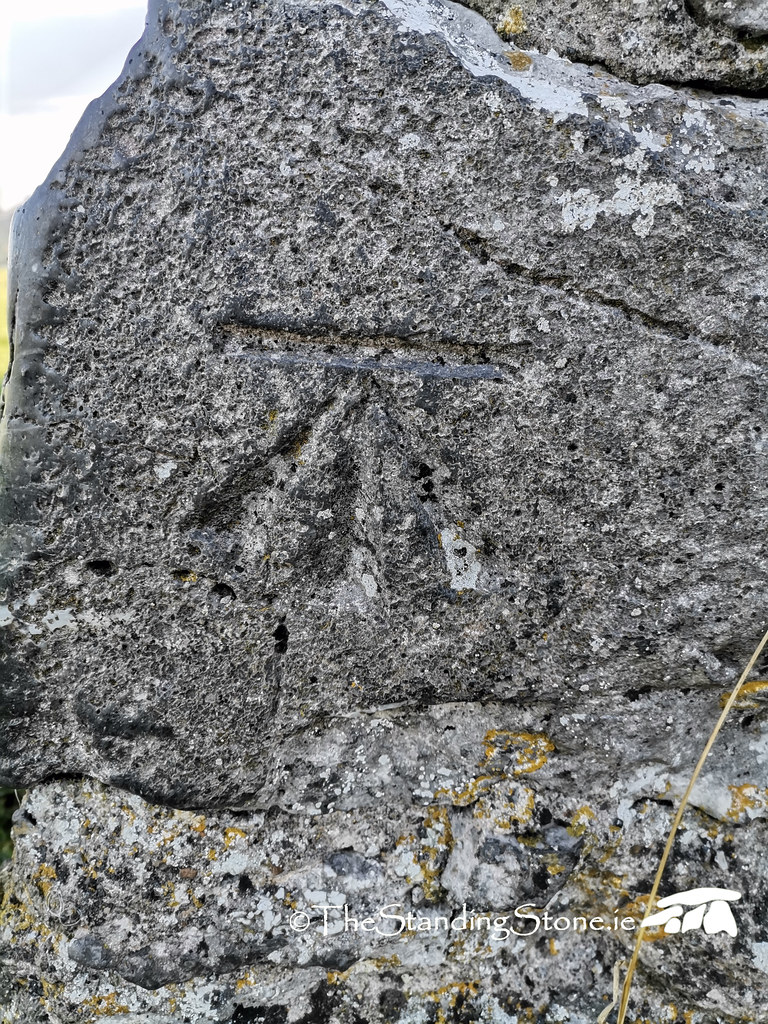
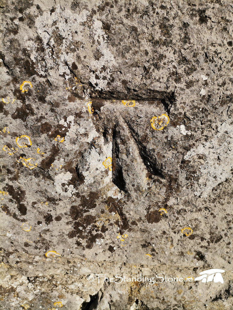
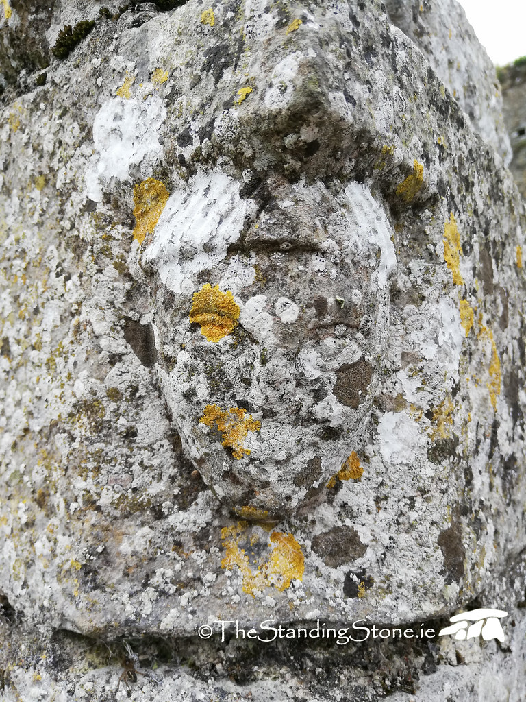
Hore Abbey was founded around the year 1270 as the last Cistercian foundation in Ireland and was connected to Mellifont in Louth. What remains today is a mixture of 13th and 15th century material. The original layout of the church can still be seen, although a wall was added in the 15th century to significantly shorten the nave, and the rest was turned into accommodation, which can be seen from the added fireplaces. This likely happened due to decreased population levels following the Black Death, coupled with an increase in people entering the church as monks. The crossing tower was added in the 15th century, and has fine rib-vaulting, with several intricate mason’s marks still visible. The original 13th century church consisted of a nave and chancel, with transepts, and aisles. The sacristy and chapter house also survive, with a bullaun stone having been inserted into the top of a wall in the chapter house. The cloister, unusually on the north of the site, also survives in the form of wall footings, with one reconstructed arch. Inside the church are the remains of the altar, and partially blocked lancet windows. The piscina and sedilia are still intact.
The site was abandoned during the dissolution of the monasteries in 1540, although part remained in use as a parish church, and other areas were reused as houses, although little physical evidence for this survives. Hore Abbey gives a fascinating insight into the changing society and needs of the people around Cashel between the 13th and 16th centuries, and is worth exploring at length.
Difficulty – Easy to find and to get to. There is ample road space to pull in and park, and it is a short walk across the field. It can get muddy during wet weather and cattle are often kept in the field where the abbey sits.
Date of visit: Various dates between 2010 and 2022.
For more sites in Co. Tipperary, click here.
For more ecclesiastical sites, click here.