Killinane Church, Closutton, Co. Carlow.

Location – On the N9 between Leighlinbridge and Bagenalstown.
OS:  S 687 633 (map 61)
Longitude: 6° 58' 59.72" W
Latitude: 52° 42' 59.45" N


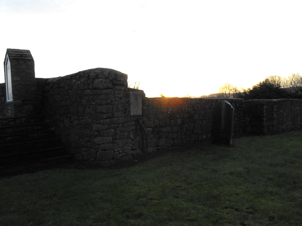
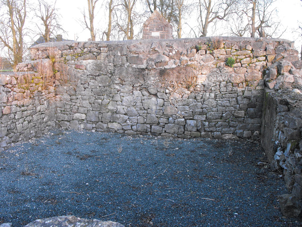
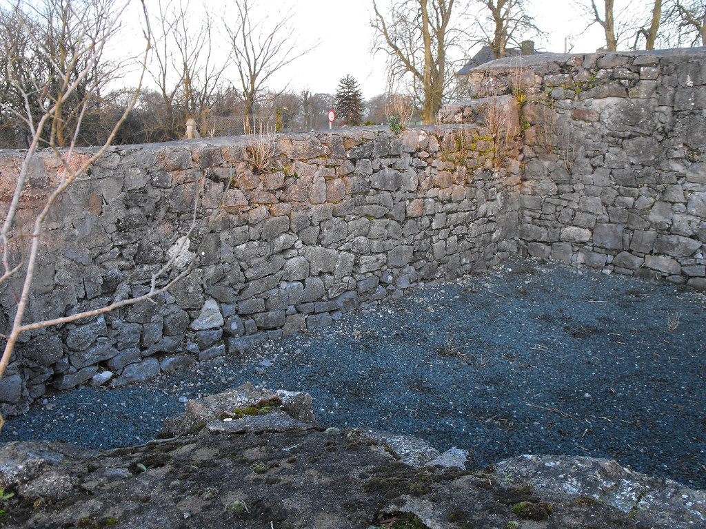
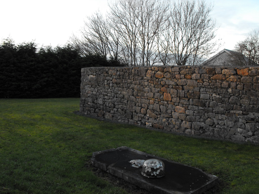
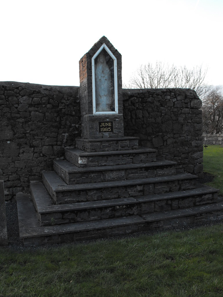
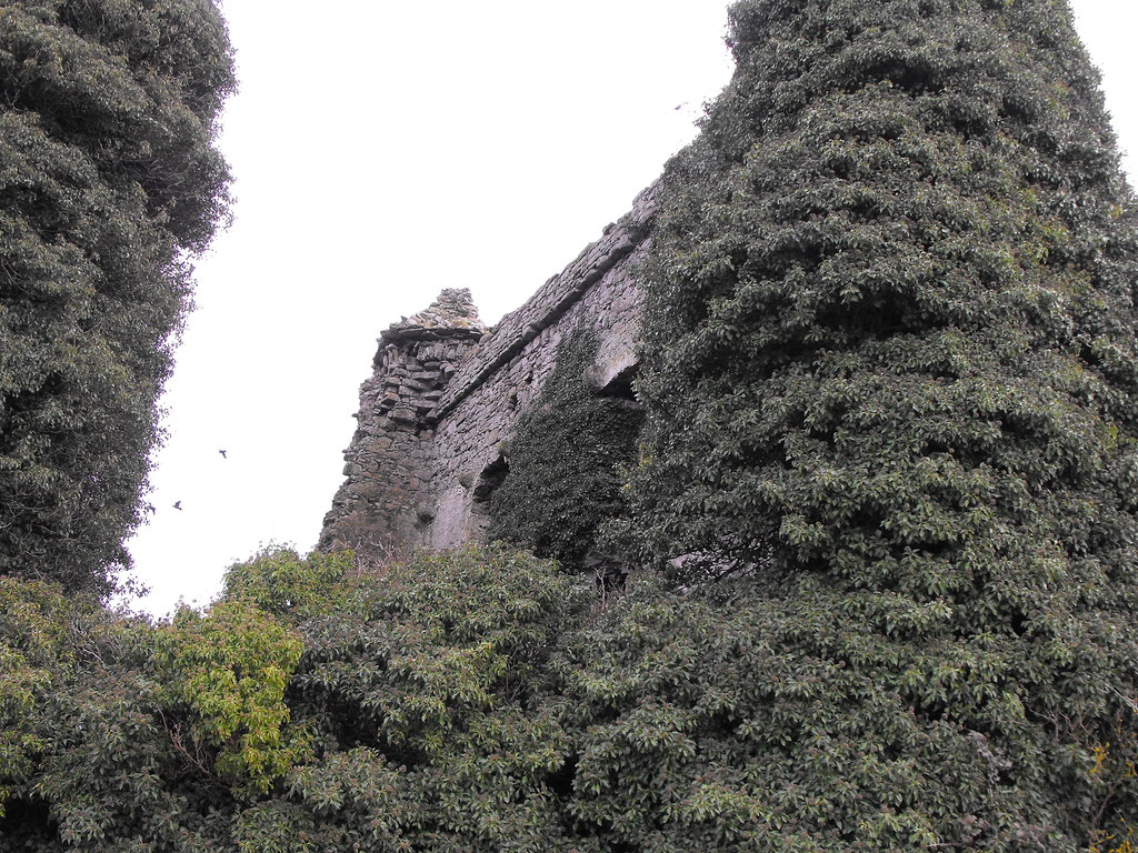
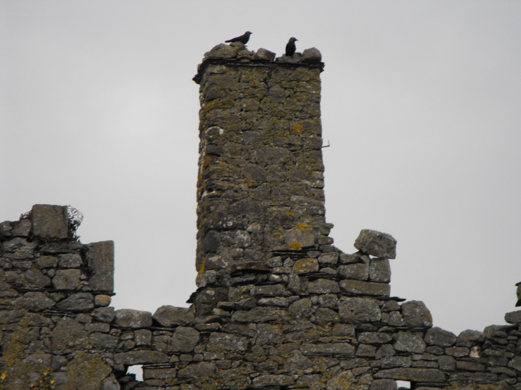
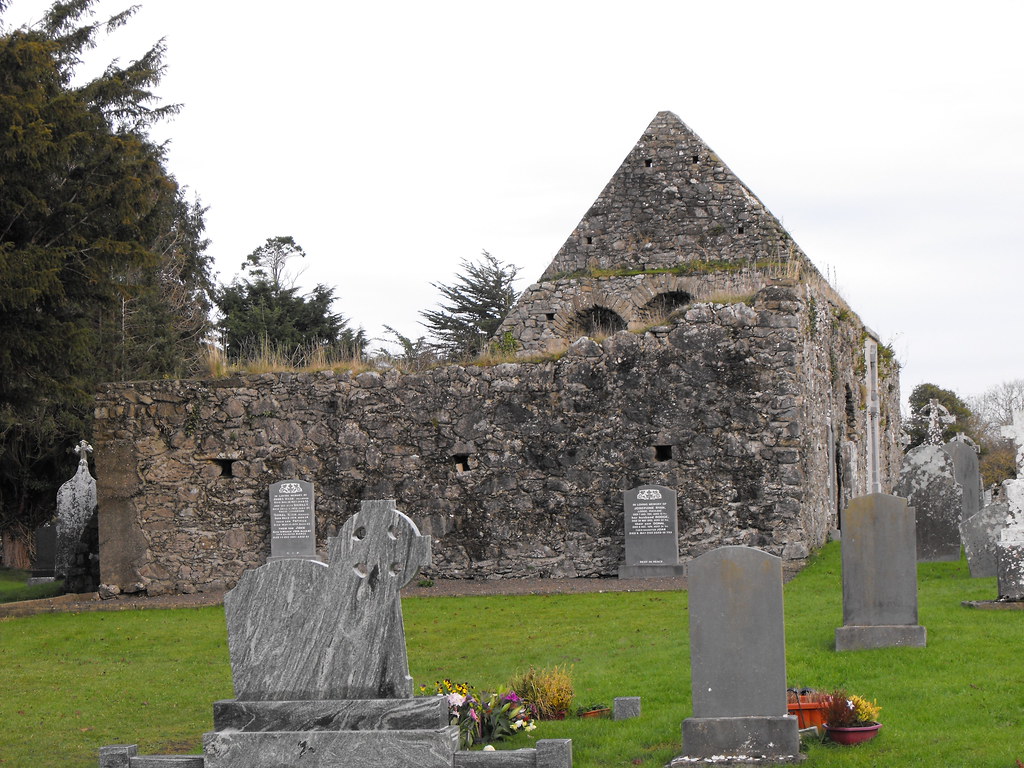
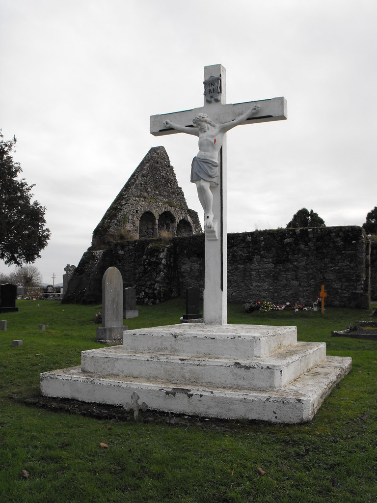
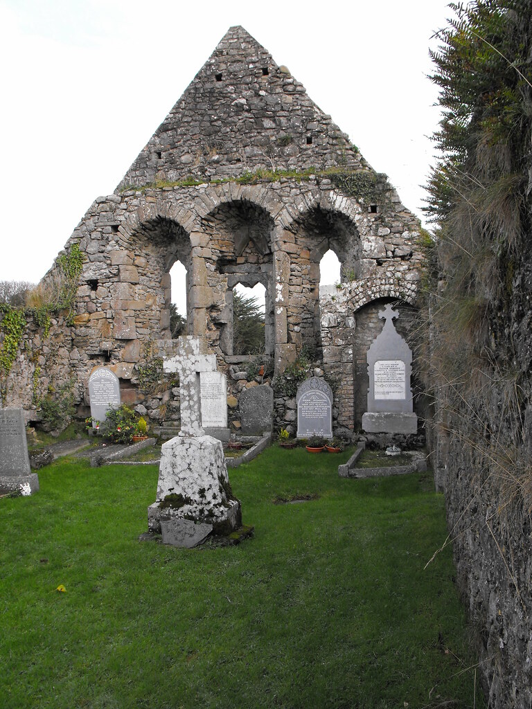
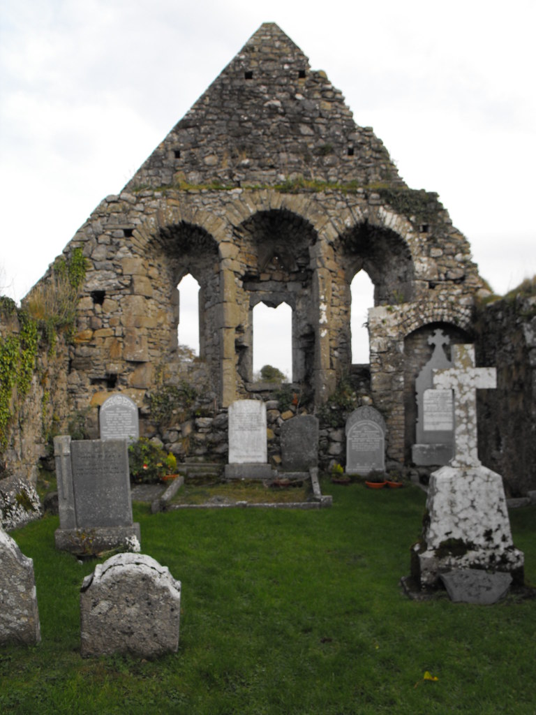
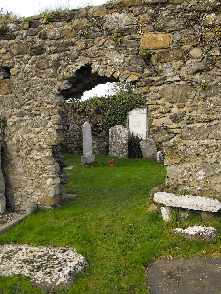
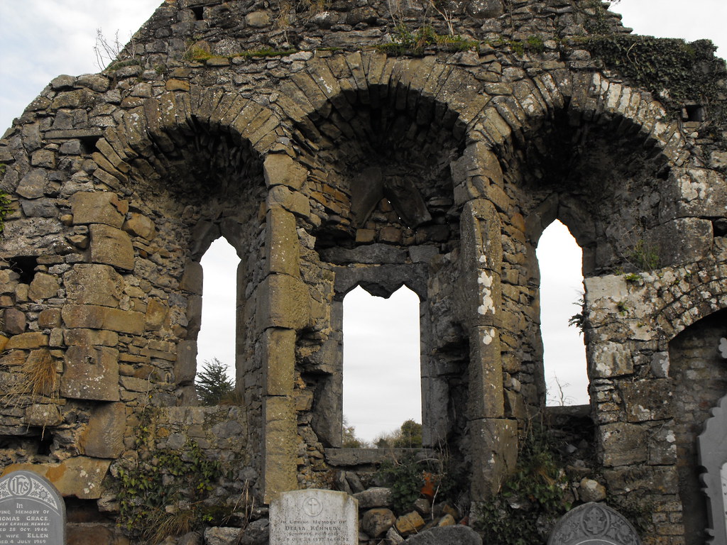
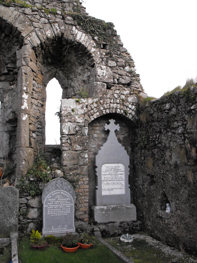
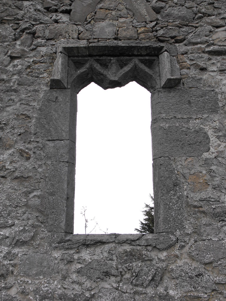
Description and History – There is very little to say about this ruin because all that remains are some much altered walls that stand to about a quarter of their original height. The work that has been done has made this place devoid of any character. The main concern in this work seems to have been tidiness as opposed to any historical or architectural concern. The remains consist of a nave and chancel measuring 14m x 6.5m. The W wall is now completely missing. The wall between the nave and chancel still remains and the original entrance is missing. No remains of any doorways survive. The E wall is now home to a large shrine.

Difficulty – Easy to find with limited parking. This is a very busy road so be careful.

For more ecclesiastical sites, click here.
For more sites in Co. Carlow, click here.


Dromineer, Hall/Tower House, Co. Tipperary.

Location – On the R495 in the town of Dromineer on the shores of Lough Derg.
OS: R 814 861 (map 59)
Longitude: 8° 16' 36.07" W
Latitude: 52° 55' 32.11" N
GPS: R 81394 86115 (Accuracy - 6m)
See map at the bottom of the page.

Description and History – This is quite an unusual castle in that it is a 13th century hall house that was later converted into a tower house in the 15th/16th century. It was built by followers of  Thomas Butler in the 13th century and by 1299 the Cantwells were tenants as Thomas Cantwell is listed as paying tax on the castle. The castle then fell into Gaelic hands and the Ormond O’Kennedys were responsible for the remodelling of the castle. In 1582 the Butler Earls of Ormond re-captured the castle and the Cantwells once again became tenants until 1640 at least. In the Civil Survey of 1654-6 the castle was describes as the ‘Mannor of Dromineer &c appertaineth a Courte Leete & Courte Barron with all the Rights privileges & immunities belonging to a mannor. Uppon the sd lands stands an old castle six thatch houses and fowerteene cottages.’ The proprietor of the castle in 1640 is John Cantwell of Cantwells Court in Kilkenny. In 1650 the castle was seized by Cromwellian forces and garrisoned. It was returned the Earl of Ormond following the occupation by Cromwell. The castle fell into ruin in the late 17th century and was sold by the Earl of Ormond in the late 19th century.

The hall house was originally only two storeys high but two storeys were later added and vaults added to the ground floor. The conversion has resulted in an unusual rectangular shape to the castle which is 11m x 15m. A base batter is present and can be attributed to the earlier structure and many of the windows were modified during the conversion from hall to tower house. There are other architectural features that I was unable to see as it is not possible to get into the castle as access is through a private garden. There is also heavy ivy growth on the castle which makes seeing certain features difficult. A bawn wall also surrounds the castle in places. This is a lovely castle in a lovely location right on the shore of the lough.

Difficulty – Easy to find and plenty of parking.

For more castles, click here.
For more sites in Co. Tipperary, click here.

Unfortunately most the castle is in a private garden so you can only walk around one side of the ruin.
Trying to glimpse inside the castle.

There is a castle under there somewhere.

Looking up at the chimney.

The chimney is looking somewhat precarious these days and is home to birds.

I suspect that a partial collapse of the castle is not far away.


View The Standing Stone in a larger map

The Labby Rock, Carrickglass, Portal Tomb, Co. Sligo.

Location – To the East of Lough Arrow behind the Cromlech Lodge hotel. Follow the path through the pine plantation at the rear and across the opening. The tomb is located at the base of a small dip in the landscape.
OS: G 796 158 (map 25)
Longitude: 8° 18' 42.48" W
Latitude: 54° 5' 27.02" N
See map at the bottom of the page.

Description and History – This is a very impressive portal tomb and is the only one I have seen so far with a capstone that rivals Browne’s Hill in Co. Carlow. It is immense and the capstone looks like it is taller than the portal stones. However, as impressive as this portal tomb is I don’t think it is very aesthetically pleasing to the eye. I am definitely in the minority in saying that but I prefer the more rounded portal tombs found in the midlands. The huge capstone rest on two front portal stones and three stones at the rear forming a small chamber. A door stone is set back from the portal stones. The large capstone may have been in situ and built around. It is also situated in a small valley which draws your eye to the tomb. It would be interesting to see how this tomb fit into the larger landscape but the pine plantation obscures most of the view. This is a must see for anyone who loves portal tombs and is one of the finest in Ireland.

Difficulty – It is a little tricky to find and there is a wall to clamber over but apart from that this is handy enough.

For more Neolithic tombs, click here.
For more sites in Co. Sligo, click here.

The tomb as it first appears to you as you approach. Note how it has been placed at the base of a small dip in the landscape.


The size of the capstone is immense.


View The Standing Stone in a larger map

Moytirra East, Court Tomb, Co. Sligo.

Location – About 2km E of Lough Arrow near Castlebaldwin and Carrowkeel.
OS: G 815 141 (map 25 and 26)
Longitude: 8° 16' 58.83" W
Latitude: 54° 4' 32.77" N
GPS: G 81477 14115 (Accuracy – 5m)
See map at the bottom of the page.

Description and History – This court tomb isn’t the largest I have seen and is quite ruined but you can still make out the shape and this is a very nice tomb to visit. Many stones are now missing from the outer court and it now forms a semi-circle while it was originally circular. The long and thin gallery is divided, by jamb stones, into many chambers. This is a good tomb to look at to see the overall layout of a court tomb because you can see the whole thing quite easily. None of the stones are much above 1m high. Of course this tomb is part of a much larger Neolithic landscape with other tombs nearby and not far from Carrowkeel. This is well worth a visit, although it is very overgrown at the moment.

Difficulty – This is easy to get to and is on private land but access has been made to the tomb and there is a gate.

For more Neolithic tombs, click here.
For more sites in Co. Sligo, click here.

Looking from the court into the chambers. I am very unhappy with these photos and want to go back and get some better shots.

As you can see the tomb is very overgrown.

The entrance to the gallery.

The gallery.

Looking into the gallery.


View The Standing Stone in a larger map

Monsea, Chruch, Co. Tipperary.

Location – Near the R495 between Nenagh and Dromineer.
OS: R 831 818 (map 59)
Longitude: 8° 15' 3.93" W
Latitude: 52° 53' 12.72" N
See map at the bottom of the page.

Description and History – Although there is nothing unique about this church I like it because it is well looked after. I have been to so many churches that are just covered in ivy and left to ruin that to see one that is so well maintained is an absolute joy. The remains are of a late medieval church about 9m x 20m. There has been a later restoration which has stabilised the remains. The E gable survives to full height while the W gable survives to about 3m. There is a gap in the N wall and the door in the S wall is partially ruined. The triple window in the E wall is in very good condition and makes this a very attractive ruin.

Difficulty – Easy enough to find and there is ample parking.

For more ecclesiastical sites, click here.
For more sites in Co. Tipperary, click here.


The outside of the E gable.

Inside the E gable.

There are some lovely old graveslabs in this church yard.


View The Standing Stone in a larger map