
Location – On the North coast of Antrim a few kilometres West of Portballintrae and Bushmills.
OS: C 904 413 (maps 4 and 5)
GPS: C 90400 41345 (Accuracy – 0m)
Longitude: 6° 34' 47" W
Latitude: 55° 12' 39.2" N
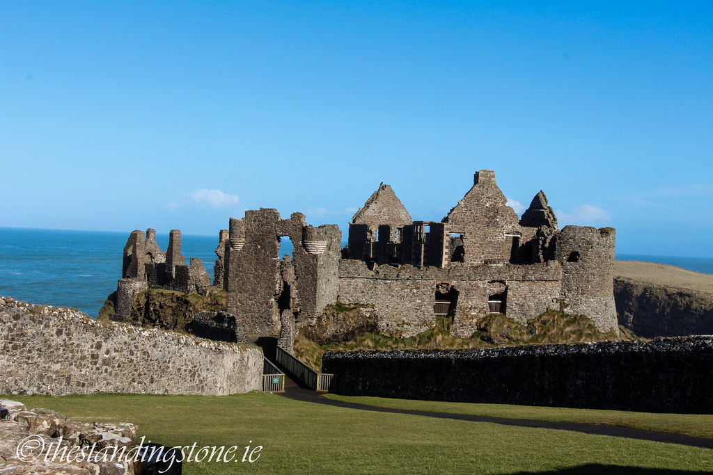
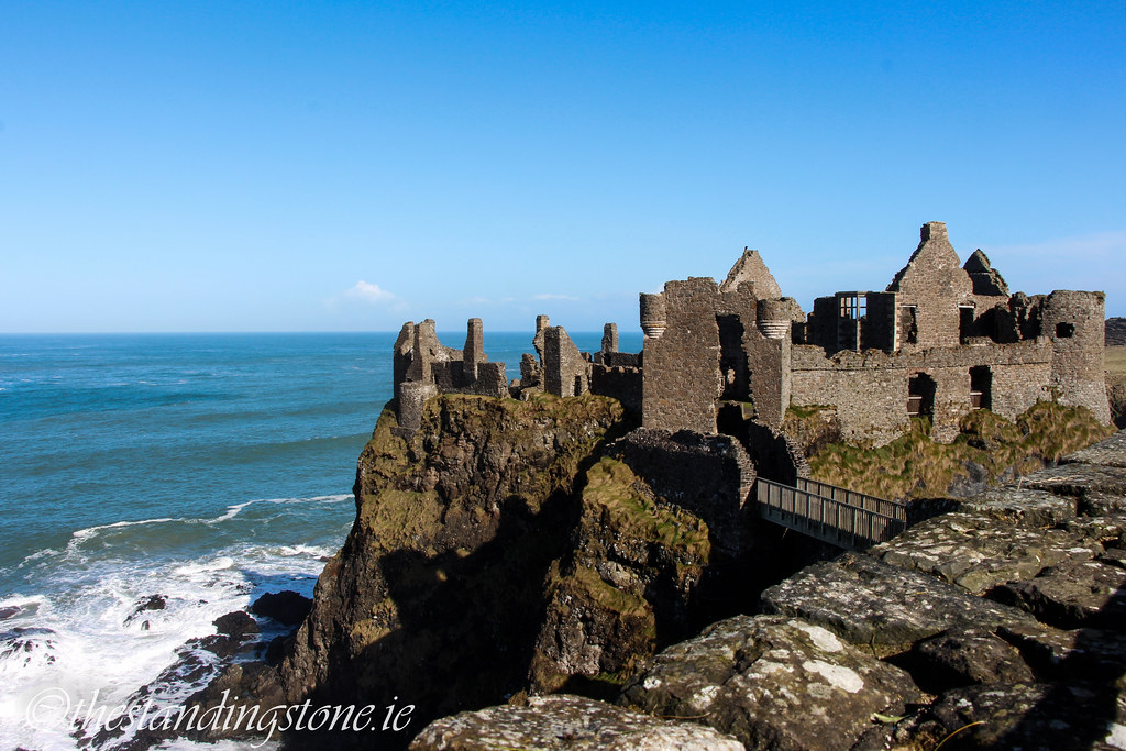
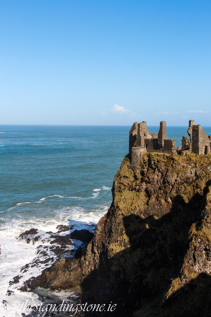
Description and History – Dunluce Castle is one of most distinctive castles in the country perched on a cliff edge in Antrim not far from the Giant’s Causeway. It was a site that had been high on our list to visit for many years and finally we had the opportunity to go to the site and it didn’t disappoint. The castle is dramatic, as is its history!
The present remains date back to c1500 when a castle was built by the MacQuillans to be their seat of power in Antrim. However, by 1550 the site was in the hands of the MacDonnells who then rapidly increased their power while feuding with other prominent families. Their power grew so great that they became a threat to the English crown during the reign of Elizabeth I. The Lord Deputy of Ireland, Sir John Perrot, was sent to besiege the castle, which he successfully did in 1584. However, the castle was given back to the MacDonnells two years later after they assured the crown of their loyalty. However, when the Nine Years War broke out in 1594 Randall MacDonnell aligned with the Ulster Gaelic chieftains joined Hugh O’Neil at the Battle of Kinsale. Yet, in spite of the defeat at Kinsale, Randall MacDonnell was pardoned following his surrender to Crown forces. Ironically, Randall MacDonnell became a key person in the plantations under James VI and established a new town at Dunluce for the new settlers. The castle passed to Randal’s son, also called Randal, and he and his wife, Catherine, lived a luxurious life at the site until the Irish Rebellion in 1642 when Randall MacDonnell was arrested. Catherine MacDonnell fled to Chester with their possessions where they were eventually sold off by Oliver Cromwell’s agents in 1651 following the fall of the English Crown. It was during this time that Dunluce castle the surrounding town fell into ruin. Cromwell granted the castle to soldiers who had fought for him during his Irish campaign. However, in 1660 the English Crown was restored under King Charles II and Randal regained Dunluce. But the castle was now a ruin so the MacDonnell family settled at Glenarm Castle where they still remain. The castle remained a ruin until it came into state ownership in 1928.
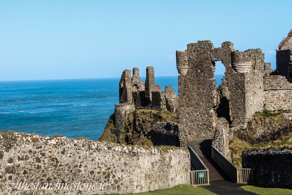
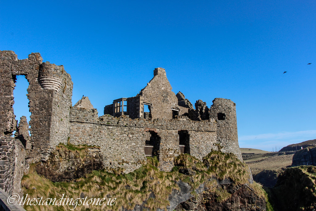
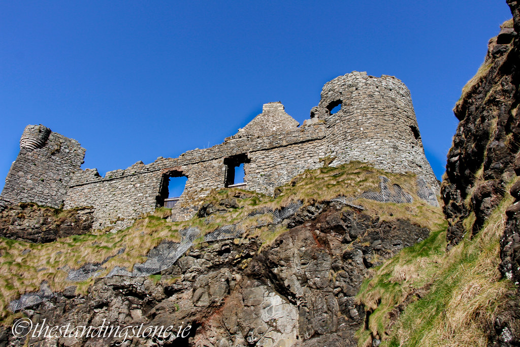
As to the physical remains of the castle, although there has been a castle on the site since the 13th century (and likely some other form of fortress before that) the remains largely reflect the 17th century occupation of the site when it was greatly altered by Randal MacDonnell. The outer ward of the castle is almost entirely 17th century in date. From here there is the castle’s brew house and stables, both probably a little earlier than the outer ward, The brew house was not accessible on the day we were there as works were being carried out in that area. The last part before reaching the castle proper is the lodgings, used to house guests. Largely collapsed these luxurious lodging would have had a fireplace in each room and a balcony which overlooked the castle’s formal gardens and bowling green. The castle itself sits on a small promontory which was originally accessed by drawbridge and later by a wooden bridge. Beyond here is the gatehouse, built by the MacQuillans in the 1560s in Scottish style. The curtain wall extends from here which is also a MacQuillan construction and dates to the 1590s. Housed in the curtain wall, facing the mainland, were cannons rescued from La Girona which was part of the Spanish Armada. A curious feature is the loggia which shows the influence of Southern European architecture. All that remains of the loggia is a row of columns which no longer stand to full height. The Manor house is built in Jacobean style and dates to 1620. Excavations at the site have shown that the Manor house occupies the site of an earlier building dating to the MacQuillan phase of building. To prevent further collapse of the façade a reconstruction of a 17th century bay window has been inserted. Flanking the Manor house are two towers, the South-East and the North-East towers. These towers belong to the pre-Manor house building and are part of the curtain wall construction. Gun-loops and wicker centring are visible in both. One of the more interesting parts of the castle sits under the Manor house and went completely un-noticed by me! A souterrain which pre-dates all the castle structures and probably dates to pre-1000 sits under the structure. The kitchens and buttery both date to the latter part of the 16th century as was the inner ward. Part of the inner ward collapsed into the sea in the 19th century.
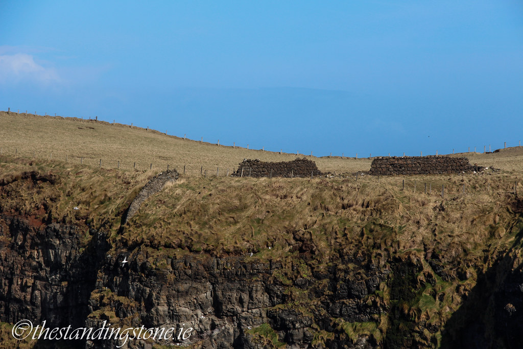
Outside of the castle are the remains, no longer visible, of Dunluce town which was established in 1608 by Randal MacDonnell as part of the Plantations. Some excavated portions show cobbled streets and it appears to have been rather large in size. The town had a short life, however, and was burned to the ground in the 1641 rebellion and abandoned in the 1680s. The town is subject to ongoing investigations by archaeologists who are slowly uncovering more of the town and what it would have been like. The remains of a church associated with the town sits a small distance away.
Dunluce castle is one of the most spectacular ruins in the country and a thoroughly enjoyable visit. However, time will take its toll on this structure which sits on a cliff edge. Parts have been crumbling into the sea for centuries and it is inevitable that it will continue its slow demise into the ocean.
Difficulty – Very easy to visit with parking and facilities. Despite being on the edge of a cliff it is suitable for families as all possible dangerous edges are well gated off.
For more castles, click here.
For more sites in Co. Antrim, click here.
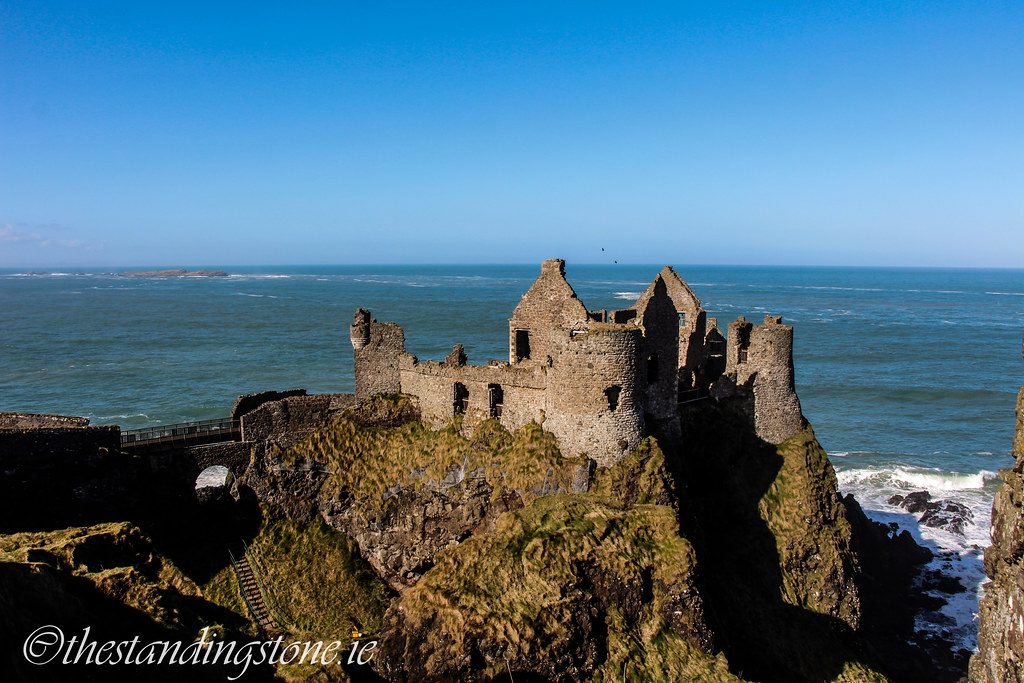
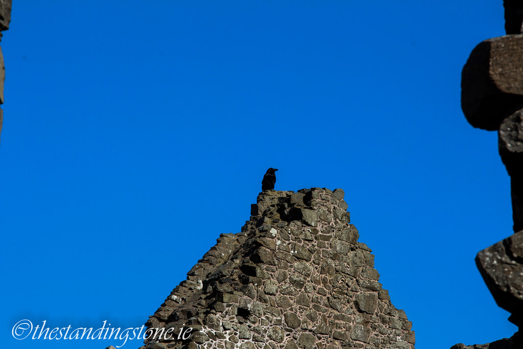
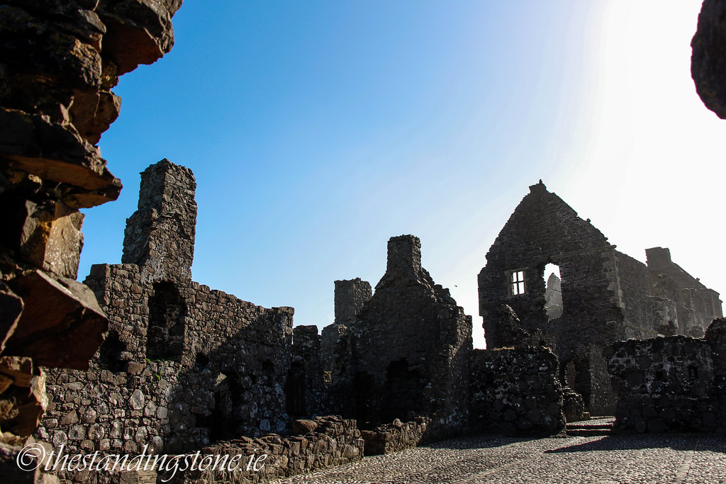
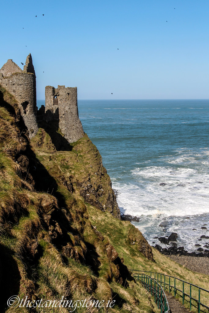
Perched precariously on a cliff edge.
This is the first courtyard you will enter when leaving the visitors centre. The brew house and the stables are located here.

The stables on the left hand side of the photograph.
The brew house.
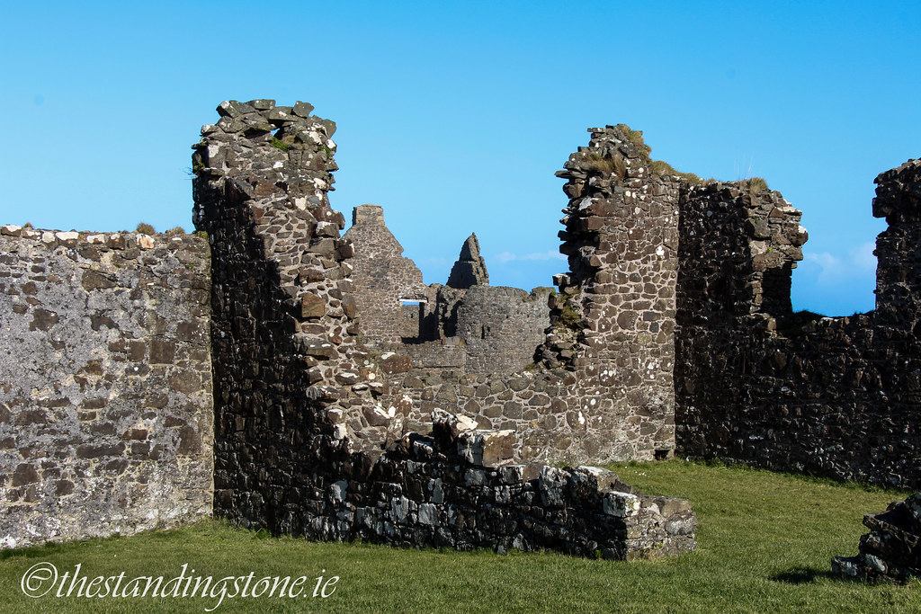

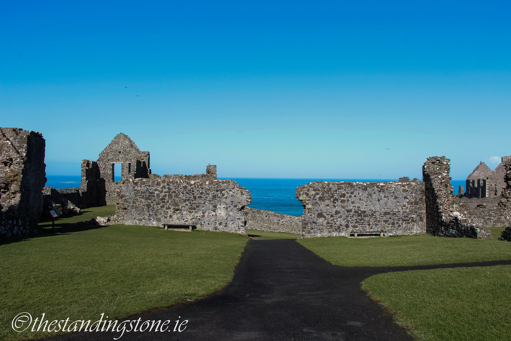
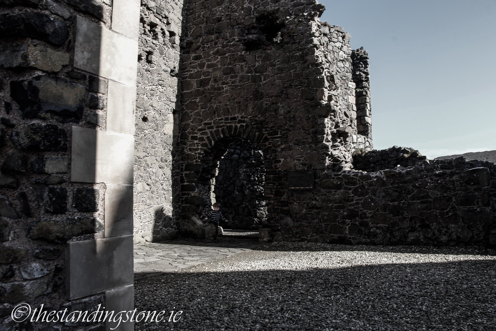
Looking through into the second courtyard.
The lodgings.
Multiple fireplaces in the lodgings.
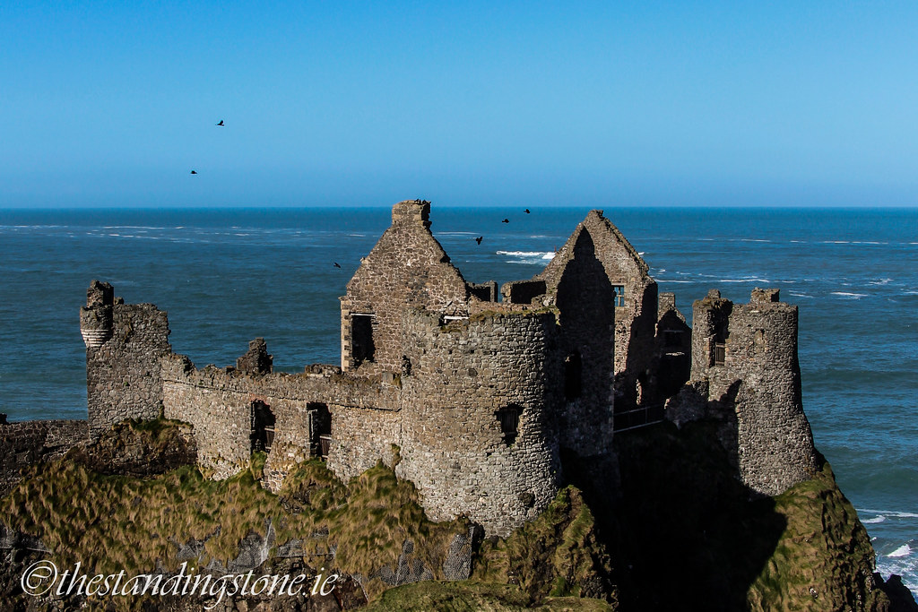
The castle as viewed from the second courtyard.
As you can see, parts of the castle are right on the cliff edge.
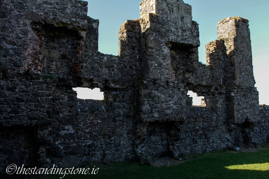
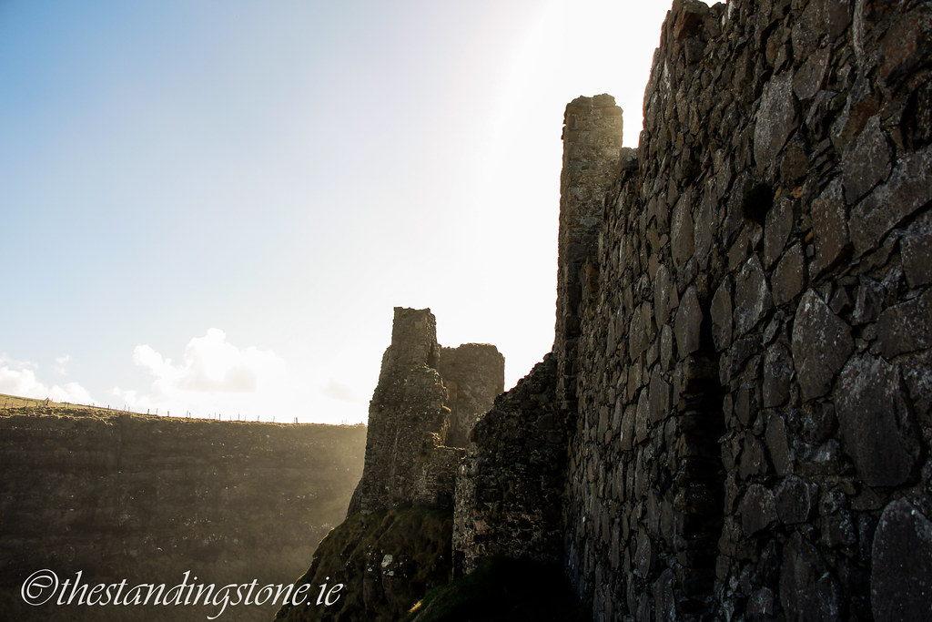
Looking at the gatehouse to the South-East tower.

The gatehouse.
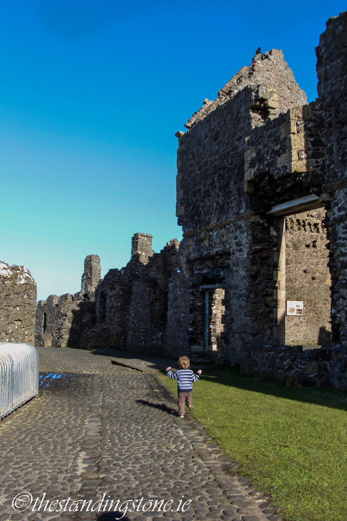
The front of the manor house...with my son running into the shot.

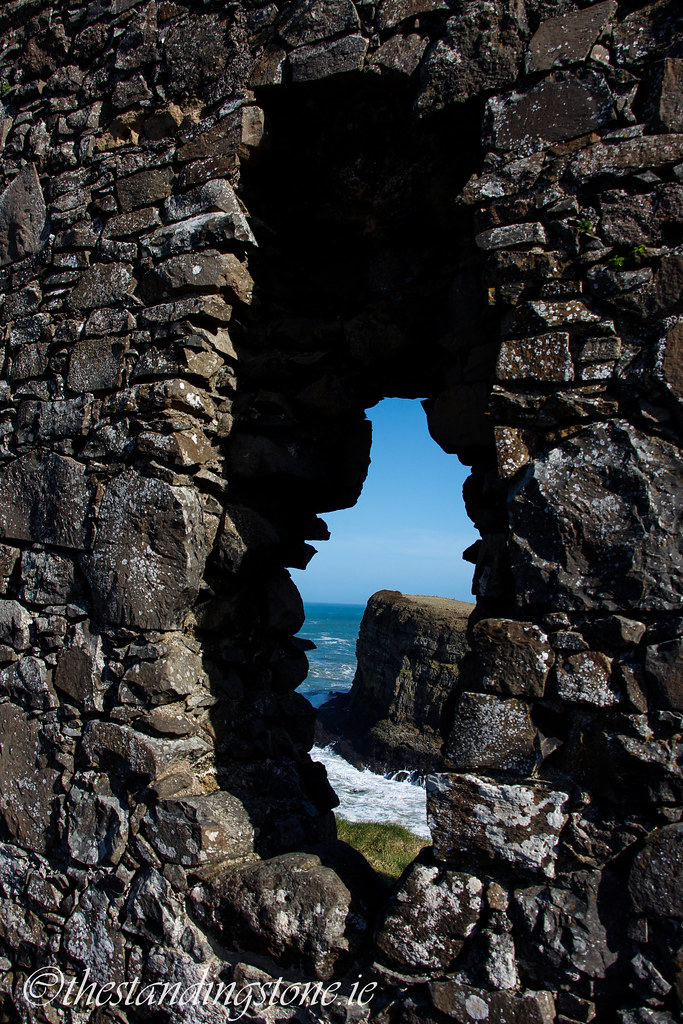
Breaks in the wall occasionally expose the cliffs and sea below. They are all, however, securely gated off and I just stuck my hand through the railings with the camera.

Graffiti from 1649.

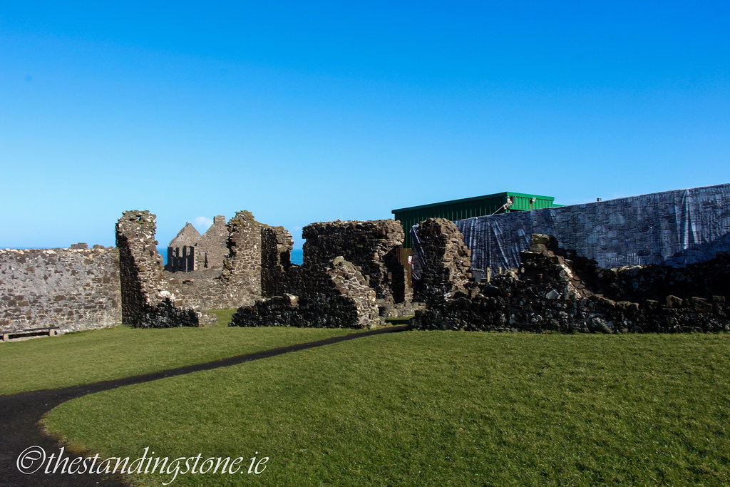
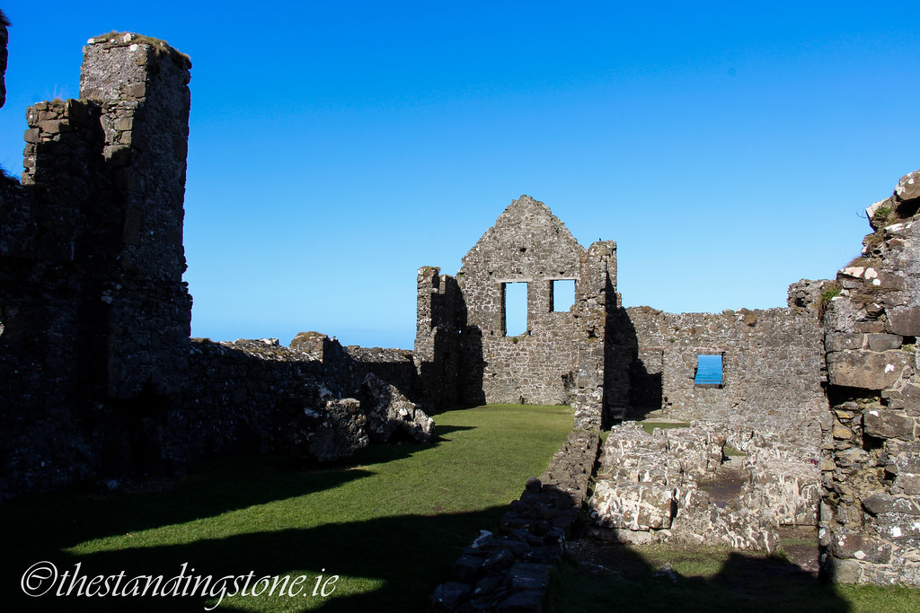
Inside the inner ward.
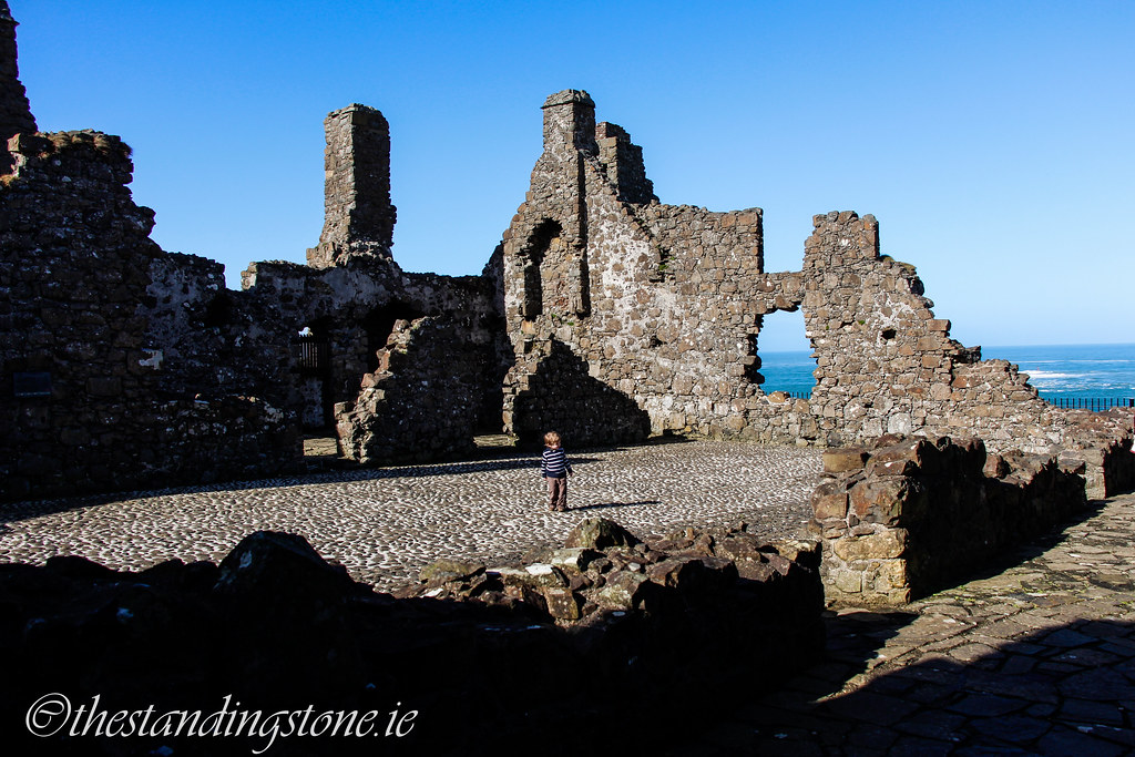
The inner ward...with my son getting in the shot.
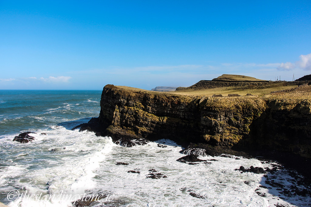
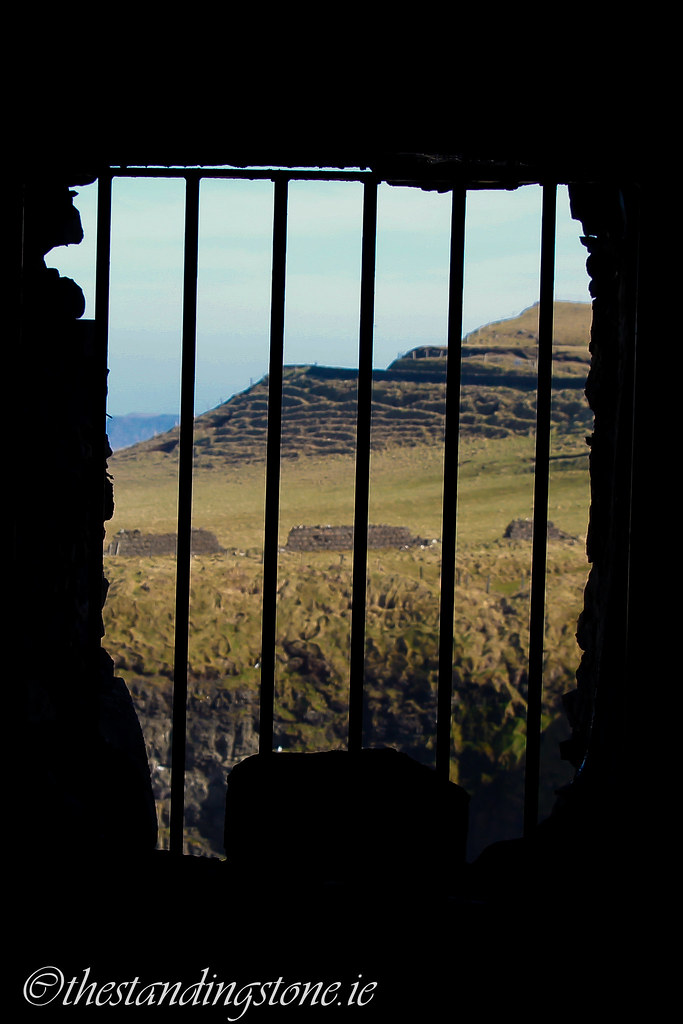
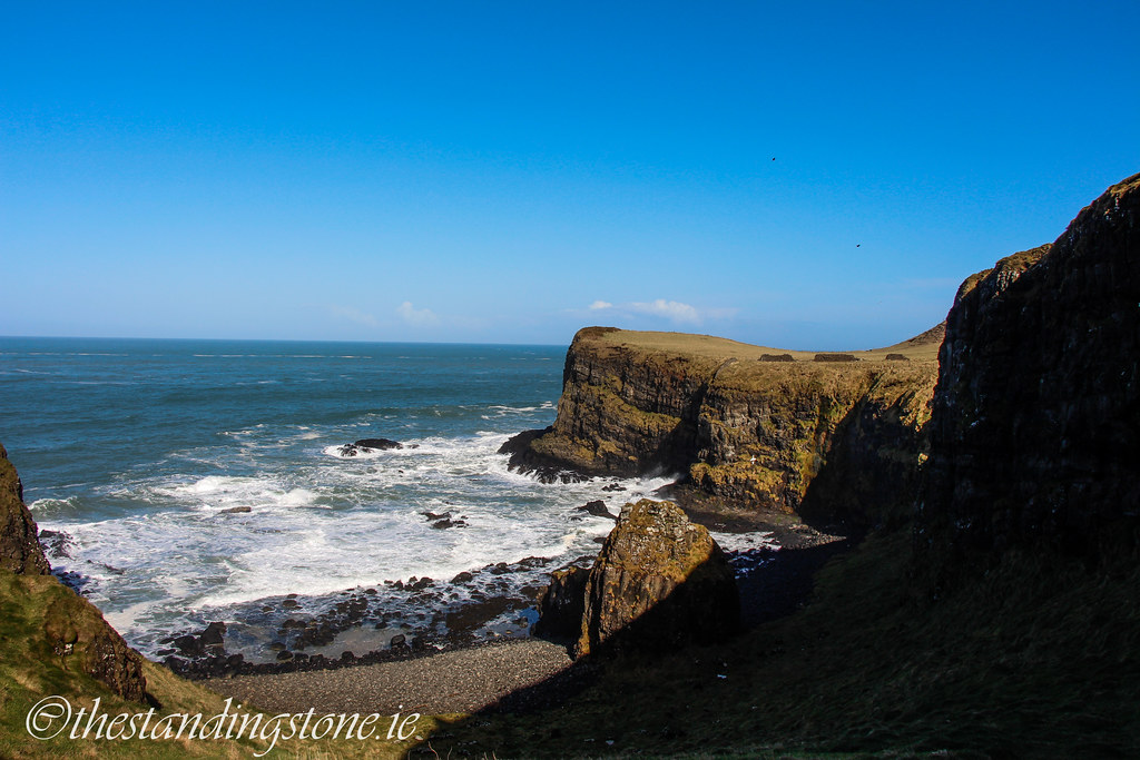
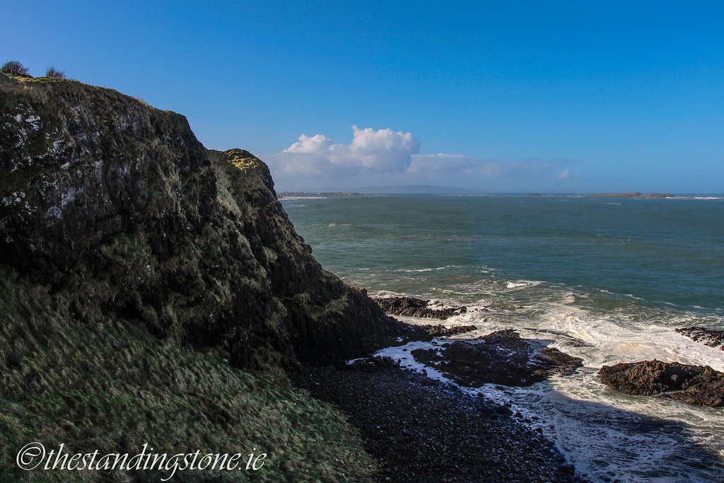
There are some stunning views from parts of the castle.
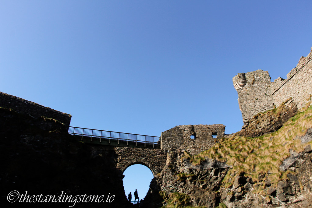
It's hard sometimes to see where the cliffs end and the castle begins.

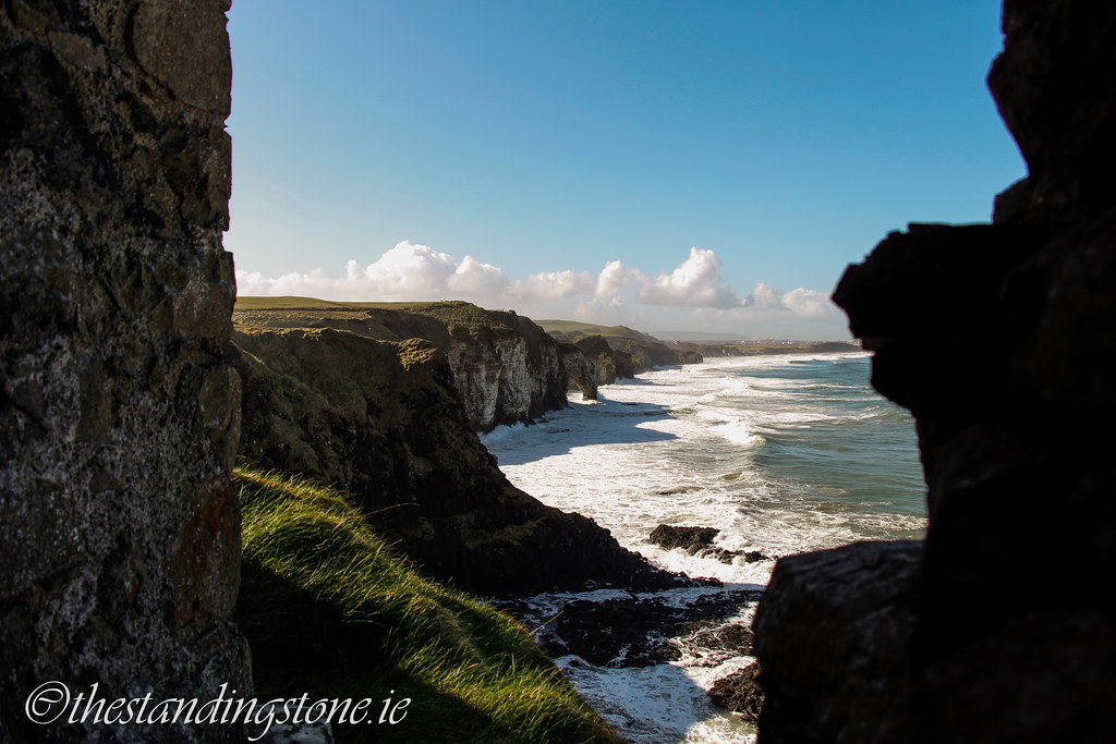
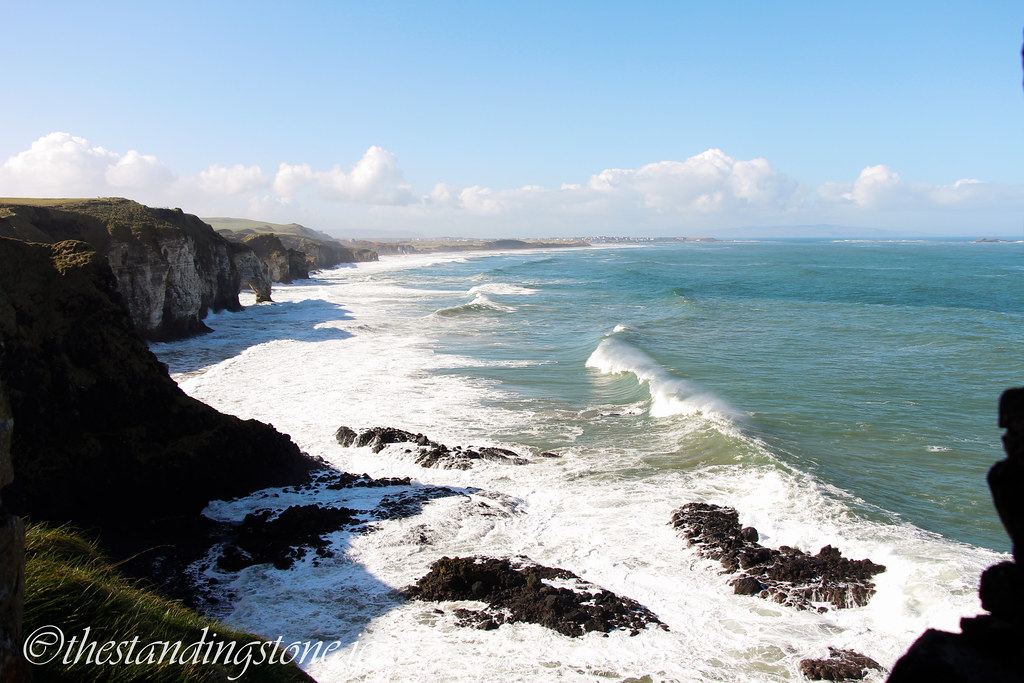
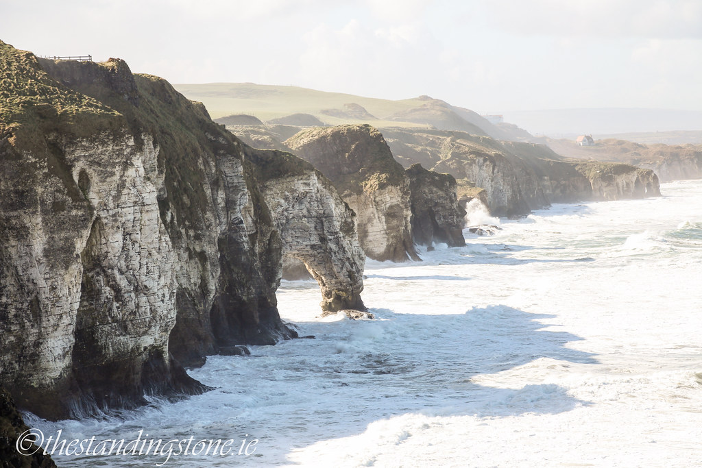
The views are fantastic.

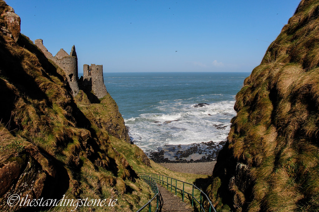
You can walk down to the base of the cliffs.
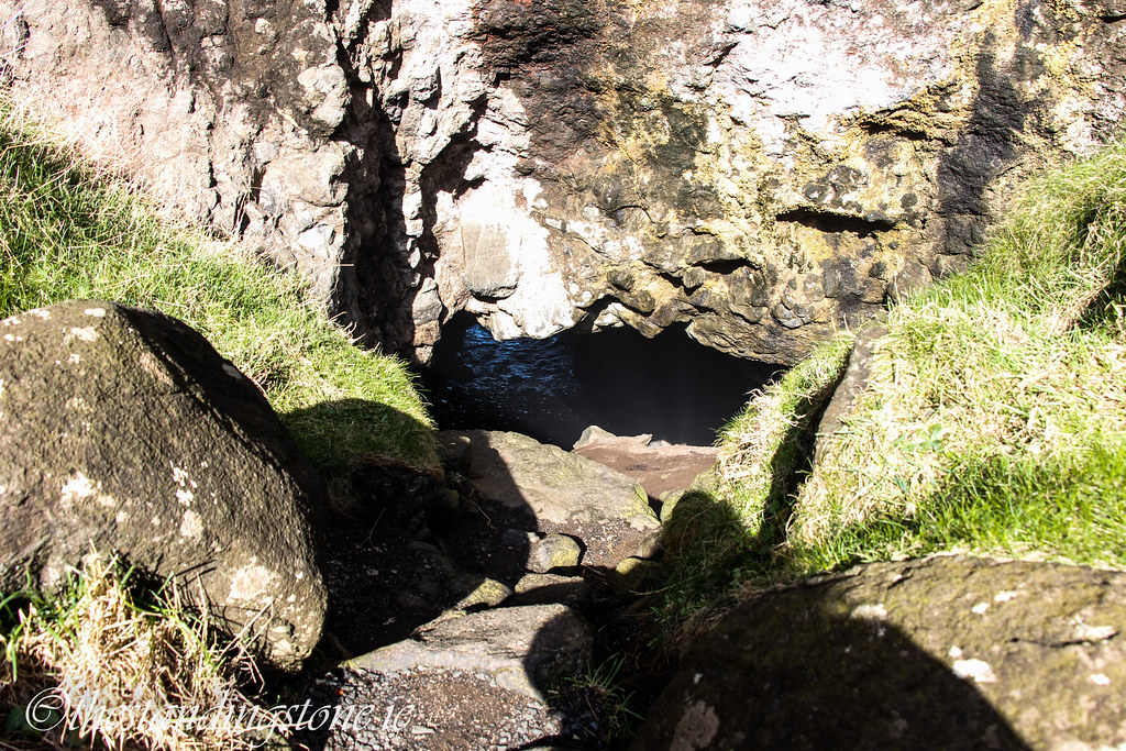
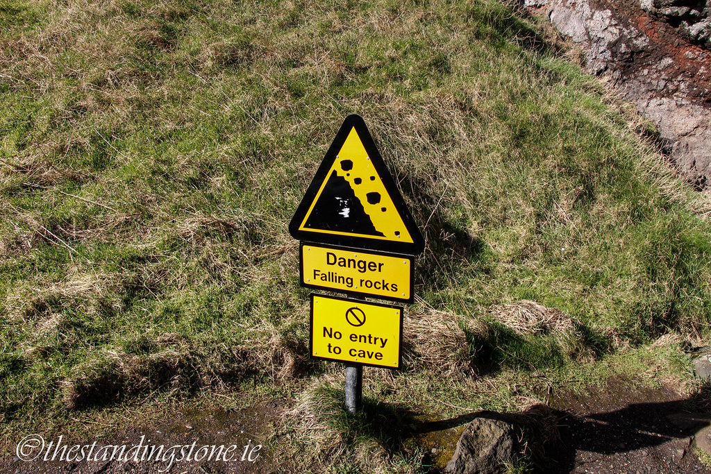
There is a small cave at the base that you can get into although it's advised that you shouldn't...I didn't.
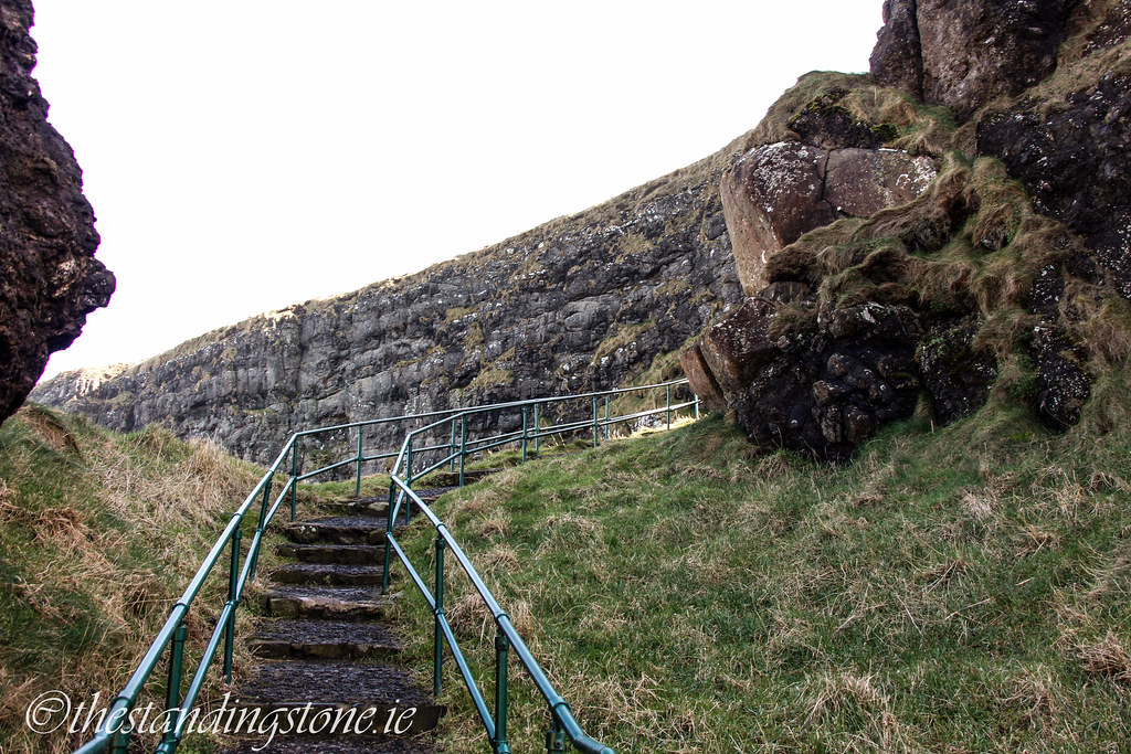
Heading back up to the top.
You can see here the result of erosion where wall are hanging over the edge and falling into the see. The castle will eventually do the same.
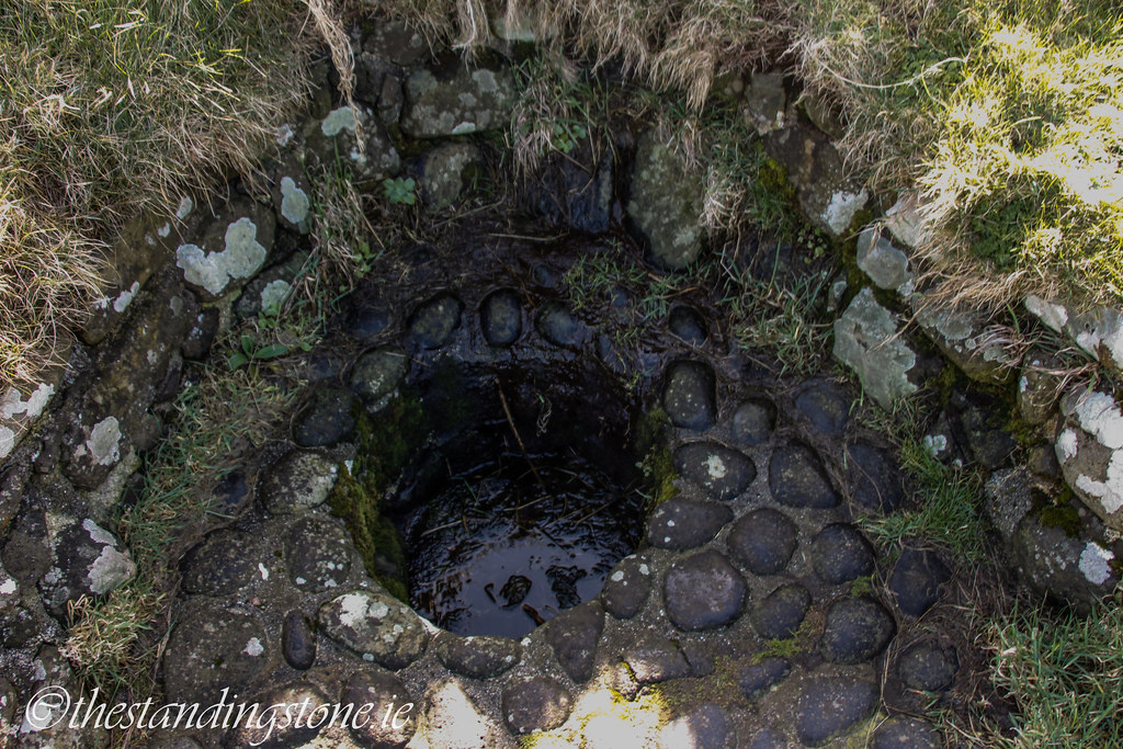
I don't know what this is. It looks like a small well. If anybody knows, let me know.
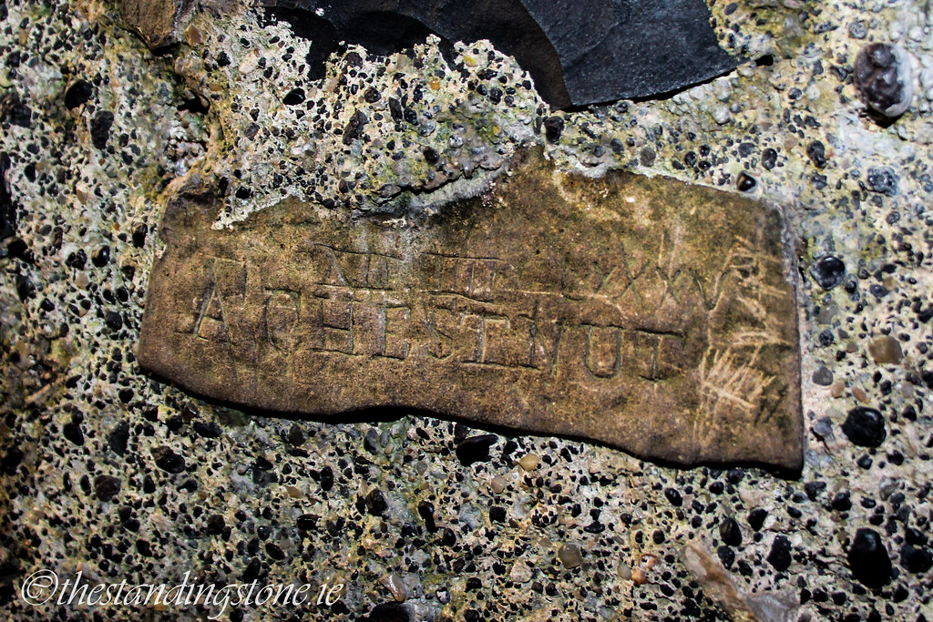
I would highly recommend going into the visitors' centre as it is full of interesting little things like this.