Ballindoon Friary, Co. Sligo.

Location – Near the Heapstown Crossroads on the banks of Lough Arrow.
OS: G 789 149 (map 25)
Longitude: 8° 19' 21.44" W
Latitude: 54° 4' 58.16" N
GPS: G 78888 14911 (Accuracy – 5m)
See map at the bottom of the page.

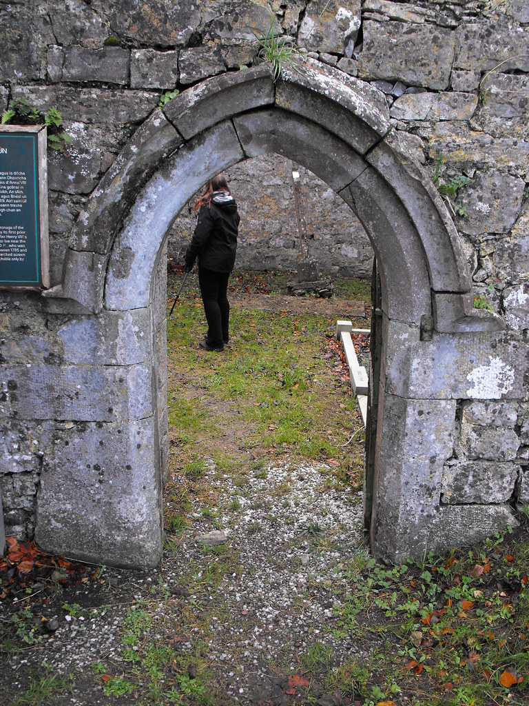
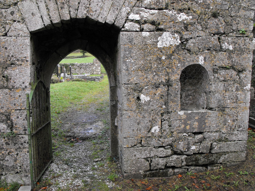
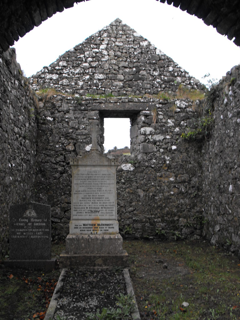
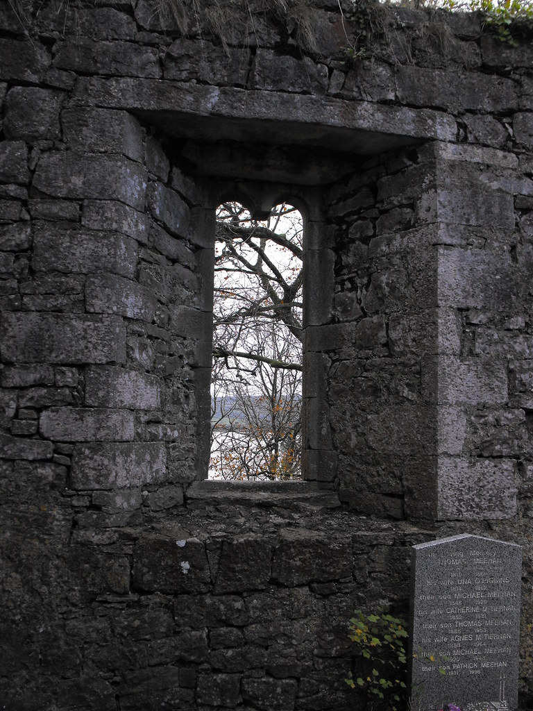
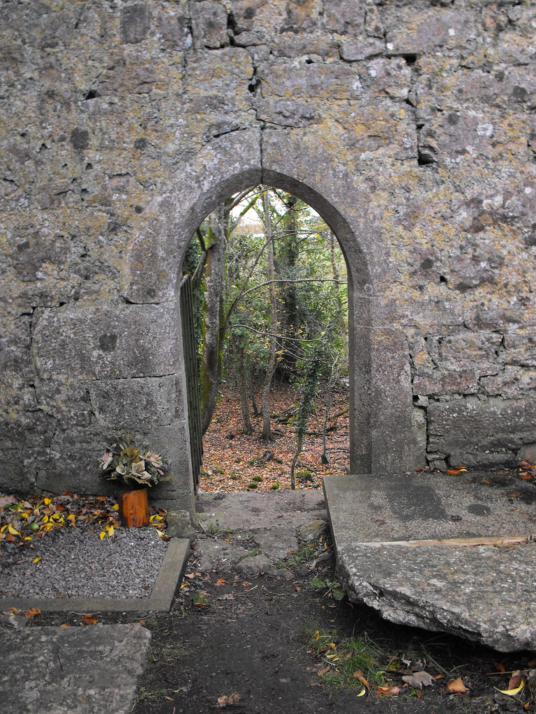
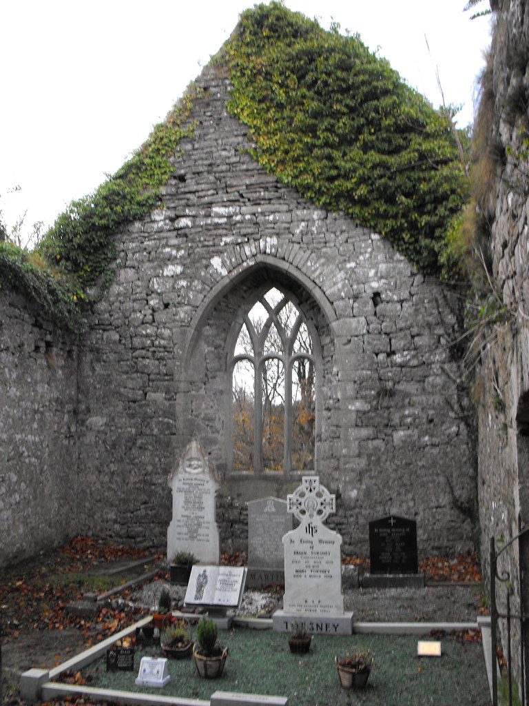
Description and History
– This is a fantastic ruin and in such an amazing location right on the banks of Lough Arrow. The friary belonged to the Dominicans and was founded by Thomas O’Farrell in 1507. He was murdered 20 years later. The life of this friary was short-lived, however, and after the dissolution it quickly fell into ruin and changed hands many times. The church is quite simple in design and is rectangular with a small transept. The central arches dividing the nave from the chancel is unique in Ireland as it is the country’s only surviving example. The arches have three barrel vaults underneath and this level above can still be reached but it is only for the brave as many of the steps are missing and there is nothing to stop you falling off. This is a great ruin and well worth the visit.

Difficulty – East to find and get around.

For more ecclesiastical sites, click here.
For more sites in Co. Sligo, click here.

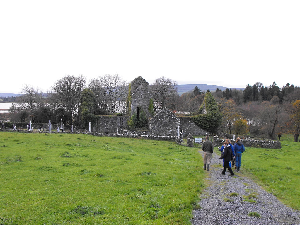
The friary from the road.

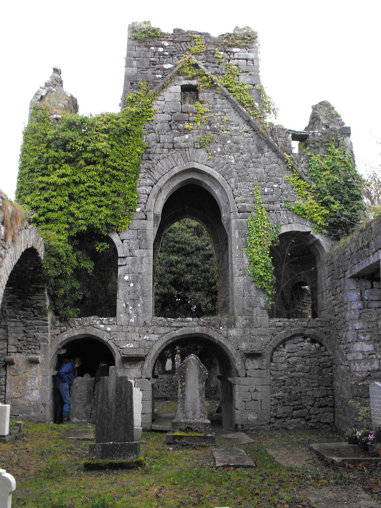
The unique screen division between the nave and the chancel.

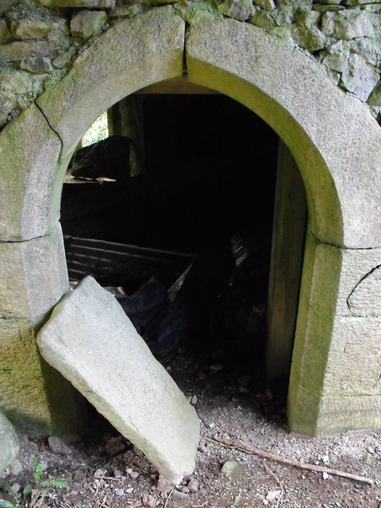
The steps to the upper floor.

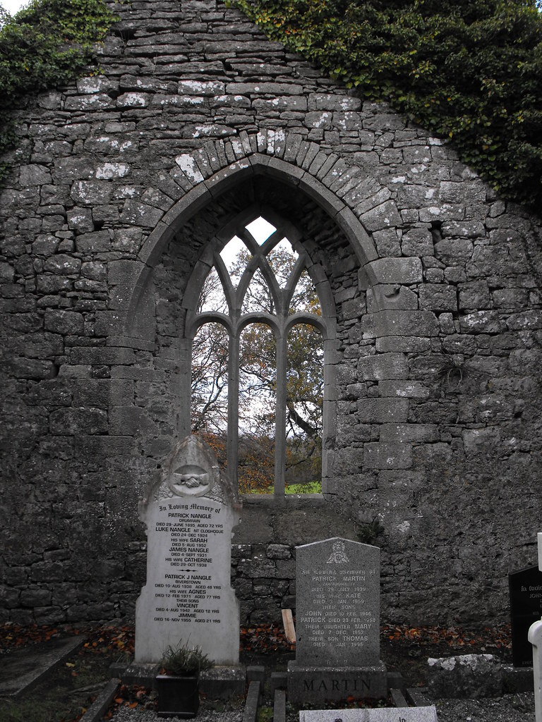
There are some lovely old gravestones here.


View The Standing Stone in a larger map

Heapstown, Cairn, Co. Sligo.

Location – Near Heapstown Crossroads, North of Lough Arrow and NE of Castlebaldwin.
OS: G 773 162 (map 25)
Longitude: 8° 20' 51.51" W
Latitude: 54° 5' 40.25" N
GPS: G 77257 16220 (Accuracy – 5m)
See map at the bottom of the page.

Description and History – We visited this cairn just as the light was beginning to dim so I am not pleased with my pictures and many came out blurred. I intend to go back here at some point to get some better shots. This cairn is absolutely massive and one of the largest, if not the largest, I have ever visited. The amazing thing about it is that it is a lot smaller than it used to be as much of the cairn has been robbed of its stone in the past two hundred years. In 1837 it stood to full height and had a standing stone on top which is now missing. Today it is about 80m in diameter and about 10m high. There is a kerb of massive stones around the edge and one of these may have some decoration on it, although it was hard to tell in the light. There may be more but some of the kerb is hidden in undergrowth. There is likely to be a passage tomb under this great mound, especially considering the many other passage tombs in the area and its proximity to Carrowkeel. This is a little visited site but yet is very accessible.

Difficulty – East to get to and get around.

For more cairns, click here.
For more sites in Co. Sligo, click here.

Even as you approach this cairn it's size strikes you right away.

The kerb is starting to become overgrown in places.

Possible rock art on one of the kerbs. It shows up here as three vertical lines.


View The Standing Stone in a larger map


Mungret, Churches and Bullaun Stone, Co. Limerick.

Location – In Mungret village about 2km West of Limerick City. Individual co-ordinates will be given on individual site pages. 
See map at the bottom of the page.

Description and History – This cluster of churches is what remains of an early Christian foundation, founded by St. Nessan. What remains are the ruins of two churches and an abbey. I also found a bullaun stone here that seems to have been un-noticed thus far. There is also a holy well here that I missed on my first visit but I will go back to look at this in the future. At its height there were 6 churches here and 1500 monks. The site was plundered three times by the Vikings in the 9th century and by the local chief Murtagh O’Brien in 1107. The site was granted to the Bishop of Limerick, Brictius, by the King of Munster, Donal Mór O'Brien in 1179. From the 12 century onwards the abbey became of the order of Augustinians.

Mungret was known as a seat of learning and one story relates how Mungret was challenged by Lismore in Co. Waterford to see who had the most learned monks. The Mungret monks decided to try and get the upper hand on the Lismore monks and dressed up as washerwoman on the day of the contest and waited by the river for the Lismore monks to arrive.  When the monks crossed the river they asked the disguised monks for directions and one gave the answer in perfect Latin and other in perfect Greek. The Lismore monks decided that even if the washer women were fluent in ancient languages that they would have no chance against the more educated monks. They left and did not challenge the monks.

Click below for individual sites within this complex:
The Old Church.
St. Nessan’s Church.
The Abbey and Bullaun Stone.

Difficulty – Easy enough to find although the graveyard around the Abbey is very uneven underfoot.

For more ecclesiastical sites, click here.
For more sites in Co. Limerick, click here.


View The Standing Stone in a larger map