Sleaty, Church and Crosses, Co. Laois.

Location – A few km north of Carlow town on the banks of the River Barrow.
OS: S 713 791 (map 61)
Longitude: 6° 56' 27.43" W
Latitude: 52° 51' 27.83" N
GPS: S 71327 79054 (Accuracy – 7m)
See map at the bottom of the page.

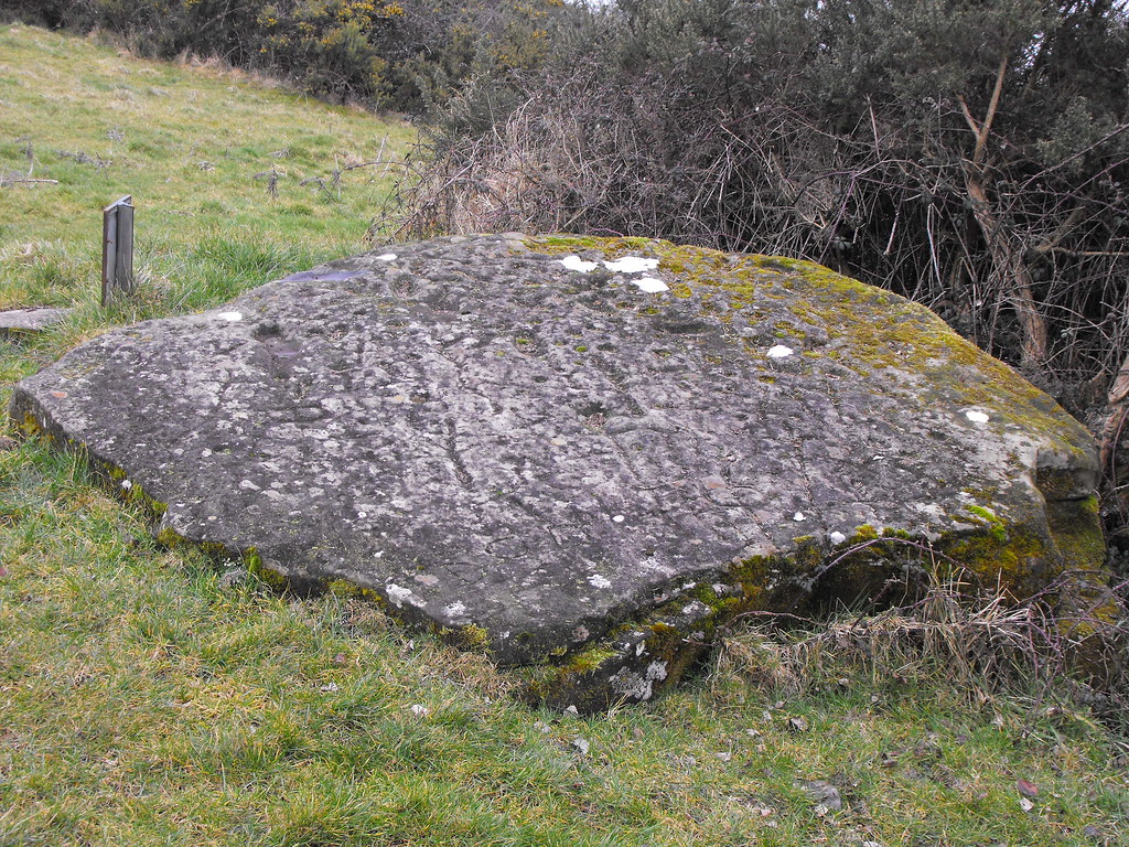
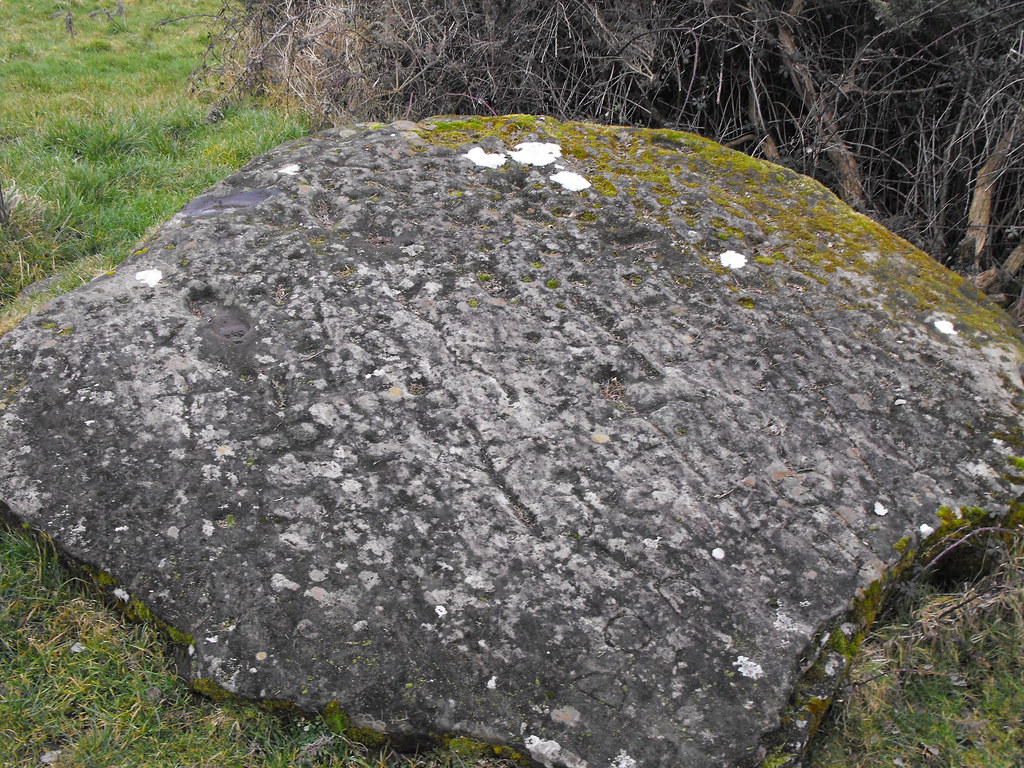
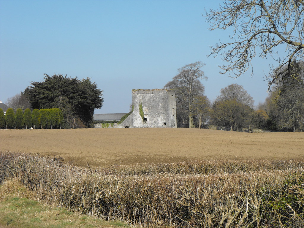
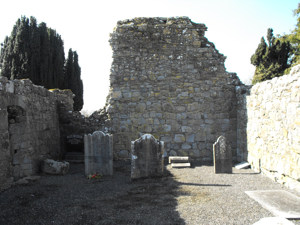
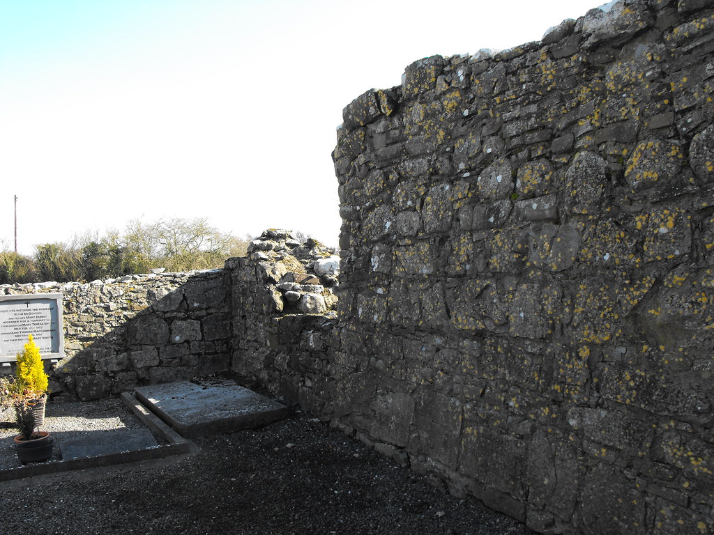
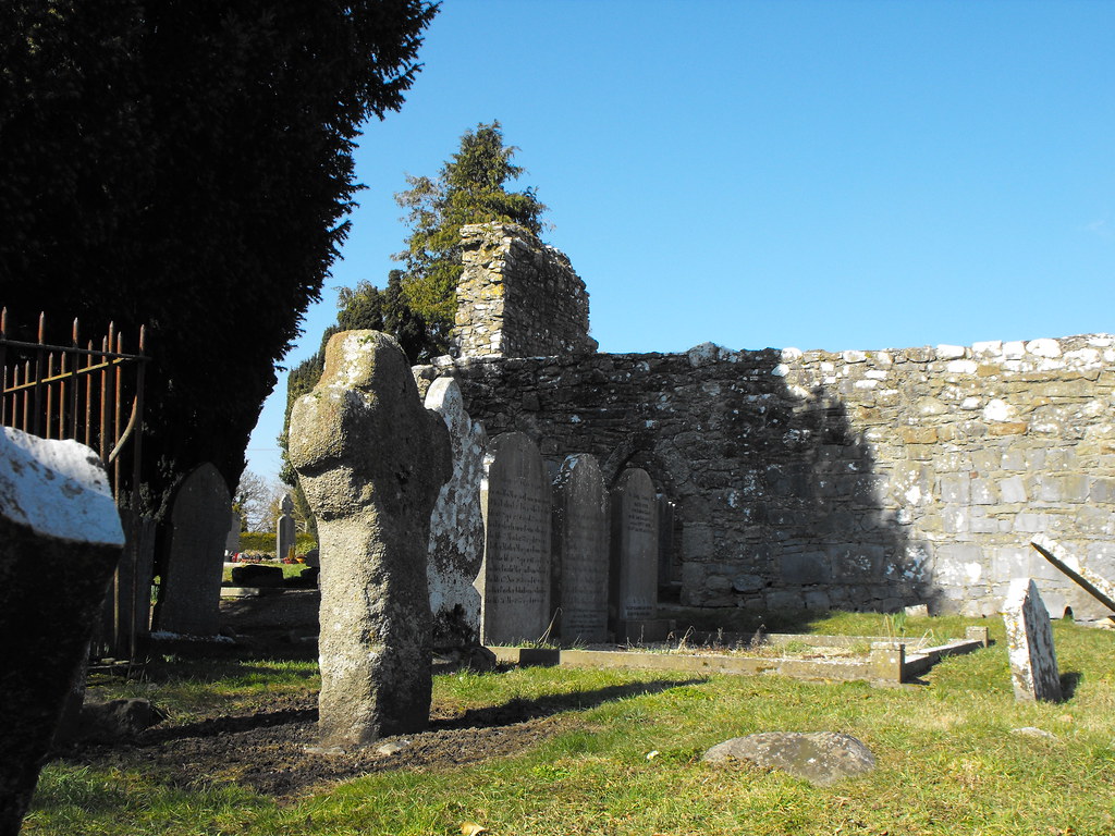
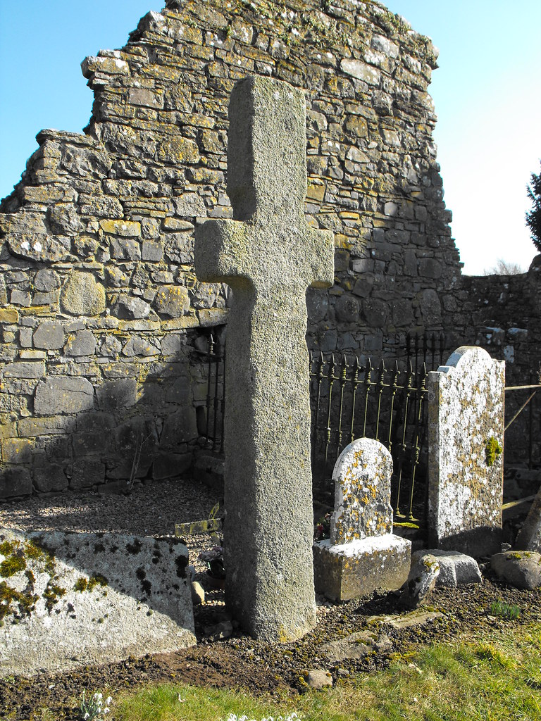
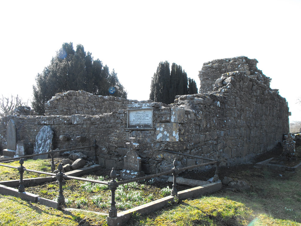
Description and History – The remains at Sleaty appear to be nothing out of the ordinary apart from the two early Christian crosses which betray its importance as the former residence of the Bishop of Leinster. This is a very early Christian foundation, of which only the two crosses remain. Associated with St. Fiacc the church is medieval in date, although some of the larger stones used in its construction may come from the earlier foundation. Large boulders were common in early Christian construction. The original monastery was on the other side of the river but when 60 monks died at the site (how I don’t know) it was moved to its present location. Aodh lived here in the 7th century who was one of the first biographers of St. Patrick. The last historical reference to the site is from 1055, after which the site lost importance.

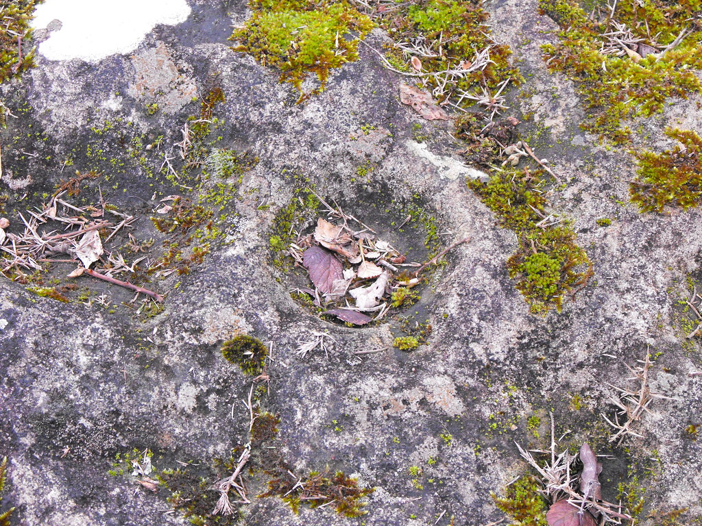
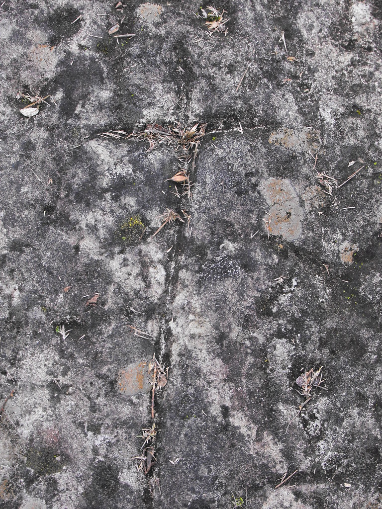
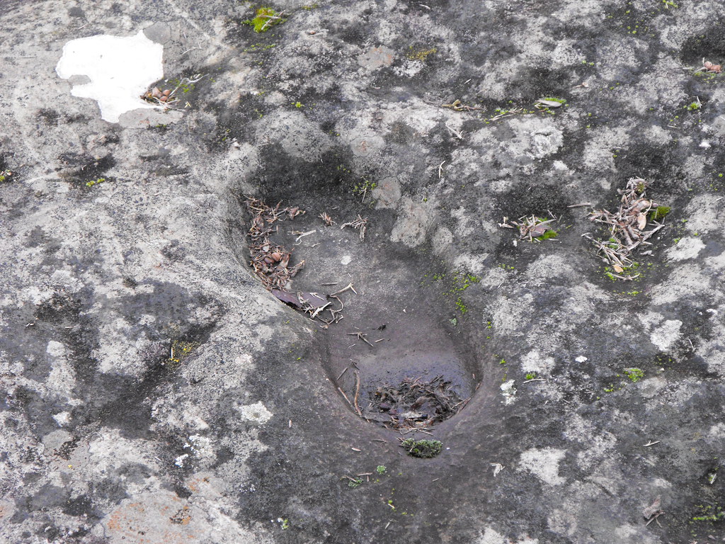
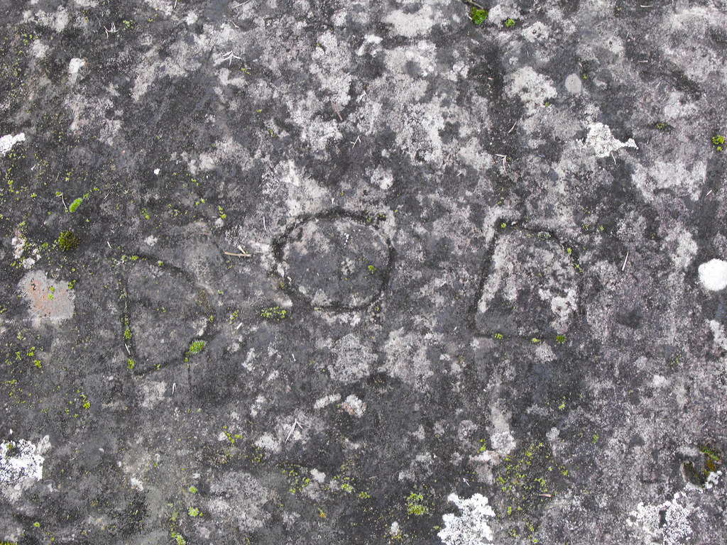
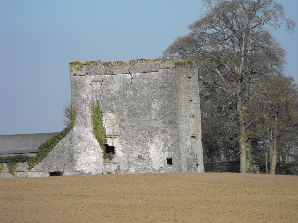
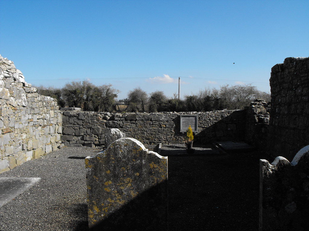
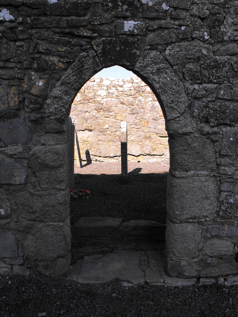
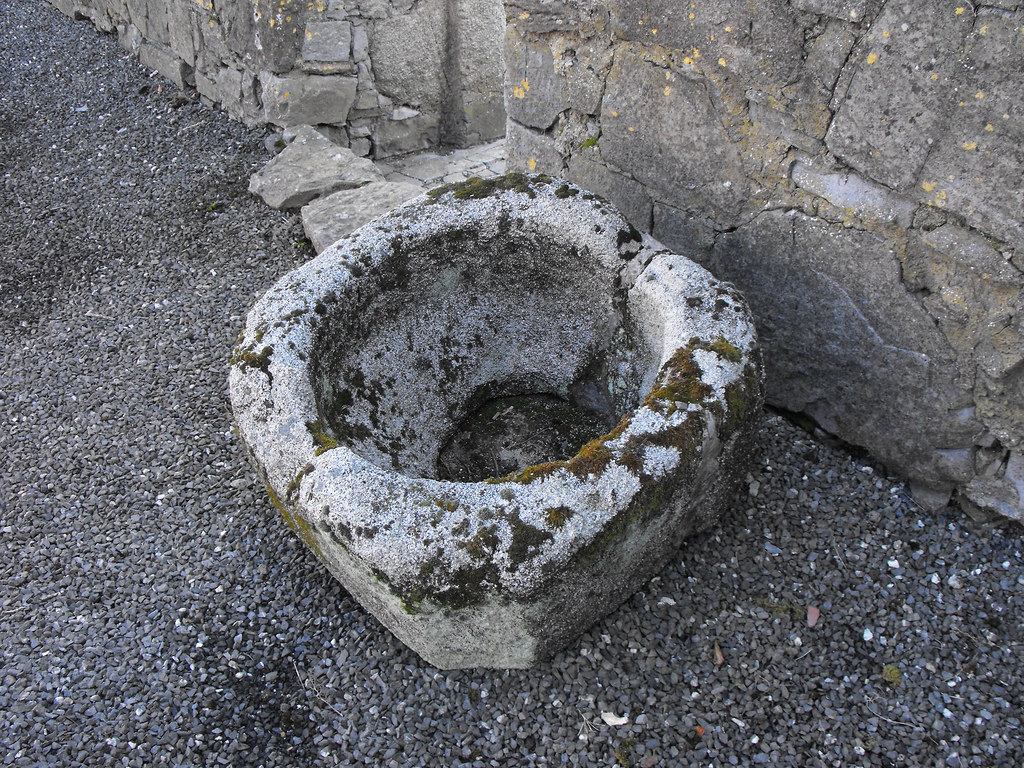
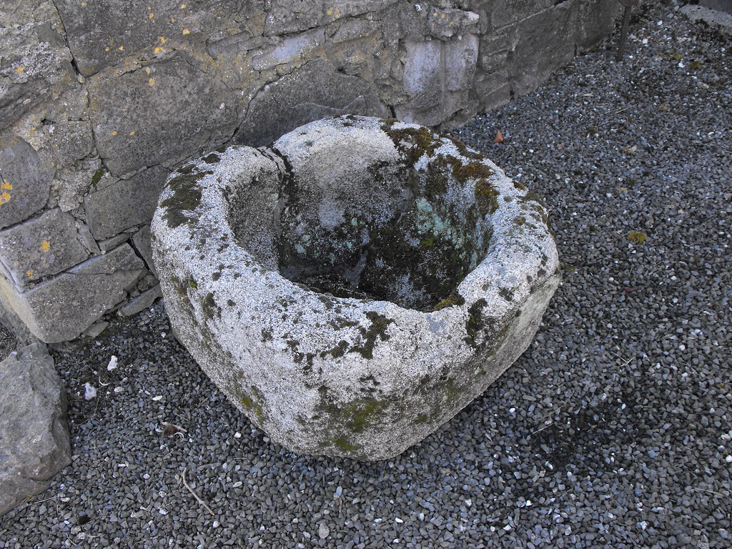
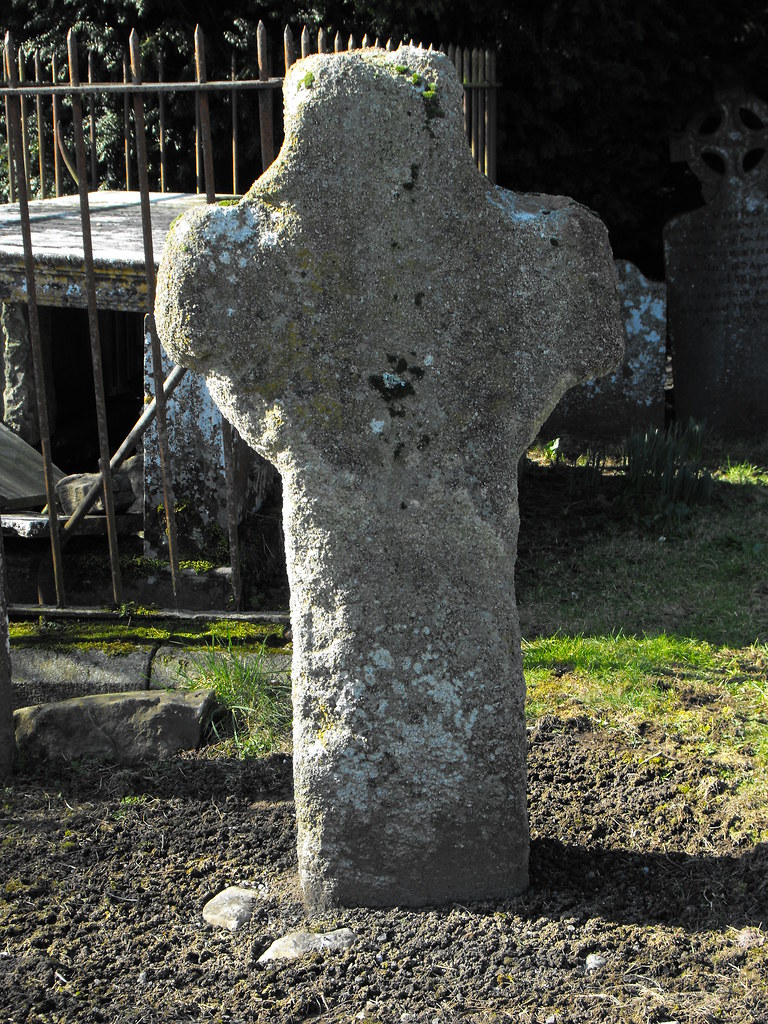
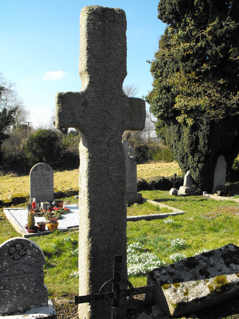
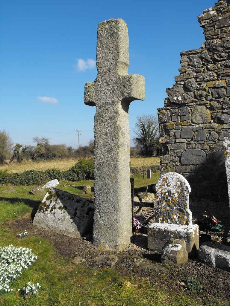
The medieval church is largely ruined and a stone font (date unknown) sits inside. The smaller of the two crosses from the earlier foundation is roughly 1.5m high and is decorated with a rough ringed cross. It is badly eroded and barely visible now. The second cross is 2.8m high and is undecorated. I had seen photographs of this cross before and you can’t really appreciate its size until you see it for yourself.
This is a nice little site and well worth the trip.

Difficulty – Easy enough to get around but it is set back from the road and easy to drive by without seeing. There is no parking here.

For more ecclesiastical sites, click here.
For more sites in Co. Laois, click here.

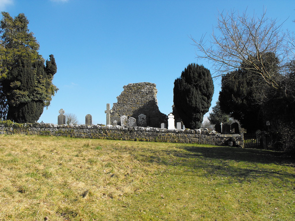
The churchyard from the roadway.


View The Standing Stone in a larger map

The Clonfinlough Stone, Rock Art, Co. Offaly.

Location – A few miles East of Clonmacnoise on Esker Hill.
OS: N 042 296 (map 47)
Longitude: 7° 56' 13.37" W
Latitude: 53° 19' 1.53" N
GPS: N04195 29647 (Accuracy – 5m)
See map at the bottom of the page.

Description and History – This rock art needs a bit of time to look at. When I got here I just couldn’t make sense of what I was seeing and it took some time to allow my brain to make sense of all the patterns and depressions in the stone. This is a large glacial boulder that has been decorated with various designs. There are cup marks indicating a Bronze Age date but yet there are some clear cross shapes which suggest a Christian hand in the making. Could this be a multi-period site? Maybe early Christians found this rock and decided to Christianize it. I’m just speculating but it is a possibility. Among the cup marks and the cross shapes is a shoe print. This is very unusual and I can’t quite make sense of it. Why a shoe print? How old is this design? It has been argued that many of the designs on the rock are natural but have been enhanced at some point by a human hand. Needless to say this is an unusual and interesting site and worth having a look at.

Difficulty – This rock is signposted from the road and there is a path up to it. There is room for one or two cars on the side of the road.

For more rock art, click here.
For more sites in Co. Offaly, click here.

Cup marks.

One of the many cross designs.

The shoe print.

Some has carved their initial onto the stone.


View The Standing Stone in a larger map

Shrule Castle, Co. Laois.

Location – On the banks of the river Barrow a few miles North of Carlow town.
OS: S 713 810 (map 61)
Longitude: 6° 56' 26.75" W
Latitude: 52° 52' 32.96"
GPS: S 71310 81067
See map at the bottom of the page.

Description and History – This castle looks lovely from the outside but I have added to my list of places I failed to see properly. It is located behind a farmhouse next to farmyard and there was nobody in when I called in so I couldn’t get access to what appears to be a rather intact castle. It was built by Robert Hartpole in the reign of Queen Elizabeth but little else is known of the castle. Internally the floors are intact (which I have yet to see for myself) and there is still a lot of plaster on the walls and many finely carved mantle pieces. This is a castle I need to return to, but for now I just have a couple of pictures of the outside.

Difficulty – Easy enough to find but it is next to a farmhouse so permission is necessary.

For more castles, click here.
For more sites in Co. Laois, click here.


View The Standing Stone in a larger map

Clonmacnoise Castle, Co. Offaly.

Location – On the banks of the Shannon and beside the main Clonmacnoise ecclesiastical site.
OS: N 007 306 (map 47)
Longitude: 7° 59' 22.18" W
Latitude: 53° 19' 32.42" N
See map at the bottom of the page.

Description and History – This castle is a true gem and one of the finest in Ireland for its sheer distinctiveness. The castle is very ruined and very dangerous but it is instantly recognisable perched on a large D shaped earthwork. The castle dates to the early 13th century and the earliest record in the historical record is from 1215 when Ralph de Derevaus and Walter Reboth were requested to deliver the castle over to Geoffrey de Mariscis. Originally the castle was three storeys high with a courtyard area within the earthwork enclosure. A draw bridge would have originally been used to connect it to the land. Garderobes and other features survive but none later than 1300 when the castle was abandoned during the Gaelic resurgence in the area. The purpose of the castle was to protect the Shannon and bridge that was at this point.

Unfortunately the castle is now precariously perched and quite dangerous. I can definitely imagine a time in the near future when large pieces of this castle will fall away into the river and into the ditch. There is a fence around it for good reason so resist the urge to go climbing on the castle. I nearly gave in but was talked out of it. This is a great castle to visit and very individual.

Difficulty – Easy to spot and find but not really accessible to walk around.

For more castles, click here.
For more sites in Co. Offaly, click here.
 As you can see parts of the castle are leaning precariously.

Bits of wall have slowly been falling into the ditch below.


View The Standing Stone in a larger map

Carrowkeel, Megalithic Cemetery, Co. Sligo.

Location – Just outside the small village of Castlebaldwin.
Accurate GPS readings will be given for each tomb on their own pages.

See map at the bottom of the page.

Description and History – Carrowkeel is one of the four main megalithic cemetery sites in Ireland. The other three are Carrowmore (also in Sligo), the Boyne Valley and Loughcrew (both in Meath). I have been to three of these sites and Carrowkeel is by far my favourite. Many of the tombs are complete and because of their remote and hard to get to location they are largely undisturbed. In fact in some of the tombs fragments of human bone can still be seen. This really is a special site and one that I will go back to again and again as I only saw a small number of the tombs on my visit.

Tombs here predate the pyramids and are roughly 5500 years old. The style of the tombs is very basic with no decoration and simple passage and chamber tombs. The more polished style of the Boyne Valley cannot be found here which suggests to me that these tombs are early in the development of Irish passage tomb building. In a similar fashion to Newgrange some of these tombs contain lightboxes which are aligned to important dates in the calendar. Many tombs are aligned with the summer solstice sunset.

When you go here do not climb onto the cairns or move the stones. The reason they have remained for to see it precisely because people have left them alone. The more people climb on them the quicker they will be destroyed. Also don’t leave rubbish on the mountain or in the tombs. I came out of one tomb with pocked of rubbish that people had left inside. It seems to be popular to light candles in the tombs and some of the stones have a lot of wax on them. This is not good for the stones and can’t be removed easily. Leave the tombs as you found them taking only the rubbish that thoughtless people have left behind.

Difficulty – This one is a little tricky. There is a path which winds its way along the side of the mountain to the top. You can bring a four wheel drive up there but if you do not have one then I would recommend parking at the bottom and walking up. The mountain is covered in blanket bog meaning that you will need wellingtons and you can easily find yourself knee deep in mud so watch your step. There are lots of stones hidden in the undergrowth so you will need to be careful and vigilant.

Click below for individual sites:

Cist tomb
Cairn G
Cairn H
Cairn K


View The Standing Stone in a larger map