Location – About 200m NE of Circle C and is visible from there also.
OS: R 634 407 (map 65)
Longitude: 8° 32' 20.19" W
Latitude: 52° 31' 0.3" N
GPS: R 63418 40724 (Accuracy – 7m)
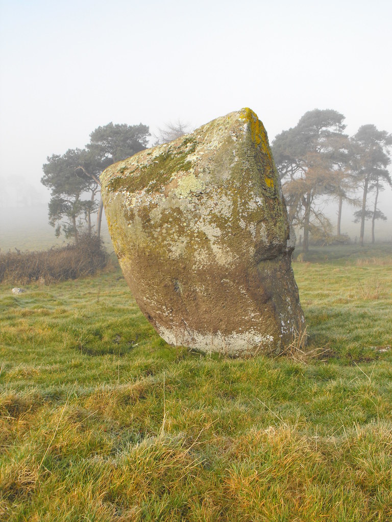
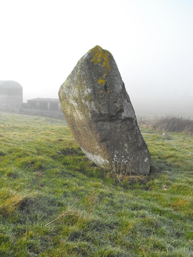
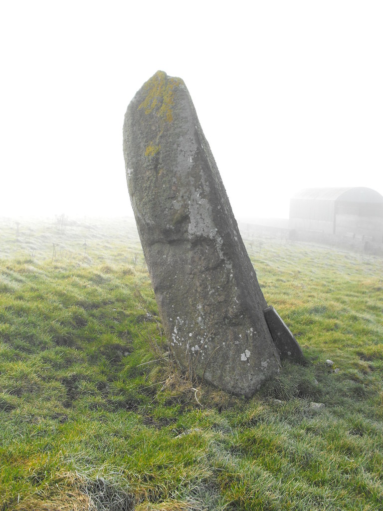
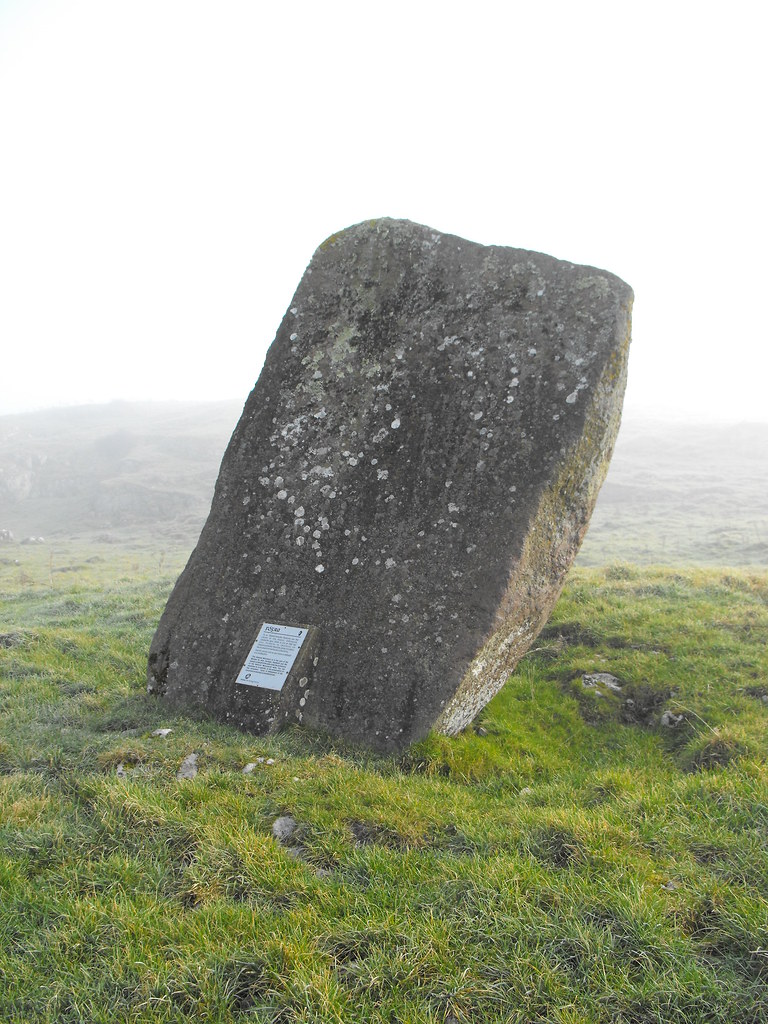
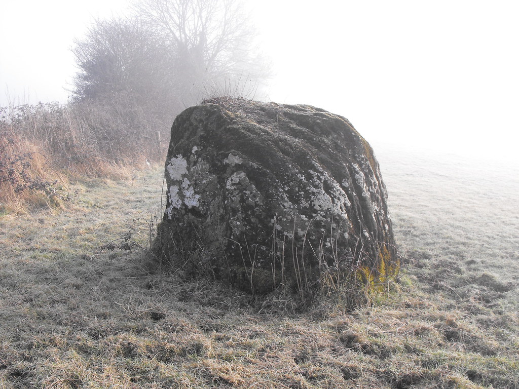
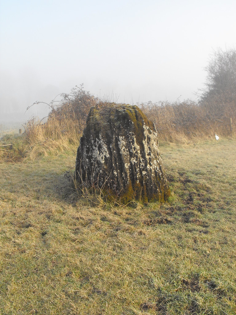
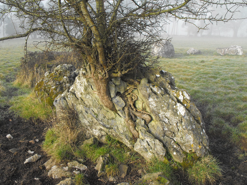
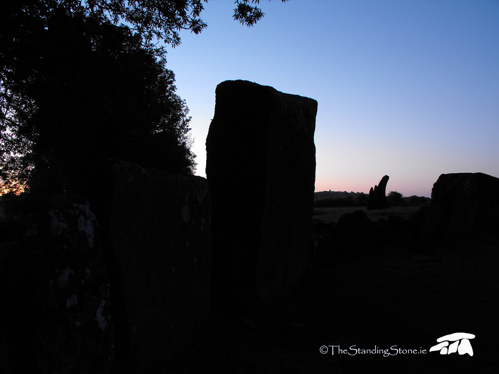
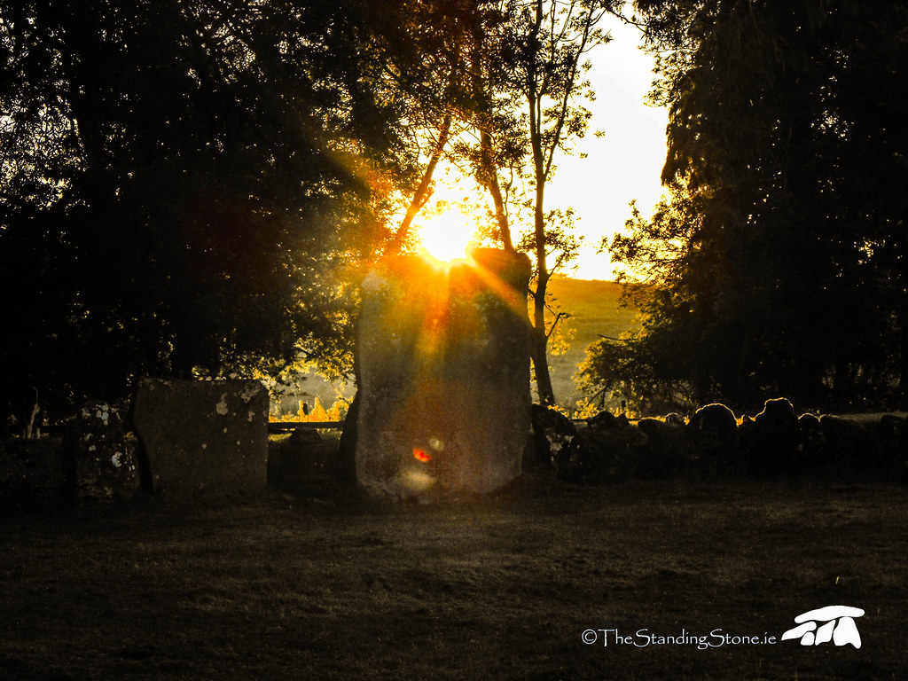
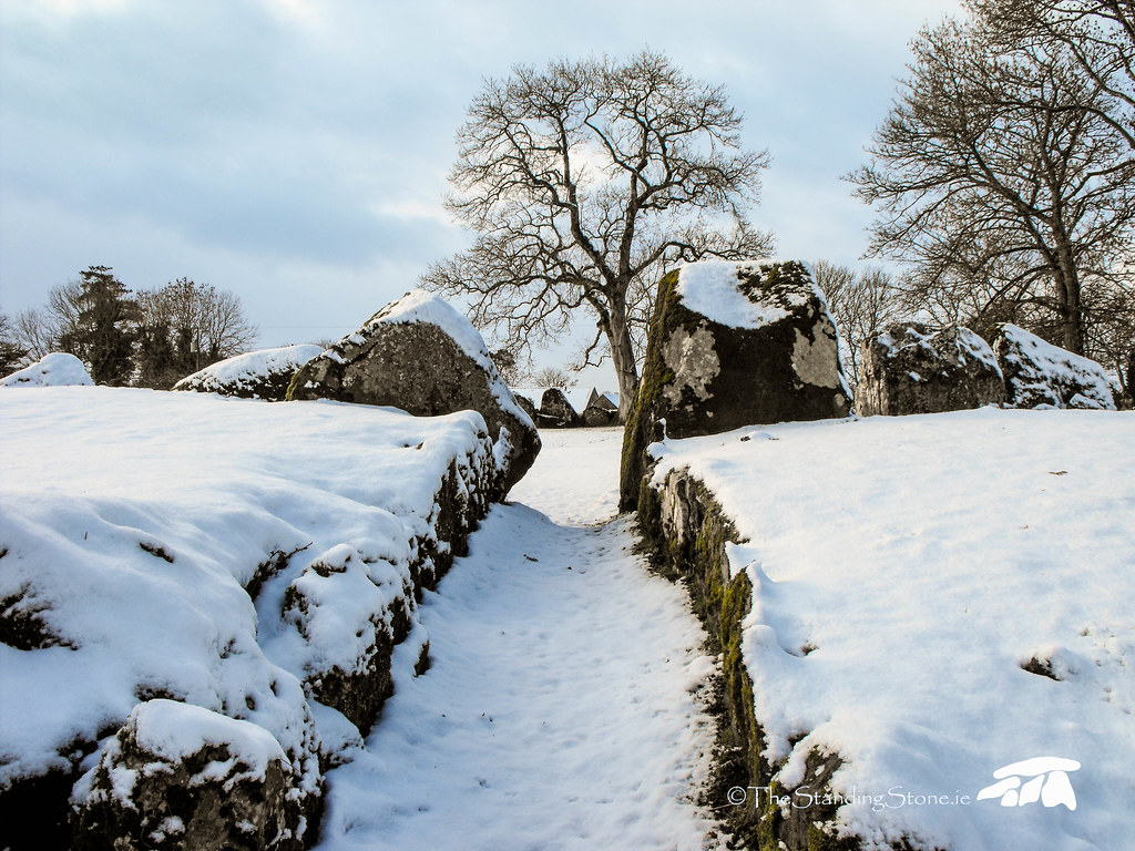
Description and History – This standing stone is huge and it really did loom out of the fog as I approached it. It is roughly 3.5 meters high and is aligned N-S. It stands between the hill Ardaghlooda and the ancient trackway Cladh na Leac and is surrounded by a system of ancient fields and hut sites. It appears as if this stone was of some importance at some point. It leans now but is still very impressive.
Difficulty – Getting to this stone can be a little tricky. It is in the field behind Circle C and that field can get boggy. Also, the amount of stones in the field with the stone means you need to watch your step.
For more standing stones, click here.
For more sites around Lough Gur, click here.
For more sites in Co. Limerick, click here.
This stone really looks different from every angle.
View The Standing Stone in a larger map
Location – Located about 75m S of the main circle at Grange and is clearly visible from there. It is in the next field and there is a gap in the hedge there.
OS: R 633 403 (map 65)
Longitude: 8° 32' 25.23" W
Latitude: 52° 30' 47.44" N
GPS: R 63320 40327 (Accuracy 5m)
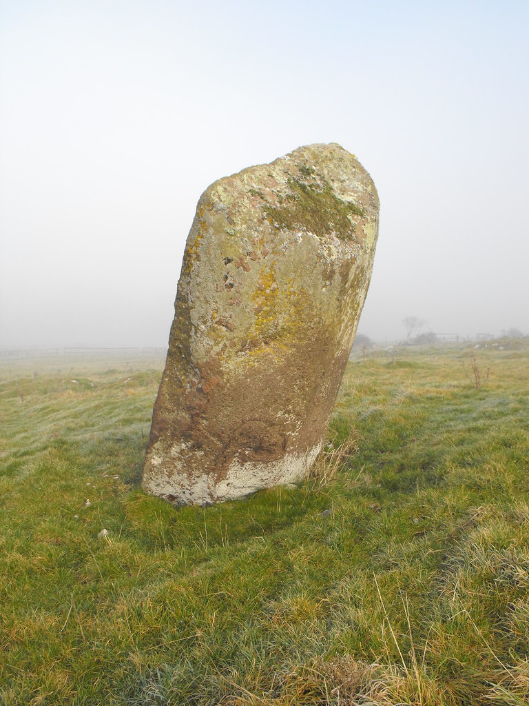
Description and History – This standing stone is about 1.5m tall and is orientated NE-SW and maybe in line with the summer solstice along with the circle, judging by its alignment. The stone has mythical associations and is said to represent the mythical tree that grows at the bottom of the nearby Lough. I can’t seem to find much more out about this stone but it is clearly related to the stone circle nearby in my opinion and I would like to see if it is aligned as well. A stone like this, so close to the main circle, is very interesting.
Difficulty – Easy to spot from the main circle and easy to get to across the field. Keep an eye out for cattle of course.
For more standing stones, click here.
For more sites around Lough Gur, click here.
For more sites in Co. Limerick, click here.
Location – Located in the field to the N of the main circle at Grange. Go through the black gate at the back of the field and there is a gap in the fence into the next field. It is visible from the main circle.
OS: R633 406 (map 65)
Longitude: 8° 32' 27.43" W
Latitude: 52° 30' 54.25" N
GPS: R63280 40538 (Accuracy 5m)
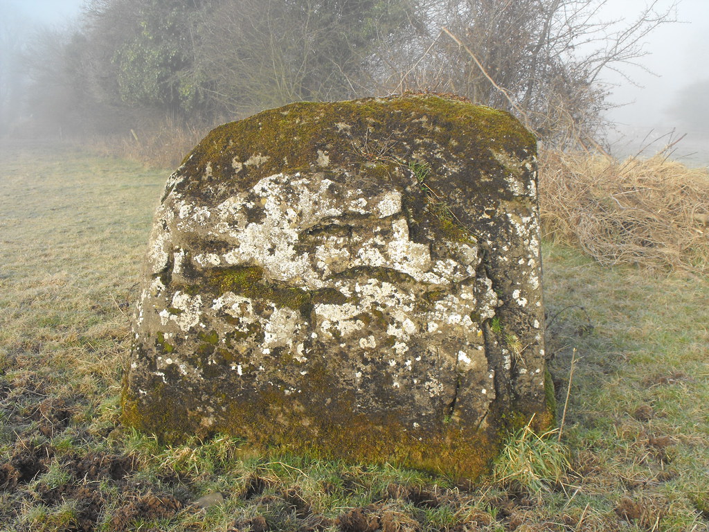
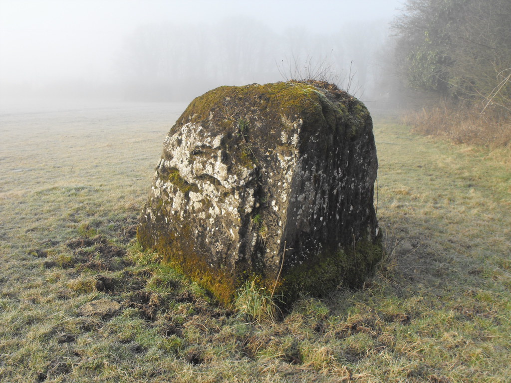
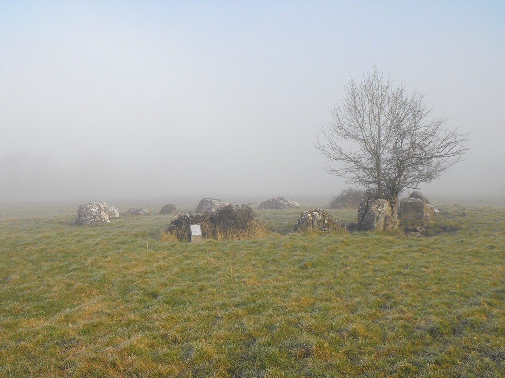
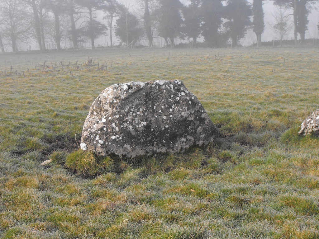
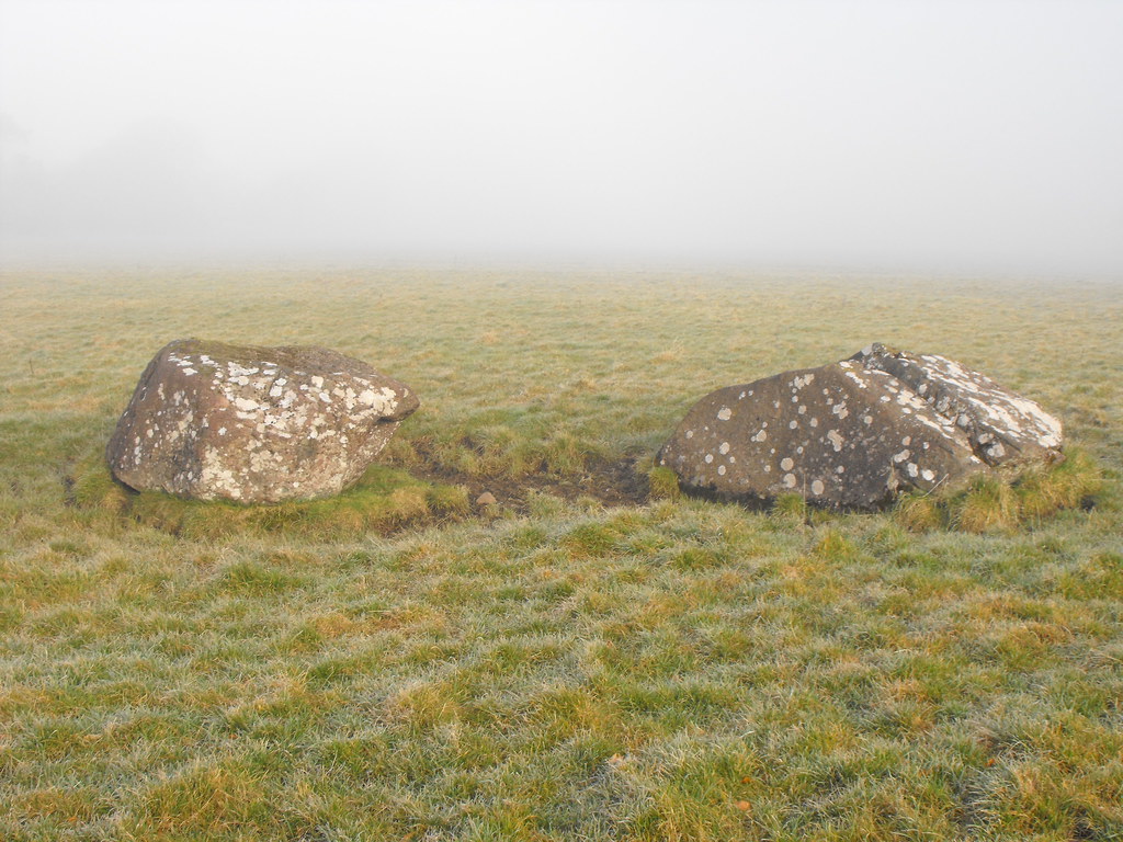
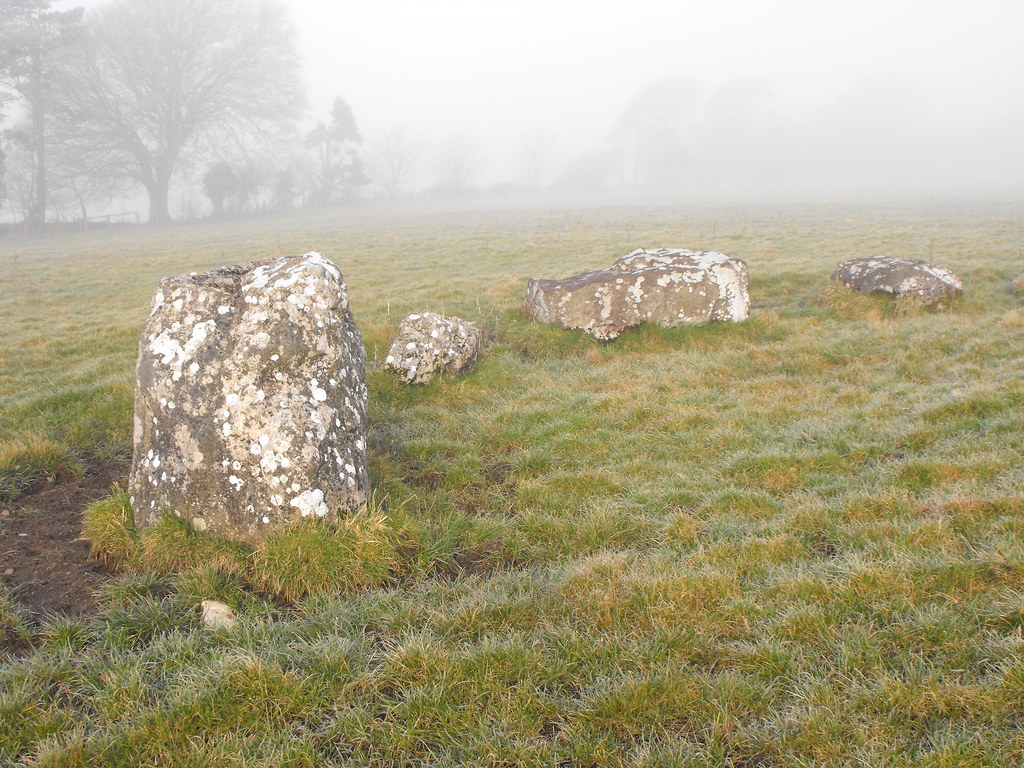
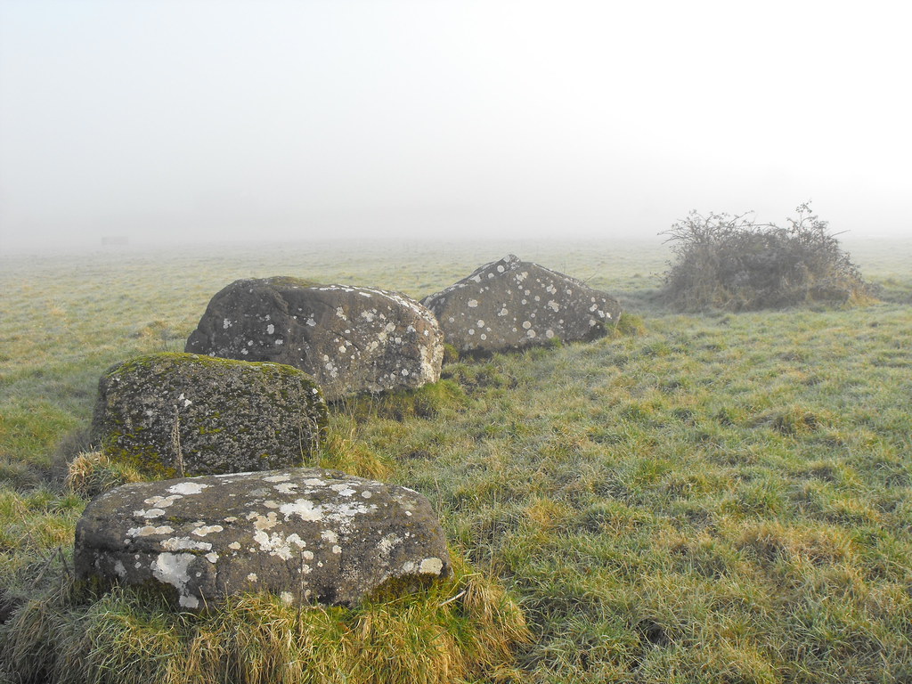
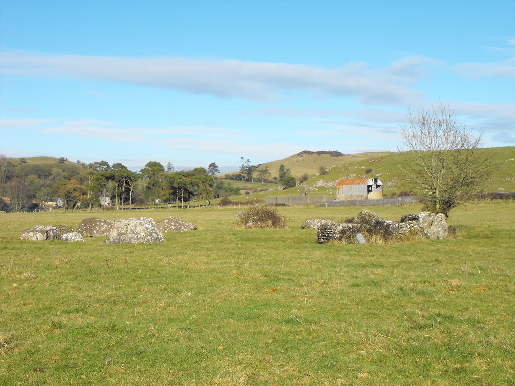
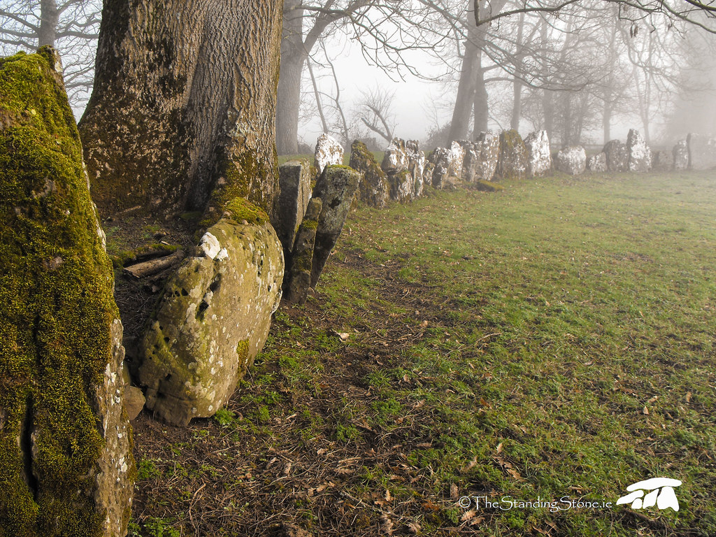
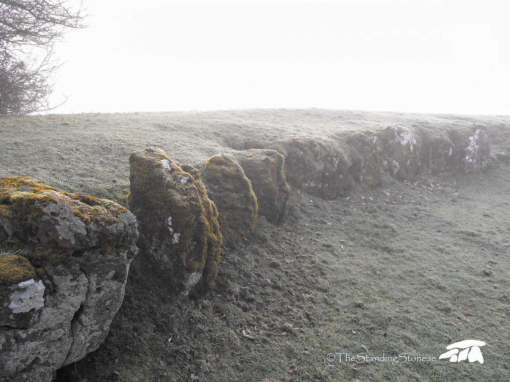
Description and History – This stone circle, unlike its big brother, has not been excavated so it is difficult to date but it is likely to be from the Bronze Age like the other circle. It seemed to me however that it is much older than the large circle. It is a much rougher and organic circle and certainly less worked out. The circle is roughly 17m in diameter and contains 15 stones with a slightly raised area in the middle. One stone has a thorn bush growing around it while another has a tree growing through it. A large gap on the Southern side of the circle indicates that some stone have been removed. None of the stones are much more than 1m high and they are all wider than they are high. The circle, even with the larger partner so close, is still very impressive.
Difficulty – Easy to get to. The only hard part is finding the gap in the fence...it is not that obvious where it is.
For more stone circles, click here.
For more sites around Lough Gur, click here.
For more sites in Co. Limerick, click here.
Seeing the circle emerge out the fog as I walked across the field toward it only added to its mystery.
The stones are low but quite big.
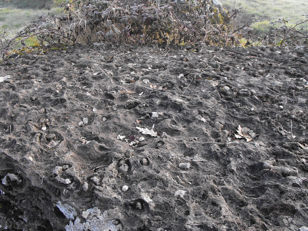
This stone has weathered in an interesting way.
The tree, as you can see, has grown through this stone.
The circle in more clear weather.
View The Standing Stone in a larger map
Location – Located on the R512 between Limerick and Bruff and is only s few hundred meters from Lough Gur. The lake use to be much closer but the level of the lake was lowered in the 19th century.
OS: R 632 404 (map 65)
Longitude: 8° 32' 28.76" W
Latitude: 52° 30' 50.04" N
GPS: R 63254 40408 (Accuracy: 4m)
See map at the bottom of the page.
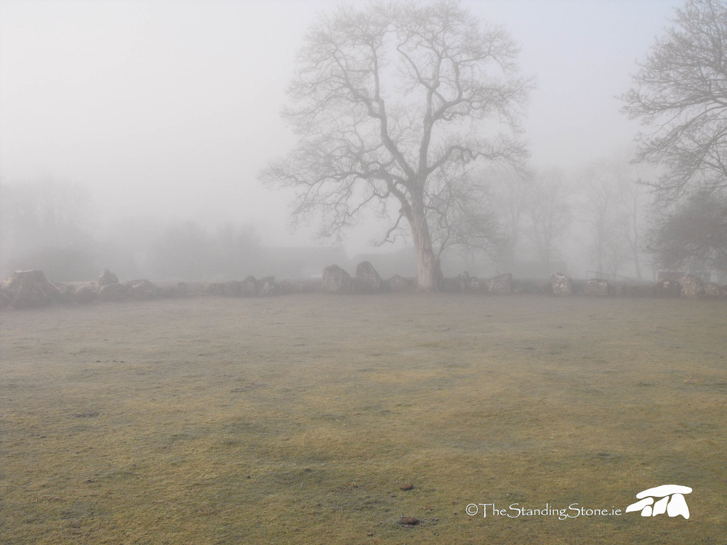
Description and History – This is Ireland’s largest stone circle and I first visited here in 2010 when the site was enveloped in a thick fog. At first I was dismayed because I didn’t think I would be able to get from one site to the next or be able to get good pictures. The fog actually gave the circle a mysterious quality which made the pictures all the better. Luckily I had some GPS co-ordinates to guide me to other places nearby and it was quite the experience to be walking across a field and to see a standing stone slowly emerging out of the fog.
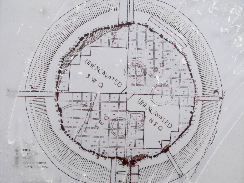
The circle at Grange is quite something. It is banked in that the stones are pressed right up against an outer henge. The diameter of the circle is 47.5m and is perfectly circular. During excavations a post hole in the centre of circle was found from which the circle could have been measured out with a rope. I don’t think I have ever seen a stone circle with such a variation in stone size. Some are barely over 50cm tall while the largest (known as Rannach Croim Duibh - this means the 'division of Crom Dubh' an important figure from Irish mythology) stands at nearly 3m in height. The bank into which the stones are set is ditchless and roughly 1.2m high and 9m wide. Unusually there is a formal entrance to the circle on the E side of the circle. A stone lined entrance has been set out and is still impressive to walk up and into the circle...especially in the fog. A lot of archaeological material was found during excavation and carbon dating indicates a construction date around 3000-2600BC during the Late-Neolithic Period. Beaker ware was found at the site and was found to be very similar to Beaker ware found in Somerset in England and to me that would indicate a close connection between these people.
Another stone circle and two standing stones can be seen from this site, when it is not foggy, and there is a possible megalithic tomb on the other side of the road that would be visible from the circle is it wasn’t for the modern road. This is truly a fantastic site at an amazing place. Even if you only have a passing interest in these places you will certainly be impressed by this place.
Summer solstice 2010 (20th and 21st June) - I decided to head down to Lough Gur for the Summer Solstice. I had always read that the circle was aligned to the entrance on June 21st. Sadly this is not the case. The sun rises near the entrance but not through it. I have since learned that it is aligned with Lughnasa on August 1st so I will be heading back to the circle then. However, spending the solstice at the circle was a worthwhile experience and it really took my breath away. I went twice. First on the 20th and then again on the 21st (the day of the solstice). I went the day before because I knew there would be less people and that the sun would rise in basically the same place - there would be a barely noticeable difference. It turned out that conditions were better on the 20th than the 21st, although conditions on the 21st were still fantastic. All the pictures below were taken on the 20th. I woke at 3am on the 20th and had a look outside and saw stars which was a good sign...I also saw light on the horizon so thought I had miscalculated the time of the sunrise. I rushed to the circle and was the only person there. 45 minutes later and still no sun. I hadn't misjudged afterall. People started to trickle along and by 5am there were about ten of us. At about 5.20am the sun finally peaked over the hill in a sudden burst of light. It was quite spectacular even though it didn't rise where I had expected. The sun did appear to rise between two of the stones but not at the entrance. The sun did hover above the massive Rannach Croim Duibh which cast a shadow over the interior of the circle. I will definitely heading back for Lughnasa and maybe Samhain in October. About 100 people showed up on the 21st to see the sun rise which was great to see. However, the constant slamming of car doors as people arrived, the flash of cameras and the beep beep beep of mobile phones meant the atmosphere wasn't as nice as the day before which had been quite tranquil. Overall it was a fantastic experience and following the previous years bad weather those of us who went to see it were very lucky to have such clear days. The pictures of the solstice are at the bottom of the page.
Difficulty – Easy to find and traverse with parking at the site. Tim, the owner of the site, has provided a handrail to the circle as it can get a little muddy and he had erected a fence to keep cattle out. He also sells postcards and a very good little booklet about the sites around Lough Gur as well. He does ask for a donation to the upkeep of the site and there is a little collection box for this...I encourage you to donate.