The Spectacles, Hut Site, Co. Limerick.

Location – Near the Lough Gur visitors centre. OS: R 646 415 (map 65) Longitude: 8° 31' 15.14" W Latitude: 52° 31' 24.96" N GPS: R 64650 41477 (Accuracy: 7m) See map at the bottom of the page. 
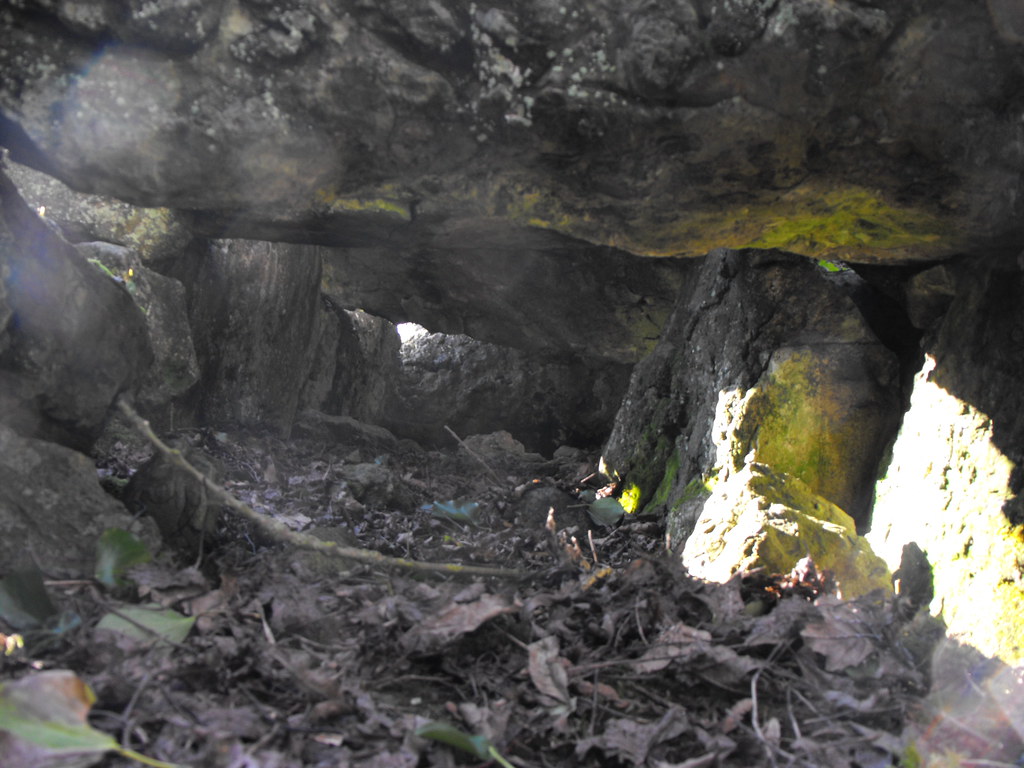
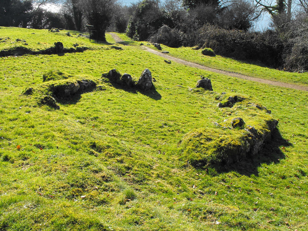
Description and History – The spectacles may seem an odd name for this hut site but from above it looks like a pair of glasses. It was thought that there were two hut sites here but upon excavation one turned out to be a natural rock formation. The hut site dates to the early Christian period and is about 4.5m in diameter and consists of a simple stone kerb. Posts would have been around this forming the hut with a thatch or turf roof. Around the hut is a system of fields from this period also. It is kind of hard to make out when you are there but there is an information board which gives you a site plan. Difficulty – Really easy to get to. For more sites around Lough Gur, click here. For more sites in Co. Limerick, click here.
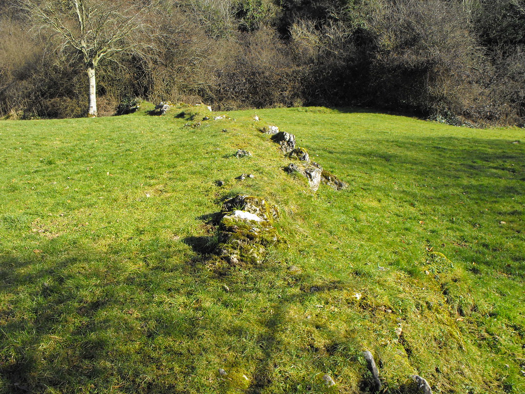
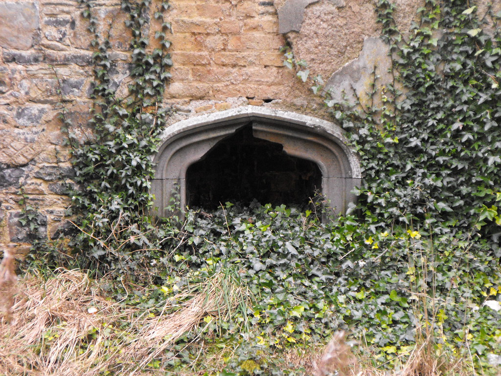
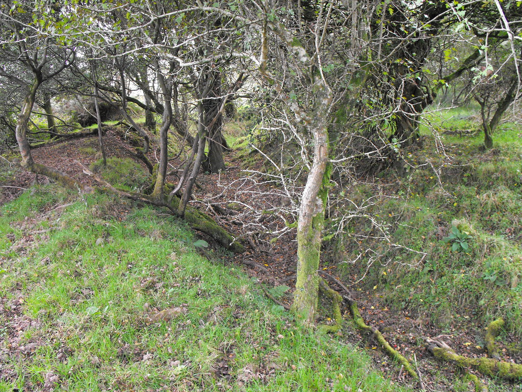
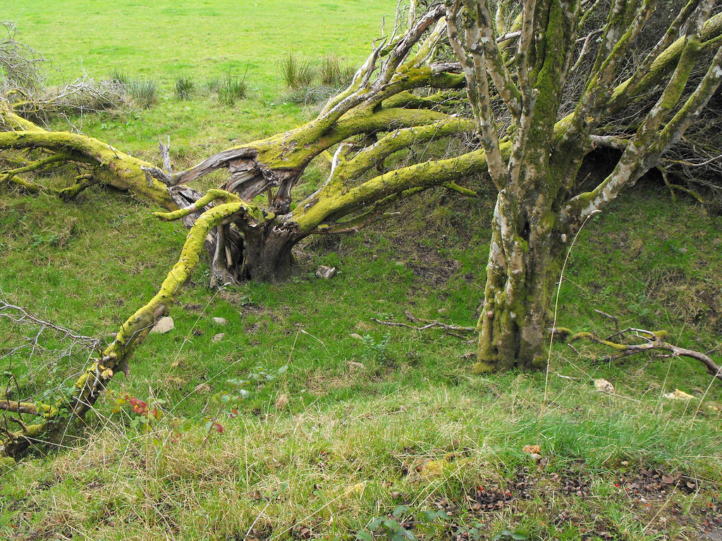
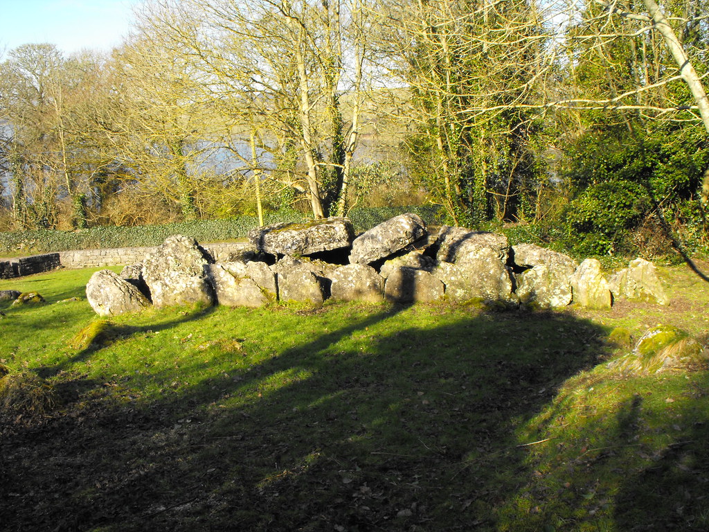
Part of the ancient field boundaries.
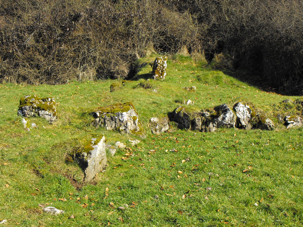
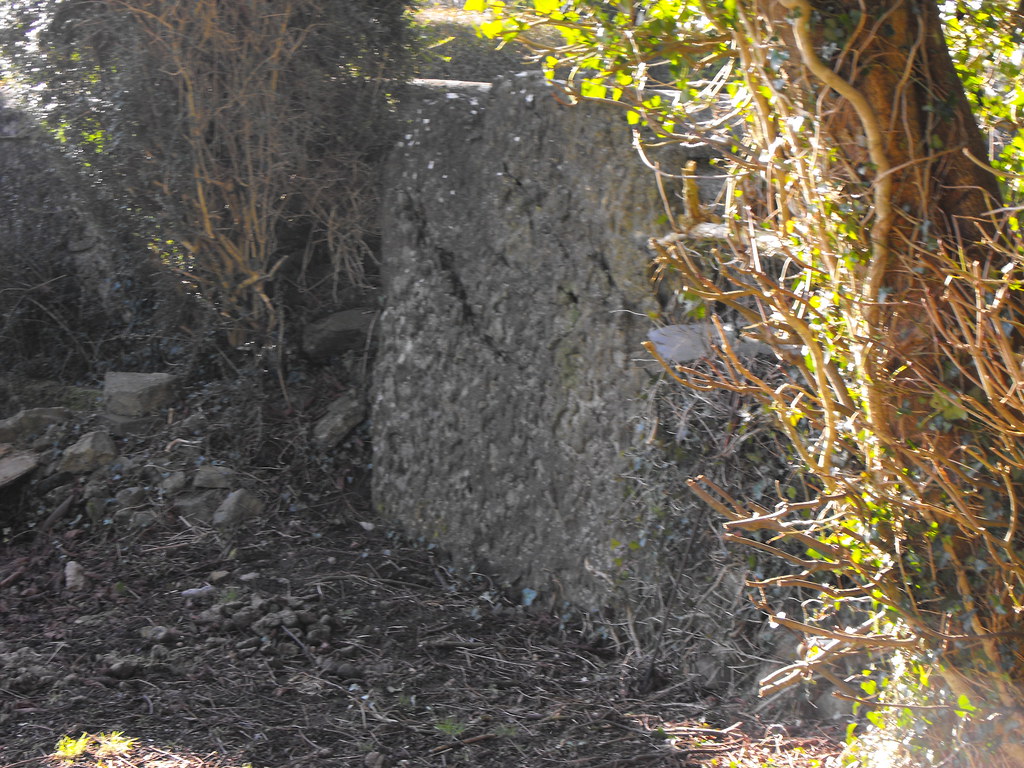
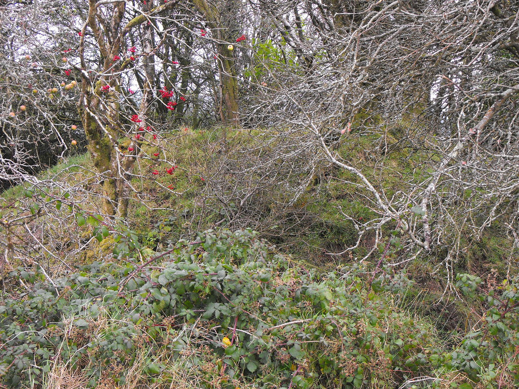
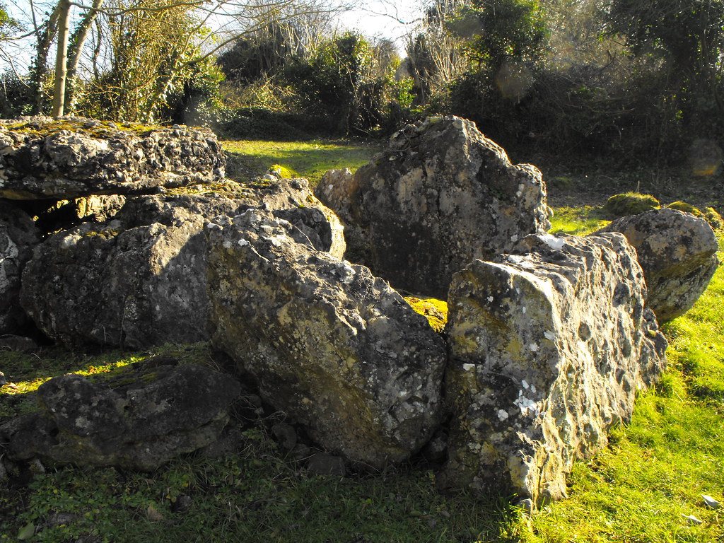
More field boundaries.
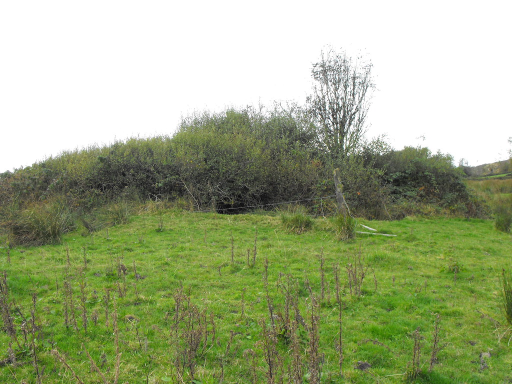
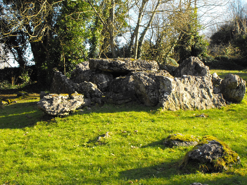
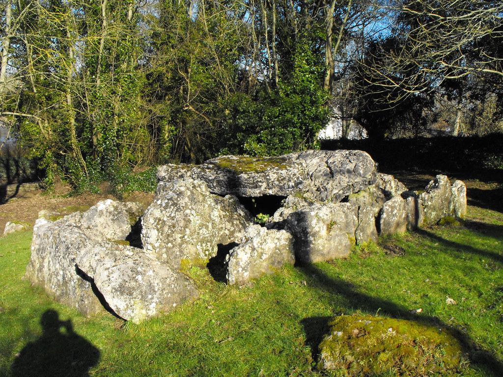
The hut site. The two larger stones near the front form an entrance.
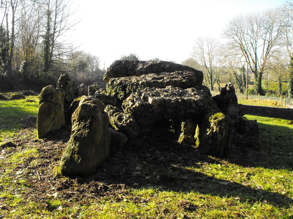
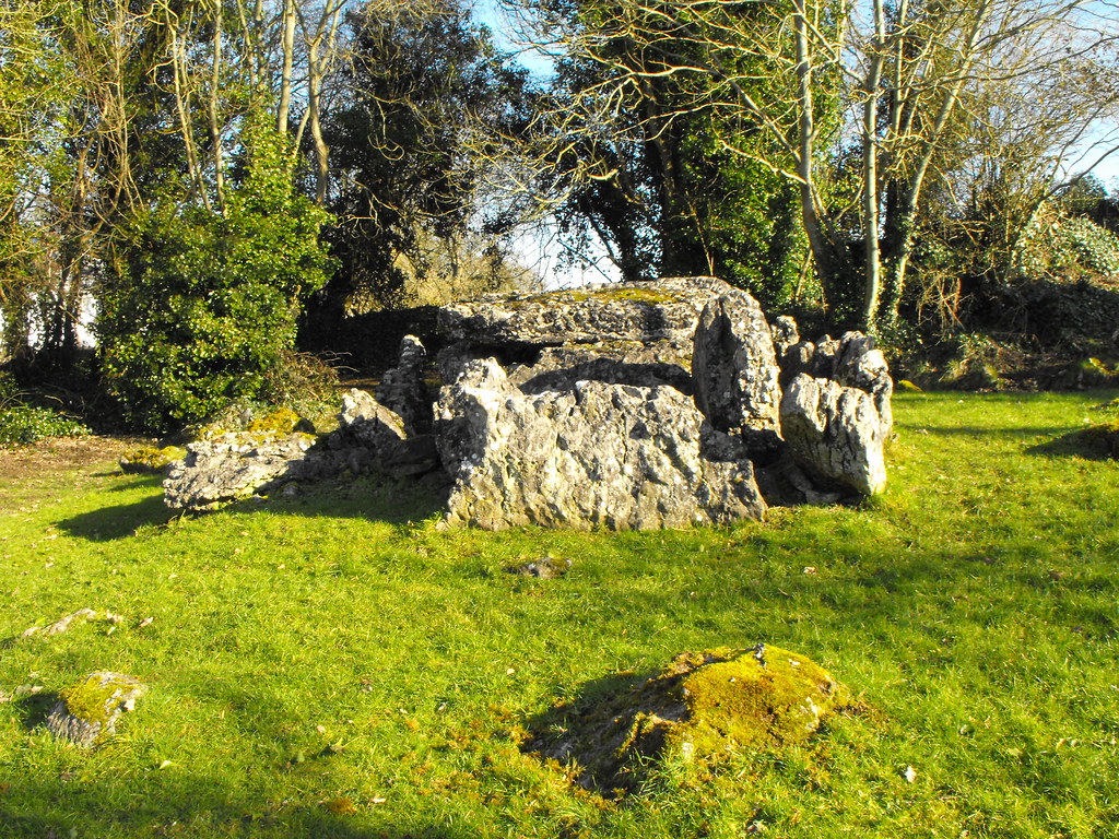
Looking down on the circular hit site.
View The Standing Stone in a larger map

Lackagh More, Church, Co. Kildare.

Location – Not far from the old N7 which is now the R445.
OS: N 677 127 (map 55)
Longitude: 6° 59' 12.64" W
Latitude: 53° 9' 41.03" N
GPS: N 67759 12799 (Accuracy: 6m)
See map at the bottom of the page.  

Description and History – This church and graveyard holds some personal significance for me as it is where my family’s grave plot is and this is where I’m likely to end up...not for many many years yet I hope. Lackagh has ancient roots and local tradition holds that the present graveyard is on the site of ancient and pagan burial ground. Lackagh was also the last area of land to have been held by the Uí Fhailí after their lands were taken by the Ui Neill. The remaining church, however, is relatively modern and probably dates to the late medieval period or early modern period. I’m not sure of the date and there is little written about this church but I will do some research. The church is very simple and small with some of the plaster still in situ. A small fireplace sits under the bell tower which still has the wooden frame and pulleys in place. Wooden lintels and window frames are also in place. It appears as if this church has only been abandoned in the past century. The bell tower is very ornate and your eye is drawn up to it as it dominates the church. It is a picturesque church in a picturesque graveyard.
 
Difficulty – Easy to park at and get around.

For more ecclesiastical sites, click here.
For more sites in Co. Kildare, click here.
View as you enter the graveyard.
As viewed from the rear of the graveyard.
I think this is a wonderful bell tower.
The main entrance to the church.
Triple window at the rear of the church.
Memorial to those who were sent away to be slaves by Oliver Cromwell.
The inner workings of the bell tower.
Open to the elements the plaster is slowly crumbling off the walls.
Internal view of the triple window.
The small fireplace.
View The Standing Stone in a larger map

Lough Gur, Standing Stone, Co. Limerick.

Location – Located at Lough Gur crossroads on the way around to the visitors centre. OS: R 655 405 (map 65) Longitude: 8° 30' 29.34" W Latitude: 52° 30' 51.09" N GPS: R65506 40424 (Accuracy: 7m) See map at the bottom of the page. Description and History – This standing stone is somewhat unusual and there really is little to say about it. It is now wedged between a garden wall and a fence. If you didn’t know it was there you could easily pass it by. It is about 1.4m high and 1.6m wide and is very thin. If it wasn’t overshadowed by everything around it then it would be much more impressive. There were two cats sat on it when I arrived and there were about 3 more sleeping in its shadow. I has been suggested that this may have been part of a larger structure at some point. Difficulty – Easy to get to and to be honest you don’t even need to get out of your car. For more standing stones, click here. For more sites around Lough Gur, click here. For more sites in Limerick, click here.
Viewed from the rear.
View The Standing Stone in a larger map

Roscomroe, Church, Holy Well and Rag Tree, Co. Offaly.

Location – W of Hardyman mountain in the Slieve Bloom Mountains.
OS: S 166 976 (map 54)
Longitude: 7° 45' 9.2" W
Latitude: 53° 1' 43.91" N
See map at the bottom of the page.

Description and History
– This site is somewhat frustrating in that I couldn’t really find anything out about its history. The present remains of the church are medieval but it is believed that this was built on a much earlier Christian foundation which is attributed to St Molua and to whom the nearby holy well is attributed.  St Molua is also associated with and allegedly buried at Kyle in Co. Laois.  The remains of the medieval church consist of the W gable end and portions of the N and S wall.  The surviving gable stands to full height with portions of the bellcote remaining. It really is a very attractive ruin within a nicely kept graveyard. 

The holy well sits in the field to the rear of the graveyard.  It can be accessed via a gate next to the entrance to the graveyard.  The field can be a little boggy but it’s well worth making your way there because it is a nice little well.  The enclosure is modern but very nicely done with the face of the saint represented on the face of the well which is very similar to Cumber Upper which is also in Offaly.  The rag tree sits next to the well and only has a few rags attached to it.  I get the impression that this well is not widely used but somebody is going to the effort of keeping it well maintained which is really great to see.  When you see holy wells like Anatrim in Laois, which is barely identifiable, this is a nice sight.

Difficulty – The church is right on the side of the road with plenty of space for parking.  The well is a little harder to get to depending on the weather as it can get boggy.

For more ecclesiastical sites, click here.
For more sites in Co. Offaly, click here.

I think this gable end has a fantastic shape to it.

The holy well in the adjoining field.

I think the face of the saint looks more realistic from this angle.

A few rags hanging from the tree.


View The Standing Stone in a larger map

Carrowreagh, Rath, Co. Laois.

Location – In the foothills of the Slieve Bloom Mountains, S of Arderin mountain and N of two nearby barrows.
OS: S 236 960 (map 54)
Longitude: 7° 38' 53.99" W
Latitude: 53° 0' 51.2" N
See map at the bottom of the page.

Description and History – This ringfort is quite nice and located on the rising slopes leading up the Slieve Bloom Mountains.  If the trees nearby were cleared it would be visible from some distance.  It is roughly 30m in diameter with bank (2.2m wide  and 1.5m high) and fosse (1.8m wide and 1m high).  Some stone has been used in the building of this rath.  This maybe because of the marshy nature of the surrounding land. There is a causewayed entrance in the NNE of the site but it was too marshy and overgrown to reach. I was told by a local man that a king used to live in the rath and is buried in one of the nearby barrows.

Difficulty – It’s signposted but it is a bit of an uphill walk.

For more raths, click here.
For more sites in Co. Laois, click here.

Quite overgrown as you can see.  You can just make out the circular shape of it here. It is possible to get inside however.

On the inside looking out.  Note the rise of the bank.

Close up of the ditch and fosse.


View The Standing Stone in a larger map

Carrowreagh, Barrows, Co. Laois.

Location – On the S side of Arderin mountain in the Slieve Bloom Mountains. The barrows are accessed off a track leading from the road.
Barrow 1 is located at:
OS: S 237 959 (map 54)
Longitude: 7° 38' 48.65" W
Latitude: 53° 0' 47.95" N

Barrow 2 is located at:
OS: S 236 959 (map 54)
Longitude: 7° 38' 54.02" W
Latitude: 53° 0' 47.97" N
See map at the bottom of the page.

Description and History – I had been meaning to come here for so long as I had seen everything else in the area and had never made it up to here. I failed to see them on my first trip because as I was walking up the pathway I looked up to see a bull about 20m further up the path so I decided not to go on. The second time, he was nowhere to be seen and I saw the two barrows and nearby ringfort. The first barrow is a simple ring barrow that is so overgrown that I wasn’t very certain that I was in the right place. I found traces of the ditch so I am pretty sure now that it was the barrow. According to the Archaeological Inventory for County Laois the barrow is c10m wide and the fosse is partially filled in. It stands to a maximum height of 1.35m.

The second barrow is a bowl barrow and is very impressive. It stands 3m high and is nearly 6m wide. The fosse is 3.5m wide and 1.6 in depth. Trees have grown in the fosse but can be easily traversed. It created a nice atmosphere this barrow and have helped to keep cattle out. It has survived well and its size suggests to me that there may be something inside this mound worth seeing. However, the barrow is nice as it is so it should probably be left alone. I was told by a local man that a king is buried in one of these barrows and that he lived in the nearby ringfort.

Difficulty – It’s a bit of a walk up to these barrows and it is definitely worth it for the second barrow. Watch out for cattle. The nearby ringfort is signposted so you do have the right to go up there but keep an eye out.

For more barrows, click here.
For more sites in Co. Laois, click here.

Yes there is a barrow under here, believe it or not.

Although very overgrown this bowl-barrow is still impressive.

You can just make out the top of the barrow through the trees.

Looking down into the ditch from the top of the barrow.


View The Standing Stone in a larger map

Castlecuffe, Fortified House, Co. Laois.

Location – On the R422 between Cadamstown and Clonaslee.
OS: N 282 113
Longitude: 7° 34' 42.4" W
Latitude: 53° 9' 5.37" N

Description and History – This impression that you get when you first see this severely ruined fortified house is that its original size must have been immense. Standing nearly 15m high this house would have been 30m long and 20m wide. The Jacobean chimneys take up a lot of this height and give the impression of an imposing building. Unfortunately it is in a very bad state and only portions of the gable ends survive along with the huge chimney stacks. Portions of the back wall also survive. The W wall is the best preserved but is covered with ivy during the summer months so the winter is the best time to see this site. The field the ruin is located in is also known as Pairc na Sagairt which means ‘the priest’s field.’ The land originally belonged to the O’Dunnes but became the land of the Coote’s in 1560 and Sir Charles Coote built the present building. His wife was Dorothy Cuffe from Cork, after whom the castle is named. Little else is known.

ifficulty – It is right on the side of the road so it is very easy to find but it is on a farm and the field it is in is used for cattle. There are strict signs not to trespass so permission is essential.

For more fortified houses, click here.
For more sites in Co. Laois, click here.


Part of the surviving bawn.
View The Standing Stone in a larger map

Lough Gur, Wedge Tomb, Co. Limerick.

Location – Not far from the New Church this tomb is clearly visible from the road as you approach the main Lough Gur visitors centre. OS: R 647 402 (map 65) Longitude: 8° 31' 12" W Latitude: 52° 30' 43.66" N OS: R 64530 40219 (Accuracy: 9m) Description and History – Until I saw this tomb the only wedge tomb I had seen was Cloneen in Tipperary which only has two stones in situ so apart from what I had read in books and the odd picture and diagram I didn’t really know what to expect so I was learning on the go here. I took some time at this site so that I could really get to grips with it and figure it out. By all accounts this has all the standard features of a wedge tomb so was a great place to learn about them.
Known as the ‘Giants’ Grave’ this tomb was excavated by S.P. O Riordain in 1938. The entire tomb is 8.8m length and 3.6m wide and is orientated NE-SW. The gallery is divided by a septal slab into two sections and sides are formed by double walling with rubble in-between the two rows of stone. The portico is much smaller than the main chamber and is 1.5m long. There are many other stones lying around in the vicinity that may have been part of the tomb.
Legend says that a woman use to live in the tomb and that when she died in 1833 the covering cairn was thrown off by money diggers. During excavations the remains of 8 adults and 4 children were found as well as many pottery fragments. Some fragments belonged to the beaker ware type. Difficulty – On the side of the road so this is easy to get to. For more wedge tombs, click here. For more sites around Lough Gur, click here. For more sites in Co. Limerick, click here.
View as you approach from the road.
Looking SW into the chamber.
From this angle you get a really good idea of the size of the tomb. You can also see why they are called wedge tombs because of the shape.
Looking towards the NE at the portico.
The portico - the capstone is missing here.
Close up of the capstones.
The double-walling.
Looking into the chamber...at a bad angle!
View The Standing Stone in a larger map